|
|
Burlington-alamance Rgnl Airport |
| Burlington-Alamance Regional Airport |
| IATA: none – ICAO: KBUY – FAA LID: BUY |
| Summary |
| Airport type |
Public |
| Operator |
Burlington-Alamance Airport Authority |
| Location |
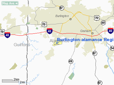
Burlington, North Carolina |
| Elevation AMSL |
617 ft / 188.1 m |
| Coordinates |
36°02′55″N 079°28′30″W / 36.04861°N 79.475°W / 36.04861; -79.475Coordinates: 36°02′55″N 079°28′30″W / 36.04861°N 79.475°W / 36.04861; -79.475 |
| Runways |
| Direction |
Length |
Surface |
| ft |
m |
| 6/24 |
5,000 |
1,524 |
Asphalt |
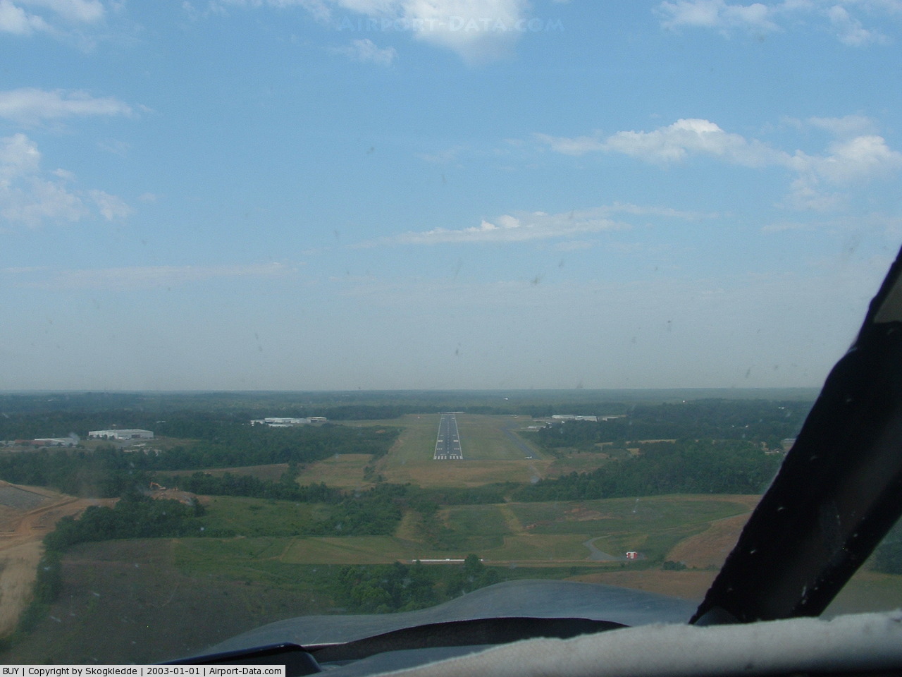
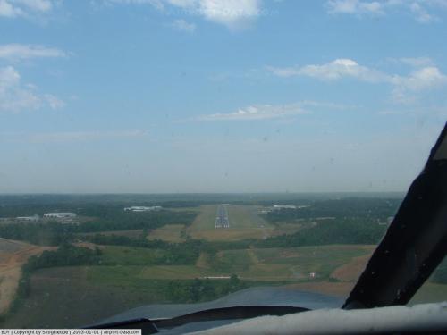
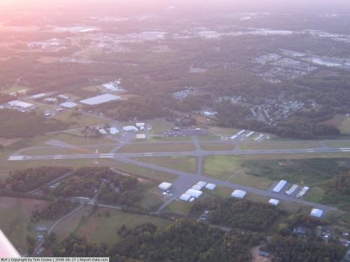
Burlington-Alamance Regional Airport (ICAO: KBUY, FAA LID: BUY) is a public airport located three miles (5 km) southwest of the central business district (CBD) of Burlington, a city in Alamance County, North Carolina, USA. This general aviation airport covers 340 acres (138 ha) and has one runway.
Although most U.S. airports use the same three-letter location identifier for the FAA and IATA, Burlington-Alamance Regional Airport is assigned BUY by the FAA and has no designation from the IATA (which assigned BUY to Bunbury, Western Australia, Australia). The airport's ICAO identifier is KBUY.
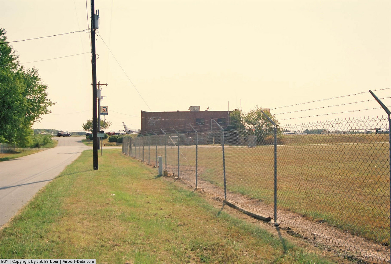
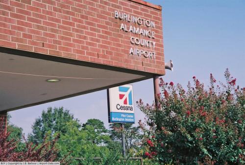
Burlington-Alamance is a small airport, serving small planes like Cessnas and rebuilt Mustangs. It also has a pilot training school. There is no charge for landing or taking off at the airport; it makes money through the sale of fuel, and hangar space.
On September 18, 2008, it was announced that the one runway at Burlington-Alamance, runway 6/24, will be extended from 5,000 feet to 6,400 feet. The main reason for the runway extension is to connect the airport to the new Honda Aero headquarters and manufacturing plant. Construction should be complete in 2010 or 2011.
The above content comes from Wikipedia and is published under free licenses – click here to read more.
 |
(Click on the photo to enlarge) |
 |
(Click on the photo to enlarge) |
 |
(Click on the photo to enlarge) |
 |
(Click on the photo to enlarge) |
Location & QuickFacts
| FAA Information Effective: | 2008-09-25 |
| Airport Identifier: | BUY |
| Airport Status: | Operational |
| Longitude/Latitude: | 079-28-29.6010W/36-02-54.7560N
-79.474889/36.048543 (Estimated) |
| Elevation: | 617 ft / 188.06 m (Surveyed) |
| Land: | 340 acres |
| From nearest city: | 3 nautical miles SW of Burlington, NC |
| Location: | Alamance County, NC |
| Magnetic Variation: | 08W (2000) |
Owner & Manager
| Ownership: | Publicly owned |
| Owner: | Burlington-alamance Airport Authori |
| Address: | 3441 N. Aviation Dr.
Burlington, NC 27215 |
| Phone number: | 336-227-0771
ARPT PHONE 336-227-1278. |
| Manager: | Dan Danieley |
| Address: | 3441. N Aviation Drive
Burlington, NC 27215-6374 |
| Phone number: | 336-227-0771 |
Airport Operations and Facilities
| Airport Use: | Open to public |
| Wind indicator: | Yes |
| Segmented Circle: | Yes |
| Control Tower: | No |
| Lighting Schedule: | DUSK-DAWN
PAPI RY 06 & PAPI RY 24 OPER CONT. ACTVT REIL RYS 06 & 24 - CTAF. |
| Beacon Color: | Clear-Green (lighted land airport) |
| Landing fee charge: | No |
| Sectional chart: | Cincinnati |
| Region: | ASO - Southern |
| Boundary ARTCC: | ZDC - Washington |
| Responsible ARTCC: | ZTL - Atlanta |
| Tie-in FSS: | RDU - Raleigh |
| FSS on Airport: | No |
| FSS Toll Free: | 1-800-WX-BRIEF |
| NOTAMs Facility: | BUY (NOTAM-d service avaliable) |
| Federal Agreements: | NGY3 |
Airport Communications
| CTAF: | 122.975 |
| Unicom: | 122.975 |
Airport Services
| Fuel available: | 100LLA1+
FOR AFTER HOURS FUEL OR EMERGENCY ONLY CALL 919-306-4981 PRIOR TO ARRIVAL. |
| Airframe Repair: | MAJOR |
| Power Plant Repair: | MAJOR |
| Bottled Oxygen: | HIGH |
| Bulk Oxygen: | NONE |
Runway Information
Runway 06/24
| Dimension: | 5000 x 100 ft / 1524.0 x 30.5 m |
| Surface: | ASPH, Good Condition |
| Weight Limit: | Single wheel: 30000 lbs.
Dual wheel: 36000 lbs.
Dual tandem wheel: 57000 lbs. |
| Edge Lights: | Medium |
| |
Runway 06 |
Runway 24 |
| Longitude: | 079-28-53.6200W | 079-28-05.5800W |
| Latitude: | 36-02-39.5700N | 36-03-09.9400N |
| Elevation: | 617.00 ft | 584.00 ft |
| Alignment: | 52 | 127 |
| ILS Type: | ILS
| |
| Traffic Pattern: | Left | Left |
| Markings: | Precision instrument, Good Condition | Precision instrument, Good Condition |
| Crossing Height: | 45.00 ft | 27.00 ft |
| VASI: | 4-light PAPI on left side | 2-light PAPI on left side |
| Visual Glide Angle: | 3.00° | 3.00° |
| Runway End Identifier: | Yes | Yes |
| Obstruction: | 38 ft trees, 850.0 ft from runway, 290 ft right of centerline, 17:1 slope to clear | 90 ft trees, 2250.0 ft from runway, 250L/ ft right of centerline, 22:1 slope to clear |
|
Radio Navigation Aids
| ID |
Type |
Name |
Ch |
Freq |
Var |
Dist |
| OQA | FAN MARKER | Rockingham County | | | | 28.5 nm |
| HB | NDB | Himun | | 361.00 | 08W | 6.8 nm |
| TOX | NDB | Siler City | | 371.00 | 07W | 17.3 nm |
| HUR | NDB | Person | | 220.00 | 08W | 22.7 nm |
| SIF | NDB | Slammer | | 423.00 | 07W | 24.5 nm |
| CQJ | NDB | City Lake | | 266.00 | 08W | 27.6 nm |
| TT | NDB | Leeco | | 406.00 | 08W | 36.9 nm |
| LE | NDB | Leevy | | 350.00 | 07W | 37.3 nm |
| UV | NDB | Bales | | 396.00 | 07W | 39.0 nm |
| EEJ | NDB | Lee County/dcmsnd | | 428.00 | 07W | 42.4 nm |
| SEN | NDB | Swearing/dcmsnd | | 260.00 | 06W | 43.2 nm |
| HXO | NDB | Huntsboro | | 271.00 | 07W | 44.2 nm |
| VU | NDB | Aller | | 346.00 | 06W | 44.8 nm |
| DVZ | NDB | Davie | | 354.00 | 06W | 48.4 nm |
| DAN | VOR | Danville | | 113.10 | 06W | 32.0 nm |
| LIB | VORTAC | Liberty | 077X | 113.00 | 03W | 15.7 nm |
| GSO | VORTAC | Greensboro | 109X | 116.20 | 03W | 24.4 nm |
| RDU | VORTAC | Raleigh/durham | 119X | 117.20 | 04W | 35.3 nm |
| SBV | VORTAC | South Boston | 041X | 110.40 | 05W | 43.8 nm |
Remarks
- PAEW NW RY 06 AND SW RAMP SR-SS MON-FRI.
Images and information placed above are from
http://www.airport-data.com/airport/BUY/
We thank them for the data!
| General Info
|
| Country |
United States
|
| State |
NORTH CAROLINA
|
| FAA ID |
BUY
|
| Latitude |
36-02-54.756N
|
| Longitude |
079-28-29.593W
|
| Elevation |
617 feet
|
| Near City |
BURLINGTON
|
We don't guarantee the information is fresh and accurate. The data may
be wrong or outdated.
For more up-to-date information please refer to other sources.
|
|