|
|
 |
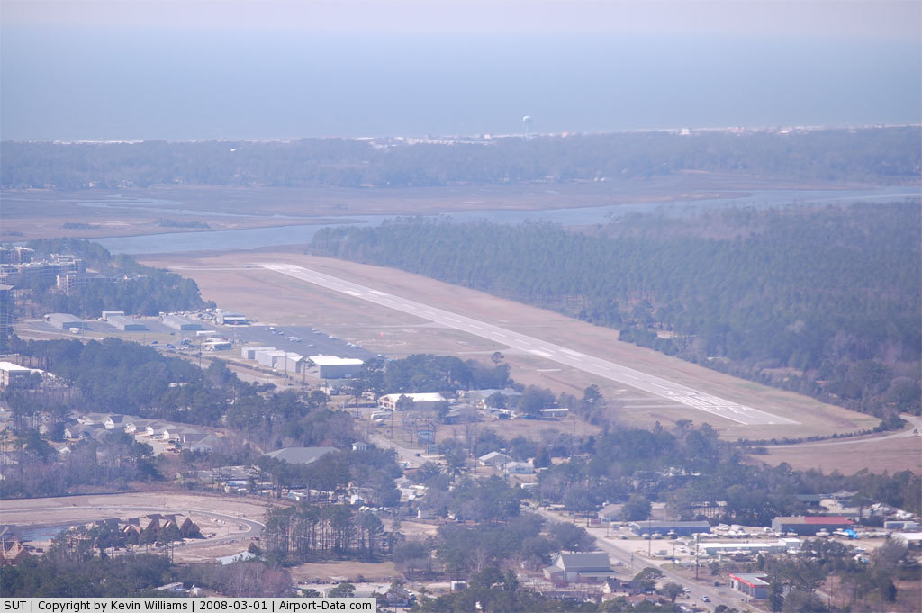
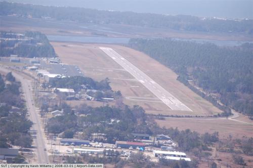
(Click on the photo to enlarge) |
 |
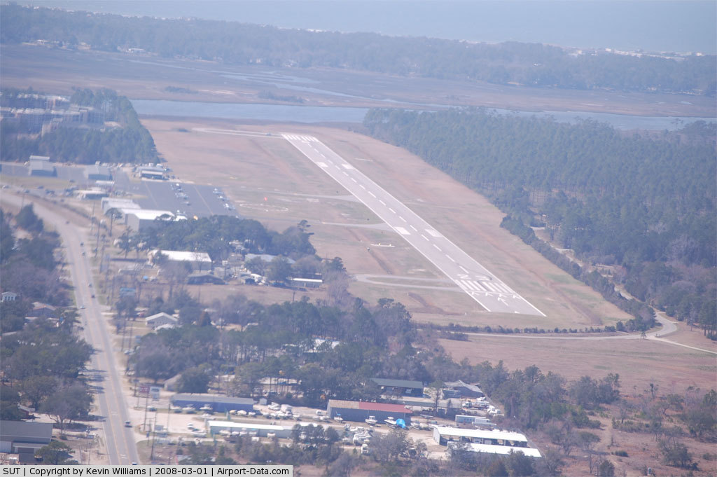
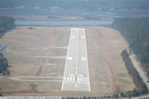
(Click on the photo to enlarge) |
 |
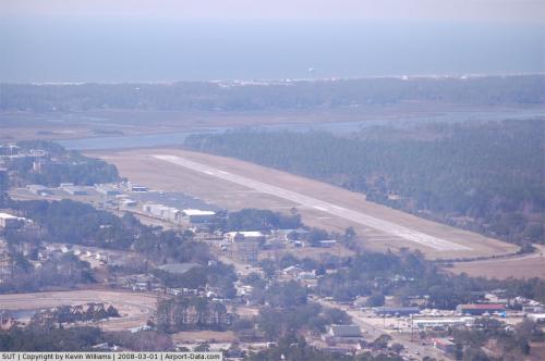
(Click on the photo to enlarge) |
Location & QuickFacts
| FAA Information Effective: | 2008-09-25 |
| Airport Identifier: | SUT |
| Airport Status: | Operational |
| Longitude/Latitude: | 078-04-28.8000W/33-55-46.5000N
-78.074667/33.929583 (Estimated) |
| Elevation: | 24 ft / 7.32 m (Surveyed) |
| Land: | 185 acres |
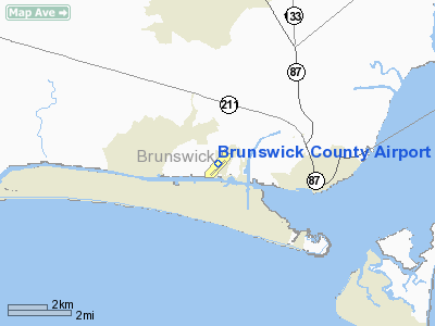
| From nearest city: | 1 nautical miles NE of Oak Island, NC |
| Location: | Brunswick County, NC |
| Magnetic Variation: | 08W (2000) |
Owner & Manager
| Ownership: | Publicly owned |
| Owner: | Brunswick Co Arpt Commission |
| Address: | 4019 Long Beach Road
Oak Island, NC 28461 |
| Phone number: | 910-457-6534 |
| Manager: | Howard Franklin |
| Address: | 4019 Long Beach Road
Oak Island, NC 28461 |
| Phone number: | 910-457-6483 |
Airport Operations and Facilities
| Airport Use: | Open to public |
| Wind indicator: | Yes |
| Segmented Circle: | Yes |
| Control Tower: | No |
| Lighting Schedule: | DUSK-DAWN
ACTVT MIRL 05/23 - CTAF. PAPI RYS 05 & 23 - ON CONTINUOUSLY. |
| Beacon Color: | Clear-Green (lighted land airport) |
| Landing fee charge: | No |
| Sectional chart: | Charlotte |
| Region: | ASO - Southern |
| Traffic Pattern Alt: | 975 ft |
| Boundary ARTCC: | ZDC - Washington |
| Tie-in FSS: | RDU - Raleigh |
| FSS on Airport: | No |
| FSS Toll Free: | 1-800-WX-BRIEF |
| NOTAMs Facility: | SUT (NOTAM-d service avaliable) |
| Federal Agreements: | NGY |
Airport Communications
| CTAF: | 123.000 |
| Unicom: | 123.000 |
Airport Services
| Fuel available: | 100LLA1+
FUEL AVABL 24 HR SELF SERVICE WITH CREDIT CARD. |
| Airframe Repair: | MAJOR |
| Power Plant Repair: | MAJOR |
| Bottled Oxygen: | NONE |
| Bulk Oxygen: | NONE |
Runway Information
Runway 05/23
| Dimension: | 4301 x 100 ft / 1310.9 x 30.5 m |
| Surface: | ASPH, Good Condition |
| Weight Limit: | Single wheel: 30000 lbs. |
| Edge Lights: | Medium |
| |
Runway 05 |
Runway 23 |
| Longitude: | 078-04-45.5600W | 078-04-12.0572W |
| Latitude: | 33-55-30.4100N | 33-56-02.5147N |
| Elevation: | 20.00 ft | 23.00 ft |
| Alignment: | 41 | 127 |
| Traffic Pattern: | Left | Left |
| Markings: | Non-precision instrument, Good Condition | Non-precision instrument, Good Condition |
| Crossing Height: | 39.00 ft | 39.00 ft |
| Displaced threshold: | 0.00 ft | 300.00 ft |
| VASI: | 2-light PAPI on left side | 2-light PAPI on left side |
| Visual Glide Angle: | 3.00° | 3.00° |
| Obstruction: | , 50:1 slope to clear | 15 ft road, 225.0 ft from runway, 1:1 slope to clear
RY 23 APCH SLOPE 8:1 TO DSPLCD THLD DUE TO 22 FT TREES 383 FT FM DSPLCD THLD AND 254 FT RIGHT OF CNTRLN.
15 FT TREES 0-200 FT FM END OF RY AND OFFSET 160 FT TO 199 FT RIGHT OF CNTRLN. |
| Decleard distances: | Take off run available 4000.00 ft
Take off distance available 4300.00 ft
Actual stop distance available 4200.00 ft
Landing distance available 4200.00 ft
| Take off run available 4300.00 ft
Take off distance available 4300.00 ft
Actual stop distance available 4300.00 ft
Landing distance available 4000.00 ft
|
|
Radio Navigation Aids
| ID |
Type |
Name |
Ch |
Freq |
Var |
Dist |
| SUT | NDB | Yaupon | | 233.00 | 08W | 0.1 nm |
| CLB | NDB | Carolina Beach | | 216.00 | 04W | 12.0 nm |
| CPC | NDB | Camp | | 227.00 | 07W | 37.9 nm |
| TGQ | NDB | Elizabethtown | | 398.00 | 08W | 42.2 nm |
| ACZ | NDB | Pendy | | 379.00 | 09W | 47.4 nm |
| DIW | NDB/DME | Dixon | 107X | 198.00 | 08W | 49.3 nm |
| ILM | VORTAC | Wilmington | 117X | 117.00 | 07W | 27.3 nm |
| CRE | VORTAC | Grand Strand | 123X | 117.60 | 03W | 33.2 nm |
Remarks
- DEER AND BIRDS ON AND INVOF ARPT.
- -8' DITCH 125' FROM RY 23 THR L & R OF CNTRLN.
- +5' FENCE 425' FM RY 23 THR EXTNDD CNTRLN.
- ARPT PHONE 910-457-6483.
- BANNER TOWING OPS ON ARPT SUMMER MONTHS.
- FLIGHT TRAINING & SIGHT-SEEING OPNS INVOF ARPT.
- SKYDIVING OPERATIONS.
Images and information placed above are from
http://www.airport-data.com/airport/SUT/
We thank them for the data!
| General Info
|
| Country |
United States
|
| State |
NORTH CAROLINA
|
| FAA ID |
SUT
|
| Latitude |
33-55-45.325N
|
| Longitude |
078-04-29.970W
|
| Elevation |
25 feet
|
| Near City |
OAK ISLAND
|
We don't guarantee the information is fresh and accurate. The data may
be wrong or outdated.
For more up-to-date information please refer to other sources.
|
|