 |
|
Brunswick Community Hospital Heliport |
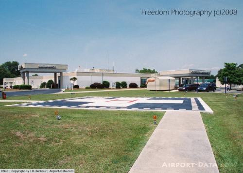 |
(Click on the photo to enlarge) |
Location & QuickFacts
| FAA Information Effective: | 2008-09-25 |
| Airport Identifier: | 05NC |
| Airport Status: | Operational |
| Longitude/Latitude: | 078-17-27.8000W/34-00-29.3000N
-78.291056/34.008139 (Estimated) |
| Elevation: | 63 ft / 19.20 m (Estimated) |
| Land: | 0 acres |
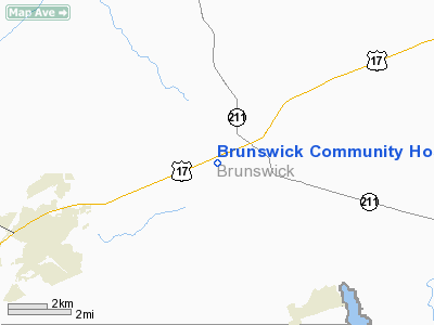
| From nearest city: | 1 nautical miles W of Supply, NC |
| Location: | Brunswick County, NC |
| Magnetic Variation: | 07W (1990) |
Owner & Manager
| Ownership: | Privately owned |
| Owner: | Brunswick Community Hospital |
| Address: | 1 Medical Center Dr
Supply, NC 28462 |
| Phone number: | 910-755-8121 |
| Manager: | Warren Faulk |
| Address: | 1 Medical Center Dr
Supply, NC 28462 |
| Phone number: | 910-755-1214 |
Airport Operations and Facilities
| Airport Use: | Private
MEDICAL USE. |
| Wind indicator: | Yes |
| Segmented Circle: | No |
| Control Tower: | No |
| Lighting Schedule: | DUSK-DAWN |
| Sectional chart: | Charlotte |
| Region: | ASO - Southern |
| Boundary ARTCC: | ZJX - Jacksonville |
| Tie-in FSS: | RDU - Raleigh |
| FSS Toll Free: | 1-800-WX-BRIEF |
Runway Information
Helipad H1
| Dimension: | 40 x 40 ft / 12.2 x 12.2 m |
| Surface: | CONC, |
| |
Runway H1 |
Runway |
| Traffic Pattern: | Left | Left |
|
Radio Navigation Aids
| ID |
Type |
Name |
Ch |
Freq |
Var |
Dist |
| SUT | NDB | Yaupon | | 233.00 | 08W | 11.8 nm |
| CLB | NDB | Carolina Beach | | 216.00 | 04W | 17.4 nm |
| CPC | NDB | Camp | | 227.00 | 07W | 26.3 nm |
| TGQ | NDB | Elizabethtown | | 398.00 | 08W | 33.2 nm |
| HYW | NDB | Horry | | 370.00 | 08W | 43.2 nm |
| ACZ | NDB | Pendy | | 379.00 | 09W | 44.9 nm |
| CRE | VORTAC | Grand Strand | 123X | 117.60 | 03W | 24.6 nm |
| ILM | VORTAC | Wilmington | 117X | 117.00 | 07W | 29.3 nm |
Remarks
- PRVDD VFR OPNS; PVT USE; AREA IS MARKED; AND WIND INDICATOR IS MAINTAINED.
Images and information placed above are from
http://www.airport-data.com/airport/05NC/
We thank them for the data!
| General Info
|
| Country |
United States
|
| State |
NORTH CAROLINA
|
| FAA ID |
05NC
|
| Latitude |
34-00-29.300N
|
| Longitude |
078-17-27.800W
|
| Elevation |
63 feet
|
| Near City |
SUPPLY
|
We don't guarantee the information is fresh and accurate. The data may
be wrong or outdated.
For more up-to-date information please refer to other sources.
|
|


