 |
|
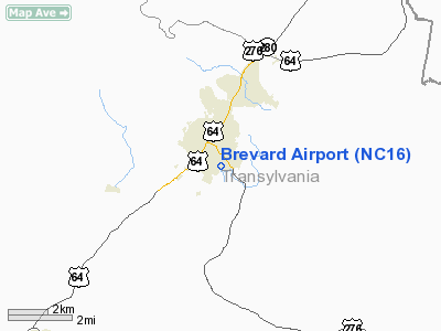
Location & QuickFacts
| FAA Information Effective: | 2008-09-25 |
| Airport Identifier: | NC16 |
| Airport Status: | Operational |
| Longitude/Latitude: | 082-43-36.4510W/35-13-21.4110N
-82.726792/35.222614 (Estimated) |
| Elevation: | 2125 ft / 647.70 m (Estimated) |
| Land: | 10 acres |
| From nearest city: | 1 nautical miles SE of Brevard, NC |
| Location: | Transylvania County, NC |
| Magnetic Variation: | 04W (1985) |
Owner & Manager
| Ownership: | Privately owned |
| Owner: | Valley Auto Sales, Inc. |
| Address: | P.o. Box 1137
Brevard, NC 28712-1137 |
| Phone number: | 828-884-9011 |
| Manager: | Charles W. Pickelsimer Jr |
| Address: | 660 Greenville Hwy
Brevard, NC 28712 |
| Phone number: | 828-884-2121 |
Airport Operations and Facilities
| Airport Use: | Private |
| Wind indicator: | Yes |
| Segmented Circle: | No |
| Control Tower: | No |
| Landing fee charge: | No |
| Sectional chart: | Atlanta |
| Region: | ASO - Southern |
| Boundary ARTCC: | ZTL - Atlanta |
| Tie-in FSS: | RDU - Raleigh |
| FSS on Airport: | No |
| FSS Toll Free: | 1-800-WX-BRIEF |
Runway Information
Runway 04/22
| Dimension: | 2100 x 50 ft / 640.1 x 15.2 m |
| Surface: | TURF, |
| |
Runway 04 |
Runway 22 |
| Traffic Pattern: | Right | Left |
|
Radio Navigation Aids
| ID |
Type |
Name |
Ch |
Freq |
Var |
Dist |
| BRA | NDB | Broad River | | 379.00 | 04W | 12.9 nm |
| LQK | NDB | Lake Keowee | | 408.00 | 04W | 24.8 nm |
| CEU | NDB | Clemson | | 257.00 | 05W | 33.9 nm |
| GY | NDB | Dyana | | 338.00 | 03W | 34.9 nm |
| RFE | NDB | Rutherford | | 344.00 | 05W | 38.7 nm |
| FRT | NDB | Fairmont | | 248.00 | 05W | 41.3 nm |
| AND | NDB | Anderson County | | 230.00 | 04W | 43.6 nm |
| SUG | VORTAC | Sugarloaf Mountain | 059X | 112.20 | 02W | 25.0 nm |
| SOT | VORTAC | Snowbird | 025X | 108.80 | 04W | 37.6 nm |
| SPA | VORTAC | Spartanburg | 104X | 115.70 | 02W | 40.9 nm |
| ODF | VORTAC | Foothills | 081X | 113.40 | 00E | 42.3 nm |
| ELW | VORTAC | Electric City | 023X | 108.60 | 00E | 48.4 nm |
Remarks
Images and information placed above are from
http://www.airport-data.com/airport/NC16/
We thank them for the data!
| General Info
|
| Country |
United States
|
| State |
NORTH CAROLINA
|
| FAA ID |
NC16
|
| Latitude |
35-13-21.411N
|
| Longitude |
082-43-36.451W
|
| Elevation |
2125 feet
|
| Near City |
BREVARD
|
We don't guarantee the information is fresh and accurate. The data may
be wrong or outdated.
For more up-to-date information please refer to other sources.
|
|


