 |
|
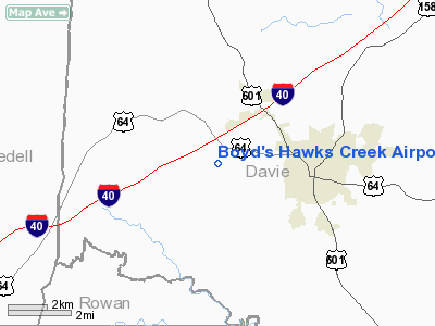
Boyd's Hawks Creek Airport |
Location & QuickFacts
| FAA Information Effective: | 2008-09-25 |
| Airport Identifier: | 4NC0 |
| Airport Status: | Operational |
| Longitude/Latitude: | 080-36-58.2250W/35-53-54.4930N
-80.616174/35.898470 (Estimated) |
| Elevation: | 815 ft / 248.41 m (Estimated) |
| Land: | 6 acres |
| From nearest city: | 3 nautical miles W of Mocksville, NC |
| Location: | Davie County, NC |
| Magnetic Variation: | 06W (1985) |
Owner & Manager
| Ownership: | Privately owned |
| Owner: | Don J. Boyd |
| Address: | 196 Mcallister Rd
Mocksville, NC 27028 |
| Phone number: | 336-492-2080 |
| Manager: | Don J. Boyd |
| Address: | 196 Mcallister Rd
Mocksville, NC 27028 |
| Phone number: | 336-408-0785 |
Airport Operations and Facilities
| Airport Use: | Private |
| Wind indicator: | Yes |
| Segmented Circle: | No |
| Control Tower: | No |
| Landing fee charge: | No |
| Sectional chart: | Charlotte |
| Region: | ASO - Southern |
| Boundary ARTCC: | ZTL - Atlanta |
| Tie-in FSS: | RDU - Raleigh |
| FSS on Airport: | No |
| FSS Toll Free: | 1-800-WX-BRIEF |
Runway Information
Runway 11/29
| Dimension: | 2000 x 60 ft / 609.6 x 18.3 m |
| Surface: | TURF, |
| |
Runway 11 |
Runway 29 |
| Traffic Pattern: | Left | Left |
| Obstruction: | 30 ft trees, 100.0 ft from runway | 20 ft pline, 800.0 ft from runway |
|
Radio Navigation Aids
| ID |
Type |
Name |
Ch |
Freq |
Var |
Dist |
| MRN | FAN MARKER | Lenoir | | | 03W | 49.5 nm |
| OQA | FAN MARKER | Rockingham County | | | | 49.6 nm |
| DVZ | NDB | Davie | | 354.00 | 06W | 7.8 nm |
| RU | NDB | Rovdy | | 275.00 | 06W | 11.7 nm |
| SEN | NDB | Swearing/dcmsnd | | 260.00 | 06W | 17.0 nm |
| VW | NDB | Temky | | 280.00 | 05W | 23.1 nm |
| ZEF | NDB | Zephyr | | 326.00 | 05W | 25.5 nm |
| UKF | NDB | Wilki | | 209.00 | 06W | 26.7 nm |
| AZW | NDB | Mount Airy | | 223.00 | 07W | 29.2 nm |
| IZN | NDB | Lincolnton | | 432.00 | 06W | 31.6 nm |
| HK | NDB | Tawba | | 332.00 | 06W | 34.3 nm |
| VU | NDB | Aller | | 346.00 | 06W | 35.9 nm |
| CQJ | NDB | City Lake | | 266.00 | 08W | 38.2 nm |
| JU | NDB | Ashee | | 410.00 | 07W | 47.0 nm |
| BZM | VOR/DME | Barretts Mountain | 045X | 110.80 | 06W | 30.5 nm |
| CLT | VOR/DME | Charlotte | 097X | 115.00 | 05W | 45.6 nm |
| GSO | VORTAC | Greensboro | 109X | 116.20 | 03W | 32.4 nm |
| LIB | VORTAC | Liberty | 077X | 113.00 | 03W | 49.2 nm |
| HKY | VOT | Hickory Regional | | 110.00 | | 38.9 nm |
| CLT | VOT | Charlotte | | 112.00 | | 44.0 nm |
Remarks
Images and information placed above are from
http://www.airport-data.com/airport/4NC0/
We thank them for the data!
| General Info
|
| Country |
United States
|
| State |
NORTH CAROLINA
|
| FAA ID |
4NC0
|
| Latitude |
35-53-54.493N
|
| Longitude |
080-36-58.225W
|
| Elevation |
815 feet
|
| Near City |
MOCKSVILLE
|
We don't guarantee the information is fresh and accurate. The data may
be wrong or outdated.
For more up-to-date information please refer to other sources.
|
|


