 |
|
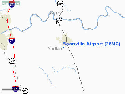
Location & QuickFacts
| FAA Information Effective: | 2008-09-25 |
| Airport Identifier: | 26NC |
| Airport Status: | Operational |
| Longitude/Latitude: | 080-42-56.2360W/36-13-22.4890N
-80.715621/36.222914 (Estimated) |
| Elevation: | 1003 ft / 305.71 m (Estimated) |
| Land: | 2 acres |
| From nearest city: | 1 nautical miles SW of Boonville, NC |
| Location: | Yadkin County, NC |
| Magnetic Variation: | 06W (1985) |
Owner & Manager
| Ownership: | Privately owned |
| Owner: | Harvey & Daniel Smith |
| Address: | 3905 Baptist Church Rd
Boonville, NC 27011-7812 |
| Phone number: | 336-367-7958 |
| Manager: | Harvey & Daniel Smith |
| Address: | 234 Baptist Church Rd
Boonville, NC 27011-8618 |
| Phone number: | 336-367-7365 |
Airport Operations and Facilities
| Airport Use: | Private |
| Wind indicator: | Yes |
| Segmented Circle: | No |
| Control Tower: | No |
| Landing fee charge: | No |
| Sectional chart: | Cincinnati |
| Region: | ASO - Southern |
| Boundary ARTCC: | ZTL - Atlanta |
| Tie-in FSS: | RDU - Raleigh |
| FSS on Airport: | No |
| FSS Toll Free: | 1-800-WX-BRIEF |
Airport Services
| Airframe Repair: | NONE |
| Power Plant Repair: | NONE |
| Bottled Oxygen: | NONE |
| Bulk Oxygen: | NONE |
Runway Information
Runway 01/19
| Dimension: | 1500 x 50 ft / 457.2 x 15.2 m |
| Surface: | TURF, Good Condition |
| |
Runway 01 |
Runway 19 |
| Traffic Pattern: | Left | Left |
| Obstruction: | 15 ft road, 30 ft left of centerline | 15 ft road, 0.0 ft from runway, 30 ft right of centerline |
|
Radio Navigation Aids
| ID |
Type |
Name |
Ch |
Freq |
Var |
Dist |
| OQA | FAN MARKER | Rockingham County | | | | 44.6 nm |
| ZEF | NDB | Zephyr | | 326.00 | 05W | 5.4 nm |
| AZW | NDB | Mount Airy | | 223.00 | 07W | 12.7 nm |
| UKF | NDB | Wilki | | 209.00 | 06W | 19.7 nm |
| DVZ | NDB | Davie | | 354.00 | 06W | 22.5 nm |
| RU | NDB | Rovdy | | 275.00 | 06W | 31.4 nm |
| VW | NDB | Temky | | 280.00 | 05W | 31.9 nm |
| JU | NDB | Ashee | | 410.00 | 07W | 32.0 nm |
| HLX | NDB | Hillsville | | 269.00 | 06W | 32.8 nm |
| SEN | NDB | Swearing/dcmsnd | | 260.00 | 06W | 33.5 nm |
| HK | NDB | Tawba | | 332.00 | 06W | 38.9 nm |
| UV | NDB | Bales | | 396.00 | 07W | 44.5 nm |
| IZN | NDB | Lincolnton | | 432.00 | 06W | 45.0 nm |
| SIF | NDB | Slammer | | 423.00 | 07W | 47.1 nm |
| MK | NDB | Suzze | | 335.00 | 06W | 49.0 nm |
| BZM | VOR/DME | Barretts Mountain | 045X | 110.80 | 06W | 33.2 nm |
| GSO | VORTAC | Greensboro | 109X | 116.20 | 03W | 37.4 nm |
| HKY | VOT | Hickory Regional | | 110.00 | | 43.8 nm |
Remarks
- WHITE REFLECTORS LCTD ON EAST SIDE OF RWY ONLY INDICATING RWY EDGE.
- RWY 1 UPHILL LANDING.
- 3 FT DITCH AT BOTH ENDS OF RY; GREATER THAN 25 FT BLDGS 40 FT EAST SIDE OF RY.
- DEPARTURES TO THE SOUTH - LANDINGS TO THE NORTH DUE TO OBSTRUCTIONS AND SLOPING RY.
- VFR OPERATIONS ONLY.
Images and information placed above are from
http://www.airport-data.com/airport/26NC/
We thank them for the data!
| General Info
|
| Country |
United States
|
| State |
NORTH CAROLINA
|
| FAA ID |
26NC
|
| Latitude |
36-13-22.489N
|
| Longitude |
080-42-56.236W
|
| Elevation |
1003 feet
|
| Near City |
BOONVILLE
|
We don't guarantee the information is fresh and accurate. The data may
be wrong or outdated.
For more up-to-date information please refer to other sources.
|
|


