 |
|
Location & QuickFacts
| FAA Information Effective: | 2008-09-25 |
| Airport Identifier: | NC02 |
| Airport Status: | Operational |
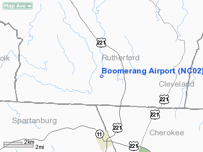
| Longitude/Latitude: | 081-51-59.3740W/35-12-45.4340N
-81.866493/35.212621 (Estimated) |
| Elevation: | 850 ft / 259.08 m (Estimated) |
| Land: | 12 acres |
| From nearest city: | 2 nautical miles S of Harris, NC |
| Location: | Rutherford County, NC |
| Magnetic Variation: | 04W (1985) |
Owner & Manager
| Ownership: | Privately owned |
| Owner: | Dave Mcpeak Family Ltd Partnership |
| Address: | Po Box 7
Harris, NC 28074-0007 |
| Phone number: | 828-245-1462 |
| Manager: | Rodney Blanton |
| Address: | 1295 Hogan Road
Forest City, NC 28043-7358 |
| Phone number: | 828-657-6224 |
Airport Operations and Facilities
| Airport Use: | Private |
| Wind indicator: | No |
| Segmented Circle: | No |
| Control Tower: | No |
| Landing fee charge: | No |
| Sectional chart: | Atlanta |
| Region: | ASO - Southern |
| Boundary ARTCC: | ZTL - Atlanta |
| Tie-in FSS: | RDU - Raleigh |
| FSS on Airport: | No |
| FSS Toll Free: | 1-800-WX-BRIEF |
Airport Services
| Airframe Repair: | NONE |
| Power Plant Repair: | NONE |
| Bottled Oxygen: | NONE |
| Bulk Oxygen: | NONE |
Runway Information
Runway 16/34
| Dimension: | 2000 x 75 ft / 609.6 x 22.9 m |
| Surface: | TURF-DIRT, Poor Condition |
| |
Runway 16 |
Runway 34 |
| Traffic Pattern: | Left | Left |
| Obstruction: | , 50:1 slope to clear | 50 ft trees, 50.0 ft from runway, 100L/ ft right of centerline |
|
Radio Navigation Aids
| ID |
Type |
Name |
Ch |
Freq |
Var |
Dist |
| MRN | FAN MARKER | Lenoir | | | 03W | 37.0 nm |
| RFE | NDB | Rutherford | | 344.00 | 05W | 9.2 nm |
| SLP | NDB | First River | | 417.00 | 06W | 13.4 nm |
| FRT | NDB | Fairmont | | 248.00 | 05W | 19.5 nm |
| BRA | NDB | Broad River | | 379.00 | 04W | 29.9 nm |
| FIQ | NDB | Fiddlers | | 391.00 | 07W | 31.4 nm |
| UOT | NDB | Union County | | 326.00 | 04W | 33.6 nm |
| GHJ | NDB | Stonia | | 260.00 | 06W | 34.9 nm |
| DCM | NDB | Chester | | 220.00 | 06W | 41.6 nm |
| GY | NDB | Dyana | | 338.00 | 03W | 42.3 nm |
| LUX | NDB | Laurens | | 307.00 | 04W | 42.5 nm |
| IZN | NDB | Lincolnton | | 432.00 | 06W | 42.9 nm |
| UZ | NDB | Rally | | 227.00 | 05W | 43.2 nm |
| HK | NDB | Tawba | | 332.00 | 06W | 44.1 nm |
| LQK | NDB | Lake Keowee | | 408.00 | 04W | 47.8 nm |
| CLT | VOR/DME | Charlotte | 097X | 115.00 | 05W | 44.9 nm |
| BZM | VOR/DME | Barretts Mountain | 045X | 110.80 | 06W | 49.9 nm |
| SPA | VORTAC | Spartanburg | 104X | 115.70 | 02W | 11.2 nm |
| SUG | VORTAC | Sugarloaf Mountain | 059X | 112.20 | 02W | 22.9 nm |
| FML | VORTAC | Fort Mill | 071X | 112.40 | 02W | 46.8 nm |
| HKY | VOT | Hickory Regional | | 110.00 | | 39.4 nm |
| CLT | VOT | Charlotte | | 112.00 | | 45.6 nm |
Remarks
- RWY 16 UPHILL LANDING.
- VFR OPNS ONLY
Images and information placed above are from
http://www.airport-data.com/airport/NC02/
We thank them for the data!
| General Info
|
| Country |
United States
|
| State |
NORTH CAROLINA
|
| FAA ID |
NC02
|
| Latitude |
35-12-45.434N
|
| Longitude |
081-51-59.374W
|
| Elevation |
850 feet
|
| Near City |
HARRIS
|
We don't guarantee the information is fresh and accurate. The data may
be wrong or outdated.
For more up-to-date information please refer to other sources.
|
|


