 |
|
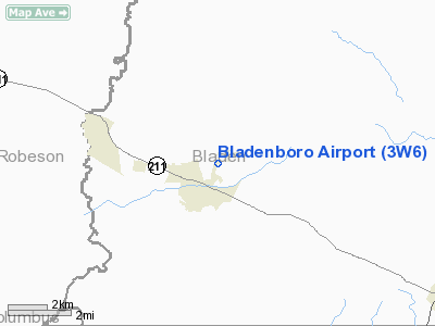
Location & QuickFacts
| FAA Information Effective: | 2008-09-25 |
| Airport Identifier: | 3W6 |
| Airport Status: | Operational |
| Longitude/Latitude: | 078-46-59.0740W/34-33-00.6070N
-78.783076/34.550169 (Estimated) |
| Elevation: | 115 ft / 35.05 m (Estimated) |
| Land: | 20 acres |
| From nearest city: | 0 nautical miles E of Bladenboro, NC |
| Location: | Bladen County, NC |
| Magnetic Variation: | 07W (1985) |
Owner & Manager
| Ownership: | Privately owned |
| Owner: | Robert E. Hester |
| Address: | Po Box 125
Bladenboro, NC 28320 |
| Phone number: | 910-863-3149 |
| Manager: | Robert E. Hester |
| Address: | 13442 N.c. 131
Bladenboro, NC 28320-8906 |
| Phone number: | 910-863-3635 |
Airport Operations and Facilities
| Airport Use: | Open to public |
| Wind indicator: | Yes |
| Segmented Circle: | No |
| Control Tower: | No |
| Landing fee charge: | No |
| Sectional chart: | Charlotte |
| Region: | ASO - Southern |
| Boundary ARTCC: | ZDC - Washington |
| Tie-in FSS: | RDU - Raleigh |
| FSS on Airport: | No |
| FSS Toll Free: | 1-800-WX-BRIEF |
| NOTAMs Facility: | RDU (NOTAM-d service avaliable) |
Airport Communications
Airport Services
| Bottled Oxygen: | NONE |
| Bulk Oxygen: | NONE |
Runway Information
Runway 02/20
| Dimension: | 2850 x 135 ft / 868.7 x 41.1 m |
| Surface: | TURF, Fair Condition |
| |
Runway 02 |
Runway 20 |
| Traffic Pattern: | Left | Left |
| Obstruction: | 91 ft trees, 25.0 ft from runway, 142 ft left of centerline | 86 ft trees, 90.0 ft from runway, 44 ft right of centerline, 1:1 slope to clear |
|
Radio Navigation Aids
| ID |
Type |
Name |
Ch |
Freq |
Var |
Dist |
| TGQ | NDB | Elizabethtown | | 398.00 | 08W | 13.3 nm |
| RSY | NDB | Robeson | | 359.00 | 08W | 14.2 nm |
| CPC | NDB | Camp | | 227.00 | 07W | 17.1 nm |
| JB | NDB | Jigel | | 384.00 | 08W | 17.6 nm |
| DLC | NDB | Dillon | | 274.00 | 05W | 29.6 nm |
| CTZ | NDB | Clinton | | 412.00 | 08W | 32.9 nm |
| ME | NDB | Maxtn | | 257.00 | 08W | 34.5 nm |
| MAO | NDB | Marion | | 388.00 | 06W | 35.0 nm |
| FGP | NDB | Fort Bragg | | 393.00 | 07W | 35.4 nm |
| ACZ | NDB | Pendy | | 379.00 | 09W | 39.8 nm |
| POB | NDB | Pope | | 338.00 | 07W | 41.5 nm |
| HFF | NDB | Mackall | | 278.00 | 06W | 45.0 nm |
| HYW | NDB | Horry | | 370.00 | 08W | 46.9 nm |
| BES | NDB | Bennettsville | | 230.00 | 07W | 47.2 nm |
| RCZ | NDB | Roscoe | | 375.00 | 07W | 48.5 nm |
| CLB | NDB | Carolina Beach | | 216.00 | 04W | 48.7 nm |
| POB | TACAN | Pope | 085X | | 07W | 38.5 nm |
| LBT | VOR | Lumberton | | 110.00 | 08W | 13.9 nm |
| FAY | VOR/DME | Fayetteville | 025X | 108.80 | 04W | 26.6 nm |
| CRE | VORTAC | Grand Strand | 123X | 117.60 | 03W | 44.4 nm |
| ILM | VORTAC | Wilmington | 117X | 117.00 | 07W | 46.6 nm |
| FLO | VORTAC | Florence | 099X | 115.20 | 03W | 47.4 nm |
Remarks
- RY 20 HAS 40 FT TREES ON CNTRLN 200 FT FROM THR.
- RY 02 HAS 40 FT TREES ON CNTRLN 100 FT FM THLD.
- 80' TREES WEST EDGE OF RY THR TO THR & 10' TREES 75' EAST OF CNTRLN THR TO THR.
- 20' WIDE BY 10' DEEP DRAINAGE CANAL CROSSES RWY 2 10' SOUTH OF THR.
- 3' SIDE DRAINAGE DITCHES BOTH SIDES OF RWY AT RWY EDGES.
- ESTABLISHED PRIOR TO 1959.
Images and information placed above are from
http://www.airport-data.com/airport/3W6/
We thank them for the data!
| General Info
|
| Country |
United States
|
| State |
NORTH CAROLINA
|
| FAA ID |
3W6
|
| Latitude |
34-33-00.607N
|
| Longitude |
078-46-59.074W
|
| Elevation |
115 feet
|
| Near City |
BLADENBORO
|
We don't guarantee the information is fresh and accurate. The data may
be wrong or outdated.
For more up-to-date information please refer to other sources.
|
|


