 |
|
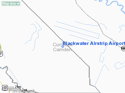
Blackwater Airstrip Airport |
Location & QuickFacts
| FAA Information Effective: | 2008-09-25 |
| Airport Identifier: | NC61 |
| Airport Status: | Operational |
| Longitude/Latitude: | 076-12-39.0000W/36-27-34.0000N
-76.210833/36.459444 (Estimated) |
| Elevation: | 12 ft / 3.66 m (Estimated) |
| Land: | 100 acres |
| From nearest city: | 6 nautical miles SW of Moyock, NC |
| Location: | Camden County, NC |
| Magnetic Variation: | () |
Owner & Manager
| Ownership: | Privately owned |
| Owner: | E & J Holdings Llc |
| Address: | 850 Puddin Ridge Road
Moyock, NC 27958 |
| Phone number: | 252-435-2488 |
| Manager: | Tony Vernon |
| Address: | 850 Puddin Ridge Road
Moyock, NC 27958 |
| Phone number: | 919-854-1282 |
Airport Operations and Facilities
| Airport Use: | Private |
| Wind indicator: | Yes |
| Segmented Circle: | No |
| Control Tower: | No |
| Sectional chart: | Washington |
| Region: | ASO - Southern |
| Boundary ARTCC: | ZDC - Washington |
| Tie-in FSS: | RDU - Raleigh |
| FSS Toll Free: | 1-800-WX-BRIEF |
Runway Information
Runway 10/28
| Dimension: | 2150 x 90 ft / 655.3 x 27.4 m |
| Surface: | TURF, |
| |
Runway 10 |
Runway 28 |
| Traffic Pattern: | Left | Left |
| Obstruction: | 20 ft trees, 350.0 ft from runway | |
|
Radio Navigation Aids
| ID |
Type |
Name |
Ch |
Freq |
Var |
Dist |
| EY | NDB | Chesi | | 233.00 | 09W | 11.8 nm |
| LLW | NDB | Woodville | | 254.00 | 10W | 12.5 nm |
| PVG | NDB | Portsmouth | | 241.00 | 10W | 22.4 nm |
| RK | NDB | Waley | | 249.00 | 10W | 22.8 nm |
| EDE | NDB | Edenton | | 265.00 | 10W | 31.3 nm |
| MQI | NDB | Manteo | | 370.00 | 09W | 41.2 nm |
| PJS | NDB | Henry | | 375.00 | 09W | 42.7 nm |
| FAF | NDB | Felker | | 226.00 | 08W | 45.3 nm |
| PMZ | NDB | Plymouth | | 221.00 | 10W | 47.4 nm |
| ASJ | NDB | Ahoskie | | 415.00 | 10W | 47.7 nm |
| AKQ | NDB | Wakefield | | 274.00 | 09W | 49.4 nm |
| NTU | TACAN | Oceana | 113X | | 10W | 23.5 nm |
| NGU | TACAN | Chambers | 048X | | 10W | 29.1 nm |
| LFI | TACAN | Langley | 070X | | 10W | 38.3 nm |
| ECG | VOR/DME | Elizabeth City | 072X | 112.50 | 07W | 12.3 nm |
| RBX | VOR/DME | Wright Brothers | 053X | 111.60 | 08W | 40.9 nm |
| ORF | VORTAC | Norfolk | 116X | 116.90 | 07W | 26.0 nm |
| CVI | VORTAC | Cofield | 093X | 114.60 | 09W | 32.4 nm |
| FKN | VORTAC | Franklin | 043X | 110.60 | 09W | 41.6 nm |
Remarks
Images and information placed above are from
http://www.airport-data.com/airport/NC61/
We thank them for the data!
|
|


