 |
|
Location & QuickFacts
| FAA Information Effective: | 2008-09-25 |
| Airport Identifier: | NC62 |
| Airport Status: | Operational |
| Longitude/Latitude: | 079-53-22.1630W/35-21-28.5070N
-79.889490/35.357919 (Estimated) |
| Elevation: | 650 ft / 198.12 m (Surveyed) |
| Land: | 0 acres |
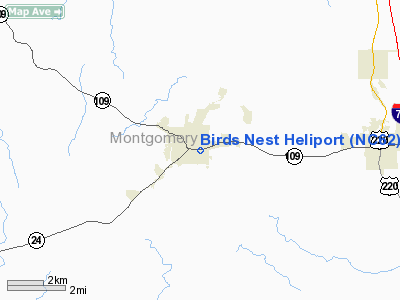
| From nearest city: | 0 nautical miles E of Troy, NC |
| Location: | Montgomery County, NC |
| Magnetic Variation: | 06W (1985) |
Owner & Manager
| Ownership: | Privately owned |
| Owner: | Carolina Explorer Inc. |
| Address: | 402 E. Main St
Troy, NC 27371 |
| Phone number: | 910-576-3041 |
| Manager: | John C. Wallace |
| Address: | 402 E. Main St
Troy, NC 27371 |
| Phone number: | 910-576-3041 |
Airport Operations and Facilities
| Airport Use: | Private |
| Wind indicator: | Yes |
| Segmented Circle: | No |
| Control Tower: | No |
| Lighting Schedule: | DUSK-DAWN |
| Beacon Color: | Clear (unlighted land airport) |
| Landing fee charge: | No |
| Sectional chart: | Charlotte |
| Region: | ASO - Southern |
| Boundary ARTCC: | ZTL - Atlanta |
| Tie-in FSS: | RDU - Raleigh |
| FSS on Airport: | No |
| FSS Toll Free: | 1-800-WX-BRIEF |
Airport Communications
Airport Services
| Airframe Repair: | NONE |
| Power Plant Repair: | NONE |
Runway Information
Helipad H1
| Dimension: | 115 x 115 ft / 35.1 x 35.1 m |
| Surface: | CONC, |
| |
Runway H1 |
Runway |
| Traffic Pattern: | Left | Left |
|
Radio Navigation Aids
| ID |
Type |
Name |
Ch |
Freq |
Var |
Dist |
| VU | NDB | Aller | | 346.00 | 06W | 12.2 nm |
| CQJ | NDB | City Lake | | 266.00 | 08W | 21.6 nm |
| AFP | NDB | Anson County | | 283.00 | 07W | 22.2 nm |
| HFF | NDB | Mackall | | 278.00 | 06W | 28.1 nm |
| RCZ | NDB | Roscoe | | 375.00 | 07W | 31.9 nm |
| TOX | NDB | Siler City | | 371.00 | 07W | 32.0 nm |
| SEN | NDB | Swearing/dcmsnd | | 260.00 | 06W | 32.3 nm |
| EEJ | NDB | Lee County/dcmsnd | | 428.00 | 07W | 32.7 nm |
| RU | NDB | Rovdy | | 275.00 | 06W | 37.0 nm |
| CQW | NDB | Cheraw | | 409.00 | 05W | 37.1 nm |
| TT | NDB | Leeco | | 406.00 | 08W | 37.7 nm |
| HB | NDB | Himun | | 361.00 | 08W | 40.1 nm |
| PYG | NDB | Pageland | | 270.00 | 06W | 43.0 nm |
| DVZ | NDB | Davie | | 354.00 | 06W | 43.4 nm |
| ME | NDB | Maxtn | | 257.00 | 08W | 43.4 nm |
| BES | NDB | Bennettsville | | 230.00 | 07W | 45.0 nm |
| POB | NDB | Pope | | 338.00 | 07W | 46.6 nm |
| TWL | NDB | Wesley | | 204.00 | 06W | 46.9 nm |
| POB | TACAN | Pope | 085X | | 07W | 44.2 nm |
| CTF | VOR/DME | Chesterfield | 019X | 108.20 | 03W | 46.6 nm |
| SDZ | VORTAC | Sandhills | 055X | 111.80 | 03W | 17.1 nm |
| LIB | VORTAC | Liberty | 077X | 113.00 | 03W | 30.4 nm |
| GSO | VORTAC | Greensboro | 109X | 116.20 | 03W | 41.6 nm |
Remarks
- PVT USE ONLY; VFR WEATHER CONDITIONS.
Images and information placed above are from
http://www.airport-data.com/airport/NC62/
We thank them for the data!
| General Info
|
| Country |
United States
|
| State |
NORTH CAROLINA
|
| FAA ID |
NC62
|
| Latitude |
35-21-28.507N
|
| Longitude |
079-53-22.163W
|
| Elevation |
650 feet
|
| Near City |
TROY
|
We don't guarantee the information is fresh and accurate. The data may
be wrong or outdated.
For more up-to-date information please refer to other sources.
|
|


