|
|
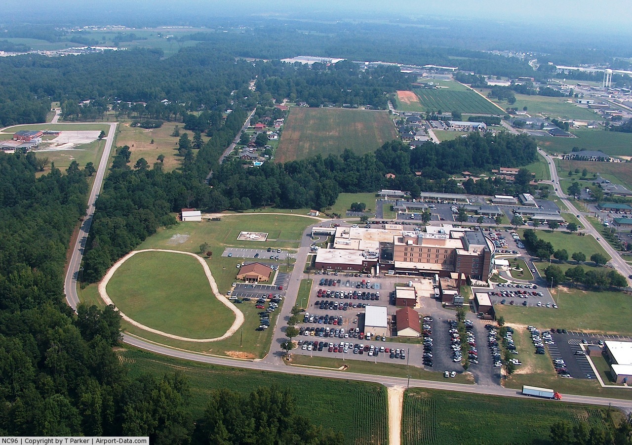
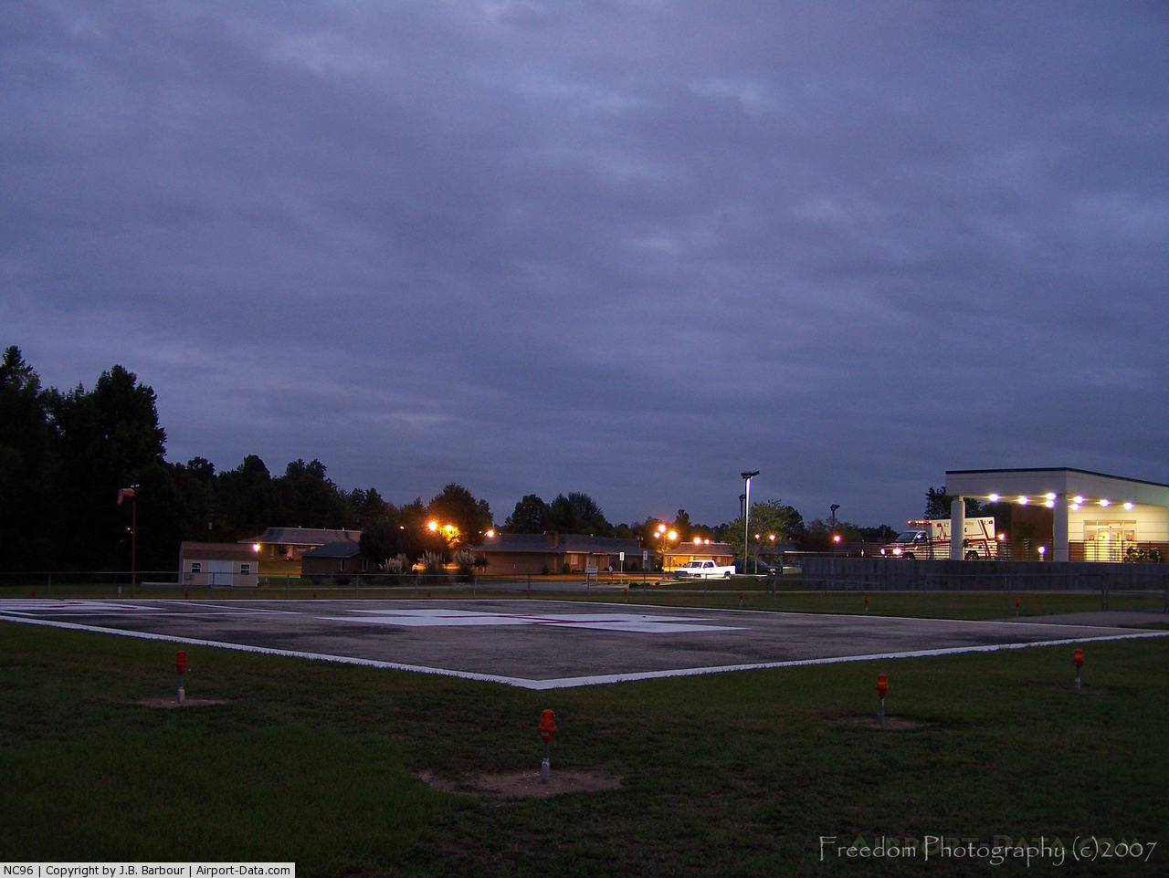
Betsy Johnson Memorial Hosp Heliport |
 |
(Click on the photo to enlarge) |
 |
(Click on the photo to enlarge) |
Location & QuickFacts
| FAA Information Effective: | 2008-09-25 |
| Airport Identifier: | NC96 |
| Airport Status: | Operational |
| Longitude/Latitude: | 078-38-09.0540W/35-18-47.5860N
-78.635848/35.313218 (Estimated) |
| Elevation: | 208 ft / 63.40 m (Estimated) |
| Land: | 1 acres |
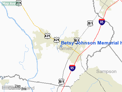
| From nearest city: | 0 nautical miles N of Dunn, NC |
| Location: | Harnett County, NC |
| Magnetic Variation: | 07W (1985) |
Owner & Manager
| Ownership: | Privately owned |
| Owner: | Betsy Johnson Memorial Hosp |
| Address: | 800 Tilghman Drive
Dunn, NC 28334-5510 |
| Phone number: | 910-892-7161 |
| Manager: | S.d. Brown |
| Address: | 800 Tilghman Drive
Dunn, NC 28334-5510 |
| Phone number: | 910-892-7161 |
Airport Operations and Facilities
| Airport Use: | Private
MEDICAL. |
| Wind indicator: | Yes |
| Segmented Circle: | No |
| Control Tower: | No |
| Sectional chart: | Charlotte |
| Region: | ASO - Southern |
| Boundary ARTCC: | ZDC - Washington |
| Tie-in FSS: | RDU - Raleigh |
| FSS on Airport: | No |
| FSS Toll Free: | 1-800-WX-BRIEF |
Runway Information
Helipad H1
| Dimension: | 70 x 70 ft / 21.3 x 21.3 m |
| Surface: | CONC, |
| |
Runway H1 |
Runway |
| Traffic Pattern: | Left | Left |
|
Radio Navigation Aids
| ID |
Type |
Name |
Ch |
Freq |
Var |
Dist |
| HQT | NDB | Harnett | | 417.00 | 08W | 7.5 nm |
| FGP | NDB | Fort Bragg | | 393.00 | 07W | 13.6 nm |
| JN | NDB | Jurly | | 263.00 | 09W | 14.2 nm |
| POB | NDB | Pope | | 338.00 | 07W | 16.5 nm |
| EUU | NDB | Jnall | | 251.00 | 07W | 22.4 nm |
| CTZ | NDB | Clinton | | 412.00 | 08W | 24.3 nm |
| TT | NDB | Leeco | | 406.00 | 08W | 27.1 nm |
| EEJ | NDB | Lee County/dcmsnd | | 428.00 | 07W | 29.0 nm |
| LE | NDB | Leevy | | 350.00 | 07W | 37.1 nm |
| DKA | NDB | Kenan | | 332.00 | 07W | 38.1 nm |
| JYN | NDB | Wayne | | 208.00 | 08W | 38.2 nm |
| RW | NDB | Jambe | | 235.00 | 09W | 42.7 nm |
| HFF | NDB | Mackall | | 278.00 | 06W | 45.1 nm |
| RSY | NDB | Robeson | | 359.00 | 08W | 47.0 nm |
| ACZ | NDB | Pendy | | 379.00 | 09W | 47.5 nm |
| TGQ | NDB | Elizabethtown | | 398.00 | 08W | 47.5 nm |
| TOX | NDB | Siler City | | 371.00 | 07W | 48.6 nm |
| POB | TACAN | Pope | 085X | | 07W | 21.1 nm |
| GSB | TACAN | Seymour Johnson | 112X | | 08W | 32.6 nm |
| LBT | VOR | Lumberton | | 110.00 | 08W | 47.0 nm |
| FAY | VOR/DME | Fayetteville | 025X | 108.80 | 04W | 22.9 nm |
| RDU | VORTAC | Raleigh/durham | 119X | 117.20 | 04W | 34.4 nm |
| SDZ | VORTAC | Sandhills | 055X | 111.80 | 03W | 47.1 nm |
Remarks
- VFR PVT USE; COORD USE OF HELI WITH RALEIGH GADO.
Images and information placed above are from
http://www.airport-data.com/airport/NC96/
We thank them for the data!
| General Info
|
| Country |
United States
|
| State |
NORTH CAROLINA
|
| FAA ID |
NC96
|
| Latitude |
35-18-47.586N
|
| Longitude |
078-38-09.054W
|
| Elevation |
208 feet
|
| Near City |
DUNN
|
We don't guarantee the information is fresh and accurate. The data may
be wrong or outdated.
For more up-to-date information please refer to other sources.
|
|