 |
|
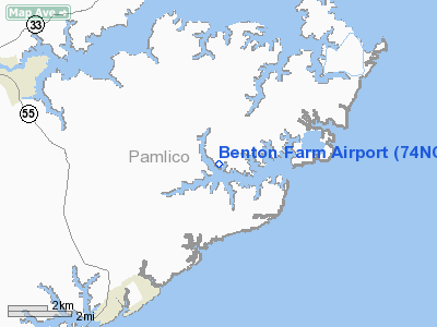
Location & QuickFacts
| FAA Information Effective: | 2008-09-25 |
| Airport Identifier: | 74NC |
| Airport Status: | Operational |
| Longitude/Latitude: | 076-37-47.0000W/35-05-47.0000N
-76.629722/35.096389 (Estimated) |
| Elevation: | 9 ft / 2.74 m (Estimated) |
| Land: | 3 acres |
| From nearest city: | 1 nautical miles E of Whartonville, NC |
| Location: | Pamlico County, NC |
| Magnetic Variation: | () |
Owner & Manager
| Ownership: | Privately owned |
| Owner: | Cornelius Bond |
| Address: | P.o. Box 33
Merritt, NC 28556 |
| Phone number: | 252-249-0464 |
| Manager: | Cornelius Bond |
| Address: | P.o. Box 33
Merritt, NC 28556 |
| Phone number: | 415-336-0558 |
Airport Operations and Facilities
| Airport Use: | Private |
| Wind indicator: | Yes |
| Control Tower: | No |
| Sectional chart: | Charlotte |
| Region: | ASO - Southern |
| Boundary ARTCC: | ZDC - Washington |
| Tie-in FSS: | RDU - Raleigh |
| FSS Toll Free: | 1-800-WX-BRIEF |
Runway Information
Runway 17/35
| Dimension: | 2000 x 150 ft / 609.6 x 45.7 m |
| Surface: | TURF, |
| |
Runway 17 |
Runway 35 |
| Traffic Pattern: | Left | Left |
| Displaced threshold: | 20.00 ft
RY 17 DSPLCD THLD MKD WITH YELLOW POSTS. | 100.00 ft
RY 35 DSPLCD THLD MKD WITH YELLOW POSTS. |
| Obstruction: | 4 ft fence, 20.0 ft from runway | 25 ft pline, 50.0 ft from runway |
|
Radio Navigation Aids
| ID |
Type |
Name |
Ch |
Freq |
Var |
Dist |
| PGV | FAN MARKER | Belvoir | | | 06W | 49.3 nm |
| HI | MARINE NDB | Hatteras Inlet Station/dcm | | 1.00 | 09W | 45.9 nm |
| MRH | NDB | Morehead | | 269.00 | 08W | 22.0 nm |
| RNW | NDB | Chocowinity | | 388.00 | 07W | 34.1 nm |
| PMZ | NDB | Plymouth | | 221.00 | 10W | 43.4 nm |
| NCA | NDB | New River | | 356.00 | 08W | 45.4 nm |
| OUC | NDB/DME | Pamlico/dcmsnd | 034X | 404.00 | 09W | 31.6 nm |
| NKT | TACAN | Cherry Point | 075X | | 09W | 16.8 nm |
| NJM | TACAN | Bogue Mcalf | 067X | | 08W | 31.4 nm |
| NCA | TACAN | New River | 101X | | 08W | 46.3 nm |
| EWN | VOR/DME | New Bern | 083X | 113.60 | 08W | 20.5 nm |
| ISO | VORTAC | Kinston | 033X | 109.60 | 05W | 48.5 nm |
Remarks
- PRVDD VFR OPNS AND PVT USE.
Images and information placed above are from
http://www.airport-data.com/airport/74NC/
We thank them for the data!
| General Info
|
| Country |
United States
|
| State |
NORTH CAROLINA
|
| FAA ID |
74NC
|
| Latitude |
34-46-07.615N
|
| Longitude |
078-22-28.004W
|
| Elevation |
125 feet
|
| Near City |
GARLAND
|
We don't guarantee the information is fresh and accurate. The data may
be wrong or outdated.
For more up-to-date information please refer to other sources.
|
|


