 |
|
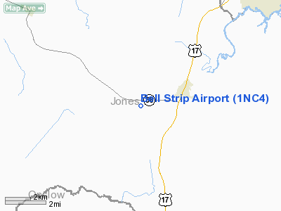
Location & QuickFacts
| FAA Information Effective: | 2008-09-25 |
| Airport Identifier: | 1NC4 |
| Airport Status: | Operational |
| Longitude/Latitude: | 077-15-27.8400W/34-59-43.5680N
-77.257733/34.995436 (Estimated) |
| Elevation: | 35 ft / 10.67 m (Surveyed) |
| Land: | 0 acres |
| From nearest city: | 2 nautical miles SW of Pollocksville, NC |
| Location: | Jones County, NC |
| Magnetic Variation: | 08W (1985) |
Owner & Manager
| Ownership: | Privately owned |
| Owner: | Hiram C. Bell |
| Address: | Box 162
Pollocksville, NC 28537 |
| Phone number: | 252-224-6376 |
| Manager: | Hiram C. Bell |
| Address: | Box 162
Pollocksville, NC 28537 |
| Phone number: | 252-224-6376 |
Airport Operations and Facilities
| Airport Use: | Private |
| Wind indicator: | Yes |
| Segmented Circle: | No |
| Control Tower: | No |
| Landing fee charge: | No |
| Sectional chart: | Charlotte |
| Region: | ASO - Southern |
| Boundary ARTCC: | ZDC - Washington |
| Tie-in FSS: | RDU - Raleigh |
| FSS on Airport: | No |
| FSS Toll Free: | 1-800-WX-BRIEF |
Airport Services
| Airframe Repair: | NONE |
| Power Plant Repair: | NONE |
Runway Information
Runway 17/35
| Dimension: | 3000 x 75 ft / 914.4 x 22.9 m |
| Surface: | TURF, |
| |
Runway 17 |
Runway 35 |
| Traffic Pattern: | Left | Left |
|
Radio Navigation Aids
| ID |
Type |
Name |
Ch |
Freq |
Var |
Dist |
| PGV | FAN MARKER | Belvoir | | | 06W | 39.2 nm |
| NCA | NDB | New River | | 356.00 | 08W | 18.5 nm |
| RNW | NDB | Chocowinity | | 388.00 | 07W | 31.8 nm |
| DKA | NDB | Kenan | | 332.00 | 07W | 32.9 nm |
| MRH | NDB | Morehead | | 269.00 | 08W | 33.4 nm |
| ACZ | NDB | Pendy | | 379.00 | 09W | 40.4 nm |
| AQE | NDB | Alwood | | 230.00 | 09W | 43.1 nm |
| JYN | NDB | Wayne | | 208.00 | 08W | 44.9 nm |
| DIW | NDB/DME | Dixon | 107X | 198.00 | 08W | 27.4 nm |
| NCA | TACAN | New River | 101X | | 08W | 19.5 nm |
| NKT | TACAN | Cherry Point | 075X | | 09W | 19.7 nm |
| NJM | TACAN | Bogue Mcalf | 067X | | 08W | 21.6 nm |
| GSB | TACAN | Seymour Johnson | 112X | | 08W | 40.6 nm |
| EWN | VOR/DME | New Bern | 083X | 113.60 | 08W | 11.5 nm |
| ISO | VORTAC | Kinston | 033X | 109.60 | 05W | 27.0 nm |
| ILM | VORTAC | Wilmington | 117X | 117.00 | 07W | 49.3 nm |
Remarks
Images and information placed above are from
http://www.airport-data.com/airport/1NC4/
We thank them for the data!
| General Info
|
| Country |
United States
|
| State |
NORTH CAROLINA
|
| FAA ID |
1NC4
|
| Latitude |
34-59-43.568N
|
| Longitude |
077-15-27.840W
|
| Elevation |
35 feet
|
| Near City |
POLLOCKSVILLE
|
We don't guarantee the information is fresh and accurate. The data may
be wrong or outdated.
For more up-to-date information please refer to other sources.
|
|


