 |
|
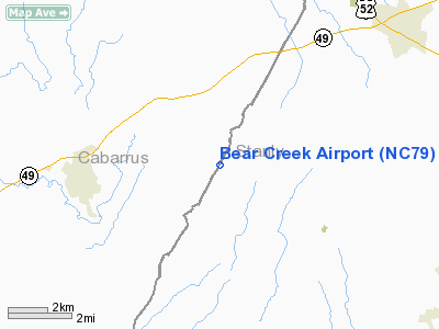
Location & QuickFacts
| FAA Information Effective: | 2008-09-25 |
| Airport Identifier: | NC79 |
| Airport Status: | Operational |
| Longitude/Latitude: | 080-21-27.2180W/35-24-25.5090N
-80.357561/35.407086 (Estimated) |
| Elevation: | 795 ft / 242.32 m (Estimated) |
| Land: | 8 acres |
| From nearest city: | 4 nautical miles E of Mount Pleasant, NC |
| Location: | Cabarrus County, NC |
| Magnetic Variation: | 06W (1985) |
Owner & Manager
| Ownership: | Privately owned |
| Owner: | Arthur Melvin Moose |
| Address: | 18808 Bear Creek Church Rd
Mt Pleasant, NC 28124 |
| Phone number: | 704-436-6894 |
| Manager: | Arthur Melvin Moose |
| Address: | 18808 Bear Creek Church Rd
Mt Pleasant, NC 28124 |
| Phone number: | 704-436-6894 |
Airport Operations and Facilities
| Airport Use: | Private |
| Wind indicator: | Yes |
| Segmented Circle: | No |
| Control Tower: | No |
| Landing fee charge: | No |
| Sectional chart: | Charlotte |
| Region: | ASO - Southern |
| Boundary ARTCC: | ZTL - Atlanta |
| Tie-in FSS: | RDU - Raleigh |
| FSS on Airport: | No |
| FSS Toll Free: | 1-800-WX-BRIEF |
Airport Services
Runway Information
Runway 03/21
| Dimension: | 2025 x 85 ft / 617.2 x 25.9 m |
| Surface: | TURF, Fair Condition |
| |
Runway 03 |
Runway 21 |
| Traffic Pattern: | Left | Left |
| Displaced threshold: | 285.00 ft | 0.00 ft |
| Obstruction: | 80 ft trees, 50.0 ft from runway, 75 ft left of centerline
RY 03 4:1 TO DSPLCD THLD. | 15 ft road, 0.0 ft from runway |
|
Radio Navigation Aids
| ID |
Type |
Name |
Ch |
Freq |
Var |
Dist |
| VU | NDB | Aller | | 346.00 | 06W | 14.4 nm |
| RU | NDB | Rovdy | | 275.00 | 06W | 20.6 nm |
| SEN | NDB | Swearing/dcmsnd | | 260.00 | 06W | 22.6 nm |
| AFP | NDB | Anson County | | 283.00 | 07W | 26.7 nm |
| CQJ | NDB | City Lake | | 266.00 | 08W | 30.4 nm |
| DVZ | NDB | Davie | | 354.00 | 06W | 30.8 nm |
| TWL | NDB | Wesley | | 204.00 | 06W | 32.2 nm |
| IZN | NDB | Lincolnton | | 432.00 | 06W | 36.5 nm |
| PYG | NDB | Pageland | | 270.00 | 06W | 39.8 nm |
| VW | NDB | Temky | | 280.00 | 05W | 41.0 nm |
| GHJ | NDB | Stonia | | 260.00 | 06W | 41.3 nm |
| RCZ | NDB | Roscoe | | 375.00 | 07W | 46.6 nm |
| CQW | NDB | Cheraw | | 409.00 | 05W | 46.7 nm |
| UZ | NDB | Rally | | 227.00 | 05W | 47.2 nm |
| LKR | NDB | Lancaster | | 400.00 | 07W | 47.9 nm |
| HFF | NDB | Mackall | | 278.00 | 06W | 48.5 nm |
| TOX | NDB | Siler City | | 371.00 | 07W | 48.7 nm |
| CLT | VOR/DME | Charlotte | 097X | 115.00 | 05W | 31.9 nm |
| CTF | VOR/DME | Chesterfield | 019X | 108.20 | 03W | 45.7 nm |
| FML | VORTAC | Fort Mill | 071X | 112.40 | 02W | 38.6 nm |
| SDZ | VORTAC | Sandhills | 055X | 111.80 | 03W | 39.5 nm |
| GSO | VORTAC | Greensboro | 109X | 116.20 | 03W | 42.7 nm |
| LIB | VORTAC | Liberty | 077X | 113.00 | 03W | 43.8 nm |
| CLT | VOT | Charlotte | | 112.00 | | 30.7 nm |
Remarks
- RWY 03 THR ELEV APPROX 30' LOWER THAN RWY 21 THR.
- AER 03 HAS NUMEROUS TREES BUT RY SLOPES UPHILL.
- MILITARY OPNS AT NIGHT.
- NON-COMPLIANCE WITH FAR 157.
Images and information placed above are from
http://www.airport-data.com/airport/NC79/
We thank them for the data!
|
|


