 |
|
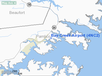
Location & QuickFacts
| FAA Information Effective: | 2008-09-25 |
| Airport Identifier: | 4NC2 |
| Airport Status: | Operational |
| Longitude/Latitude: | 076-36-43.7390W/35-12-27.6010N
-76.612150/35.207667 (Estimated) |
| Elevation: | 2 ft / 0.61 m (Estimated) |
| Land: | 0 acres |
| From nearest city: | 9 nautical miles NE of Bayboro, NC |
| Location: | Pamlico County, NC |
| Magnetic Variation: | 08W (1985) |
Owner & Manager
| Ownership: | Privately owned |
| Owner: | Johnny W. Leary |
| Address: | 190 Air Strip Road
Bayboro, NC 28515-9372 |
| Phone number: | 252-745-3521
FAX NUMBER 252-745-3521; PRESS STAR 51. |
| Manager: | Johnny W. Leary |
| Address: | 190 Air Strip Road
Bayboro, NC 28515-9372 |
| Phone number: | 252-745-3521 |
Airport Operations and Facilities
| Airport Use: | Private |
| Wind indicator: | No |
| Segmented Circle: | No |
| Control Tower: | No |
| Landing fee charge: | No |
| Sectional chart: | Charlotte |
| Region: | ASO - Southern |
| Boundary ARTCC: | ZDC - Washington |
| Tie-in FSS: | RDU - Raleigh |
| FSS on Airport: | No |
| FSS Toll Free: | 1-800-WX-BRIEF |
Runway Information
Runway 09/27
| Dimension: | 2000 x 150 ft / 609.6 x 45.7 m |
| Surface: | TURF, |
| |
Runway 09 |
Runway 27 |
| Traffic Pattern: | Left | Left |
| Obstruction: | 50 ft trees, 600.0 ft from runway | 50 ft trees, 200.0 ft from runway |
|
Radio Navigation Aids
| ID |
Type |
Name |
Ch |
Freq |
Var |
Dist |
| PGV | FAN MARKER | Belvoir | | | 06W | 45.8 nm |
| HI | MARINE NDB | Hatteras Inlet Station/dcm | | 1.00 | 09W | 44.5 nm |
| MRH | NDB | Morehead | | 269.00 | 08W | 28.7 nm |
| RNW | NDB | Chocowinity | | 388.00 | 07W | 30.3 nm |
| PMZ | NDB | Plymouth | | 221.00 | 10W | 36.9 nm |
| AQE | NDB | Alwood | | 230.00 | 09W | 47.8 nm |
| MCZ | NDB | Williamston | | 336.00 | 09W | 47.9 nm |
| EDE | NDB | Edenton | | 265.00 | 10W | 49.2 nm |
| NCA | NDB | New River | | 356.00 | 08W | 49.7 nm |
| OUC | NDB/DME | Pamlico/dcmsnd | 034X | 404.00 | 09W | 31.2 nm |
| NKT | TACAN | Cherry Point | 075X | | 09W | 22.5 nm |
| NJM | TACAN | Bogue Mcalf | 067X | | 08W | 37.3 nm |
| EWN | VOR/DME | New Bern | 083X | 113.60 | 08W | 22.8 nm |
| ISO | VORTAC | Kinston | 033X | 109.60 | 05W | 47.4 nm |
Remarks
- CAUTION: LOW LEVEL MILITARY FLIGHTS WITHIN ARPT AREA.
Images and information placed above are from
http://www.airport-data.com/airport/4NC2/
We thank them for the data!
| General Info
|
| Country |
United States
|
| State |
NORTH CAROLINA
|
| FAA ID |
4NC2
|
| Latitude |
35-12-27.601N
|
| Longitude |
076-36-43.739W
|
| Elevation |
2 feet
|
| Near City |
BAYBORO
|
We don't guarantee the information is fresh and accurate. The data may
be wrong or outdated.
For more up-to-date information please refer to other sources.
|
|


