 |
|
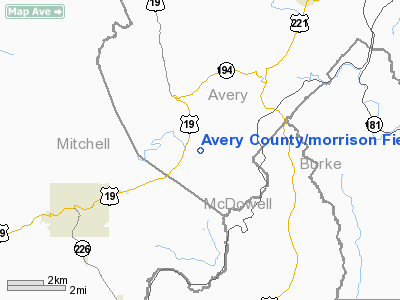
Avery County/morrison Field/ Airport |
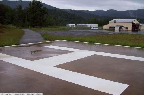 |
(Click on the photo to enlarge) |
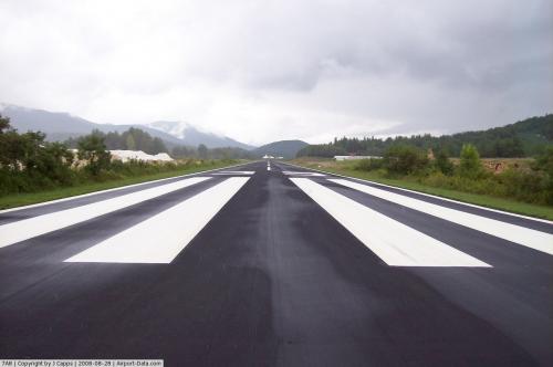 |
(Click on the photo to enlarge) |
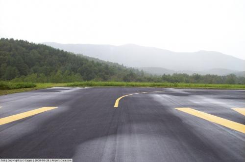 |
(Click on the photo to enlarge) |
 |
(Click on the photo to enlarge) |
 |
(Click on the photo to enlarge) |
Location & QuickFacts
| FAA Information Effective: | 2008-09-25 |
| Airport Identifier: | 7A8 |
| Airport Status: | Operational |
| Longitude/Latitude: | 081-59-44.4100W/35-56-40.4530N
-81.995669/35.944570 (Estimated) |
| Elevation: | 2750 ft / 838.20 m (Surveyed) |
| Land: | 32 acres |
| From nearest city: | 4 nautical miles NE of Spruce Pine, NC |
| Location: | Avery County, NC |
| Magnetic Variation: | 04W (1985) |
Owner & Manager
| Ownership: | Publicly owned |
| Owner: | Avery County Arpt Authority |
| Address: | P O Box 927
Newland, NC 28657 |
| Phone number: | 828-733-8200 |
| Manager: | Ryan Montague |
| Address: | 400 Brushy Creek Road, 360 Shelter Rock Circle
Spruce Pine, NC 28777 |
| Phone number: | 828-766-8187
CELL PH # 828-467-1914. |
Airport Operations and Facilities
| Airport Use: | Open to public |
| Wind indicator: | Yes |
| Segmented Circle: | No |
| Control Tower: | No |
| Landing fee charge: | No |
| Sectional chart: | Atlanta |
| Region: | ASO - Southern |
| Boundary ARTCC: | ZTL - Atlanta |
| Tie-in FSS: | RDU - Raleigh |
| FSS on Airport: | No |
| FSS Toll Free: | 1-800-WX-BRIEF |
| NOTAMs Facility: | RDU (NOTAM-d service avaliable) |
| Federal Agreements: | NGY |
Airport Communications
| CTAF: | 123.000 |
| Unicom: | 123.000 |
Airport Services
| Fuel available: | 100LL
SELF-SERVICE FUELING AFTER HOURS WITH CREDIT CARD. |
| Bottled Oxygen: | NONE |
| Bulk Oxygen: | NONE |
Runway Information
Runway 17/35
| Dimension: | 3000 x 60 ft / 914.4 x 18.3 m |
| Surface: | ASPH, Good Condition |
| Weight Limit: | Single wheel: 12500 lbs. |
| |
Runway 17 |
Runway 35 |
| Traffic Pattern: | Right | Left |
| Markings: | Basic, Good Condition | Basic, Good Condition |
| Obstruction: | 100 ft trees, 1346.0 ft from runway, 150 ft left of centerline, 11:1 slope to clear
HIGH GROUND LEFT OF CNTRLN STARTING AT 60 FT FROM RY CENTERLINE +15 FT HIGH 0-100 FT FM THLD. | 145 ft trees, 1238.0 ft from runway, 100 ft right of centerline, 7:1 slope to clear |
|
Radio Navigation Aids
| ID |
Type |
Name |
Ch |
Freq |
Var |
Dist |
| MRN | FAN MARKER | Lenoir | | | 03W | 20.2 nm |
| BAR | NDB | Hemlock | | 320.00 | 02W | 13.8 nm |
| FIQ | NDB | Fiddlers | | 391.00 | 07W | 21.2 nm |
| EZT | NDB | Elizabethton | | 275.00 | 02W | 26.0 nm |
| JJO | NDB | Mountain City | | 396.00 | 04W | 29.6 nm |
| HK | NDB | Tawba | | 332.00 | 06W | 34.9 nm |
| RFE | NDB | Rutherford | | 344.00 | 05W | 35.9 nm |
| BO | NDB | Booie | | 221.00 | 04W | 36.5 nm |
| JU | NDB | Ashee | | 410.00 | 07W | 44.0 nm |
| UKF | NDB | Wilki | | 209.00 | 06W | 44.8 nm |
| DYQ | NDB | Dulaney | | 263.00 | 04W | 45.0 nm |
| SLP | NDB | First River | | 417.00 | 06W | 45.9 nm |
| VW | NDB | Temky | | 280.00 | 05W | 46.5 nm |
| BRA | NDB | Broad River | | 379.00 | 04W | 46.6 nm |
| VJ | NDB | Whine | | 236.00 | 05W | 47.5 nm |
| BZM | VOR/DME | Barretts Mountain | 045X | 110.80 | 06W | 37.0 nm |
| HMV | VORTAC | Holston Mountain | 093X | 114.60 | 04W | 30.3 nm |
| SUG | VORTAC | Sugarloaf Mountain | 059X | 112.20 | 02W | 35.0 nm |
| HKY | VOT | Hickory Regional | | 110.00 | | 31.9 nm |
Remarks
- ARPT RESTRICTED TO VFR ONLY.
- HIGH TERRAIN ALL QUADRANTS, DAYLIGHT VFR OPS ONLY, RY 35 UPHILL GRADE, RY 17 RGT TRAFFIC PREFERRED FOR TAKEOFF.
- RWY 35 MOUNTAINOUS TERRAIN ABOVE RWY ELEVATION- 6000' FROM RWY END- 650' ABOVE RWY ELEVATION- ON CNTRLN.
- RY 35 HAS 60 FT DROPOFF 200 FT FROM THLD. RY 17 HAS 40 FT DROPOFF 300 FT FROM THLD.
- ARPT PHONE NR 828-761-7661.
- FBO SVC AVBL.
Images and information placed above are from
http://www.airport-data.com/airport/7A8/
We thank them for the data!
| General Info
|
| Country |
United States
|
| State |
NORTH CAROLINA
|
| FAA ID |
7A8
|
| Latitude |
35-56-40.453N
|
| Longitude |
081-59-44.410W
|
| Elevation |
2750 feet
|
| Near City |
SPRUCE PINE
|
We don't guarantee the information is fresh and accurate. The data may
be wrong or outdated.
For more up-to-date information please refer to other sources.
|
|


