 |
|
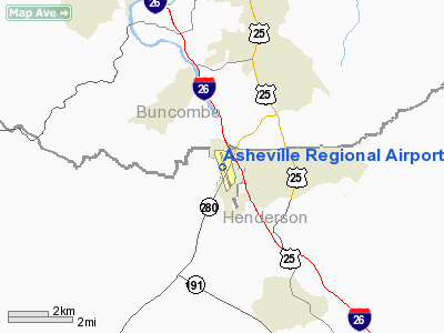
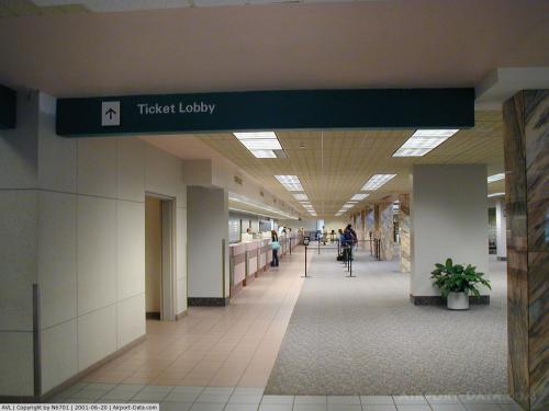
| Asheville Regional Airport |
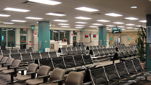 |
| Gates B2 and B3 in the main terminal. |
| IATA: AVL – ICAO: KAVL – FAA LID: AVL |
| Summary |
| Airport type |
Public |
| Owner |
City of Asheville |
| Operator |
Asheville Regional Airport Authority |
| Serves |
Asheville, North Carolina |
| Elevation AMSL |
2,165 ft / 660 m |
| Coordinates |
35°26′10″N 082°32′30″W / 35.43611°N 82.54167°W / 35.43611; -82.54167 |
| Runways |
| Direction |
Length |
Surface |
| ft |
m |
| 16/34 |
8,001 |
2,439 |
Asphalt |
| Statistics (2007) |
| Aircraft operations |
35,374 |
| Based aircraft |
130 |
| Source: Federal Aviation Administration |
Asheville Regional Airport (IATA: AVL, ICAO: KAVL, FAA LID: AVL) is a Class C airport near Interstate 40 and Interstate 26 in the town of Fletcher, 9 miles (14 km) south of the city of Asheville, in the U.S. state of North Carolina. It is owned by the City of Asheville. In 2009 it served a total of over 580,000 passengers, an increase of 4.1% over 2008. Facilities and aircraft
Asheville Regional Airport covers an area of 900 acres (360 ha) and has one runway designated 16/34 with a 8,001 x 150 ft (2,439 x 46 m) asphalt surface.
For the 12-month period ending June 30, 2007, the airport had 35,374 aircraft operations, an average of 96 per day: 64% general aviation, 24% air taxi, 9% scheduled commercial and 3% military. At that time there were 130 aircraft based at this airport: 57% single-engine, 31% multi-engine, 6% jet and 6% helicopter.
The airport currently sees the following models of aircraft on a regular basis:
- Canadair Regional Jet (50 or 70 passengers)
- De Havilland Canada Dash 8 Turboprop (37 or 50 passengers)
- Embraer ERJ (37 or 50 passengers)
- Boeing 717 (117 passengers)
- Various charter aircraft
A Concorde visited AVL during a 1987 promotional tour and was snowed in. Chartered Boeing 747s (United Airlines) have also visited, as has an Airbus A340 during the visit of Charles, Prince of Wales, to the nearby Biltmore Estate in 1996. AVL's 8,001-foot (2,439 m) runway allows for the operation of almost any aircraft type.
Airlines and destinations
| Airlines |
Destinations |
| AirTran Airways |
Orlando, Tampa [seasonal] |
| American Eagle |
Dallas/Fort Worth [seasonal] |
| Continental Express operated by ExpressJet Airlines |
Houston-Intercontinental, Newark |
| Delta Connection operated by Atlantic Southeast Airlines |
Atlanta |
| Delta Connection operated by Chautauqua Airlines |
New York-LaGuardia |
| Delta Connection operated by Pinnacle Airlines |
Detroit |
| United Express operated by SkyWest Airlines |
Chicago-O'Hare |
| US Airways Express operated by Air Wisconsin |
Charlotte, New York-LaGuardia [begins October 31] |
| US Airways Express operated by Piedmont Airlines |
Charlotte |
| US Airways Express operated by PSA Airlines |
Charlotte |
Incidents
On July 19, 1967, Piedmont Airlines Flight 22, a Boeing 727, collided in mid-air with a Cessna 310 just south of the airport in Hendersonville, North Carolina. The collision happened just moments after the 727 took off from the Asheville Airport. All 82 people on both planes were killed.
On March 15, 2003, a Cessna 177 Cardinal crashed into Old Fort Mountain after taking off from the airport. It killed author Amanda Davis, who was on a book tour promoting her first novel Wonder When You'll Miss Me (ISBN 0-688-16781-0), and her parents.
On May 4, 2007, a 1977 Cessna 182 en route to Asheville Airport crashed near the airport, killing three Georgia men. Initial reports said that rapper Jay-Z was on-board. These reports were false, however.
The above content comes from Wikipedia and is published under free licenses – click here to read more.
 |
(Click on the photo to enlarge) |
 |
(Click on the photo to enlarge) |
 |
(Click on the photo to enlarge) |
Location & QuickFacts
| FAA Information Effective: | 2008-09-25 |
| Airport Identifier: | AVL |
| Airport Status: | Operational |
| Longitude/Latitude: | 082-32-30.5000W/35-26-10.3000N
-82.541806/35.436194 (Estimated) |
| Elevation: | 2165 ft / 659.89 m (Surveyed) |
| Land: | 900 acres |
| From nearest city: | 9 nautical miles S of Asheville, NC |
| Location: | Buncombe County, NC |
| Magnetic Variation: | 04W (1985) |
Owner & Manager
| Ownership: | Publicly owned |
| Owner: | City Of Asheville |
| Address: | 61 Terminal Dr Suite 1
Fletcher, NC 28732-9442 |
| Phone number: | 828-684-2226 |
| Manager: | David Edwards |
| Address: | 61 Terminal Dr Suite 1
Fletcher, NC 28732-9442 |
| Phone number: | 828-684-2226
PUBLIC SAFETY PHONE 828-687-3554. |
Airport Operations and Facilities
| Airport Use: | Open to public |
| Wind indicator: | Yes |
| Segmented Circle: | Yes |
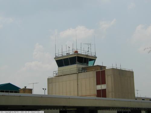
| Control Tower: | Yes |
| Lighting Schedule: | DUSK-DAWN
HIRL PRESET TO OFF WHEN TWR CLSD, TO INCREASE INTNSTY AND ACTIVATE HIRL AND MALSR RYS 16 & 34 - CTAF. |
| Beacon Color: | Clear-Green (lighted land airport) |
| Landing fee charge: | No |
| Sectional chart: | Atlanta |
| Region: | ASO - Southern |
| Boundary ARTCC: | ZTL - Atlanta |
| Tie-in FSS: | RDU - Raleigh |
| FSS on Airport: | No |
| FSS Toll Free: | 1-800-WX-BRIEF |
| NOTAMs Facility: | AVL (NOTAM-d service avaliable) |
| Certification type/date: | I B S 05/1973
PPR FOR UNSKED ACR OPNS WITH MORE THAN 30 PSGR SEATS 2300-0700; CALL AMGR 828-684-2226. |
| Federal Agreements: | NGY |
Airport Communications
| CTAF: | 121.100 |
| Unicom: | 122.950 |
Airport Services
| Fuel available: | 100LLA |
| Airframe Repair: | MINOR |
| Power Plant Repair: | MINOR |
| Bottled Oxygen: | HIGH |
| Bulk Oxygen: | NONE |
Runway Information
Runway 16/34
| Dimension: | 8001 x 150 ft / 2438.7 x 45.7 m |
| Surface: | ASPH, Good Condition |
| Surface Treatment: | Saw-cut or plastic Grooved |
| Weight Limit: | Single wheel: 120000 lbs.
Dual wheel: 160000 lbs.
Dual tandem wheel: 260000 lbs. |
| Edge Lights: | High |
| |
Runway 16 |
Runway 34 |
| Longitude: | 082-32-47.1917W | 082-32-13.8513W |
| Latitude: | 35-26-47.3858N | 35-25-33.1219N |
| Elevation: | 2165.00 ft | 2111.00 ft |
| Alignment: | 127 | 127 |
| ILS Type: | ILS
| ILS
|
| Traffic Pattern: | Left | Left |
| Markings: | Precision instrument, Good Condition | Precision instrument, Good Condition |
| Crossing Height: | 54.00 ft | 57.00 ft |
| VASI: | 4-light PAPI on left side | 4-box on left side |
| Visual Glide Angle: | 3.00° | 2.80° |
| RVR Equipment: | touchdown | touchdown |
| Approach lights: | MALSR | MALSR |
| Centerline Lights: | Yes | Yes |
| Touchdown Lights: | | Yes |
|
Radio Navigation Aids
| ID |
Type |
Name |
Ch |
Freq |
Var |
Dist |
| MRN | FAN MARKER | Lenoir | | | 03W | 49.8 nm |
| BRA | NDB | Broad River | | 379.00 | 04W | 10.4 nm |
| RFE | NDB | Rutherford | | 344.00 | 05W | 29.3 nm |
| LQK | NDB | Lake Keowee | | 408.00 | 04W | 38.4 nm |
| FRT | NDB | Fairmont | | 248.00 | 05W | 42.2 nm |
| GY | NDB | Dyana | | 338.00 | 03W | 45.0 nm |
| DYQ | NDB | Dulaney | | 263.00 | 04W | 45.4 nm |
| FIQ | NDB | Fiddlers | | 391.00 | 07W | 45.6 nm |
| SLP | NDB | First River | | 417.00 | 06W | 47.5 nm |
| CEU | NDB | Clemson | | 257.00 | 05W | 48.9 nm |
| SUG | VORTAC | Sugarloaf Mountain | 059X | 112.20 | 02W | 13.5 nm |
| SOT | VORTAC | Snowbird | 025X | 108.80 | 04W | 32.8 nm |
| SPA | VORTAC | Spartanburg | 104X | 115.70 | 02W | 38.7 nm |
Images and information placed above are from
http://www.airport-data.com/airport/AVL/
We thank them for the data!
| General Info
|
| Country |
United States
|
| State |
NORTH CAROLINA
|
| FAA ID |
AVL
|
| Latitude |
35-26-10.300N
|
| Longitude |
082-32-30.500W
|
| Elevation |
2165 feet
|
| Near City |
ASHEVILLE
|
We don't guarantee the information is fresh and accurate. The data may
be wrong or outdated.
For more up-to-date information please refer to other sources.
|
|


