 |
|
| Ashe County Airport |
| IATA: none – ICAO: KGEV – FAA LID: GEV |
| Summary |
| Airport type |
Public |
| Operator |
Ashe County |
| Location |
Jefferson, North Carolina |
| Elevation AMSL |
3,180 ft / 969.3 m |
| Coordinates |
36°25′57″N 081°25′11″W / 36.4325°N 81.41972°W / 36.4325; -81.41972 |
| Runways |
| Direction |
Length |
Surface |
| ft |
m |
| 10/28 |
4,293 |
1,309 |
Asphalt |
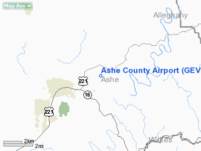
Ashe County Airport (ICAO: KGEV, FAA LID: GEV) is a public airport located three miles (5 km) east of the central business district (CBD) of Jefferson, a town in Ashe County, North Carolina, USA. This general aviation airport covers 106 acres (43 ha) and has one runway.
Although most U.S. airports use the same three-letter location identifier for the FAA and IATA, Ashe County Airport is assigned GEV by the FAA but has no designation from the IATA (which assigned GEV to Gällivare Airport in Gällivare, Sweden). The airport's ICAO identifier is KGEV.
The above content comes from Wikipedia and is published under free licenses – click here to read more.
Location & QuickFacts
| FAA Information Effective: | 2008-09-25 |
| Airport Identifier: | GEV |
| Airport Status: | Operational |
| Longitude/Latitude: | 081-25-10.8650W/36-25-56.7520N
-81.419685/36.432431 (Estimated) |
| Elevation: | 3180 ft / 969.26 m (Surveyed) |
| Land: | 106 acres |
| From nearest city: | 3 nautical miles E of Jefferson, NC |
| Location: | Ashe County, NC |
| Magnetic Variation: | 07W (2000) |
Owner & Manager
| Ownership: | Publicly owned |
| Owner: | Ashe County |
| Address: | 225 Friendship Baptist Church Road
Jefferson, NC 28640 |
| Phone number: | 336-219-2501 |
| Manager: | James Marvin Stump |
| Address: | 639 Airport Road
Jefferson, NC 28640 |
| Phone number: | 336-982-3713 |
Airport Operations and Facilities
| Airport Use: | Open to public |
| Wind indicator: | Yes |
| Segmented Circle: | Yes |
| Control Tower: | No |
| Lighting Schedule: | DUSK-DAWN
ACTVT MIRL RY 10/28, VASI RY 28 & REIL RY 28 - CTAF. ALLOW 1 SECOND INTERVALS BETWEEN CLICKS. |
| Beacon Color: | Clear-Green (lighted land airport) |
| Landing fee charge: | No |
| Sectional chart: | Cincinnati |
| Region: | ASO - Southern |
| Boundary ARTCC: | ZTL - Atlanta |
| Tie-in FSS: | RDU - Raleigh |
| FSS on Airport: | No |
| FSS Toll Free: | 1-800-WX-BRIEF |
| NOTAMs Facility: | GEV (NOTAM-d service avaliable) |
| Federal Agreements: | NGY |
Airport Communications
| CTAF: | 122.800 |
| Unicom: | 122.800 |
Airport Services
| Fuel available: | 100LLA |
| Airframe Repair: | MINOR |
| Power Plant Repair: | MINOR |
| Bottled Oxygen: | NONE |
| Bulk Oxygen: | NONE |
Runway Information
Runway 10/28
| Dimension: | 4293 x 75 ft / 1308.5 x 22.9 m |
| Surface: | ASPH, Good Condition |
| Weight Limit: | Single wheel: 12500 lbs. |
| Edge Lights: | Medium |
| |
Runway 10 |
Runway 28 |
| Longitude: | 081-25-37.1850W | 081-24-44.6650W |
| Latitude: | 36-25-56.3920N | 36-25-57.2150N |
| Elevation: | 3180.00 ft | 3102.00 ft |
| Alignment: | 89 | 127 |
| ILS Type: | | LOC/DME
|
| Traffic Pattern: | Left | Left |
| Markings: | Non-precision instrument, Fair Condition
RWY 10 MARKING FADED | Non-precision instrument, Fair Condition
RWY 28 MARKING FADED |
| Crossing Height: | 0.00 ft | 44.00 ft |
| VASI: | | 2-box on left side |
| Visual Glide Angle: | 0.00° | 3.30° |
| Runway End Identifier: | | Yes |
| Obstruction: | 25 ft trees, 542.0 ft from runway, 150 ft left of centerline, 13:1 slope to clear | 21 ft trees, 608.0 ft from runway, 19:1 slope to clear |
|
Radio Navigation Aids
| ID |
Type |
Name |
Ch |
Freq |
Var |
Dist |
| MRN | FAN MARKER | Lenoir | | | 03W | 39.5 nm |
| JU | NDB | Ashee | | 410.00 | 07W | 4.7 nm |
| JJO | NDB | Mountain City | | 396.00 | 04W | 19.6 nm |
| UKF | NDB | Wilki | | 209.00 | 06W | 24.7 nm |
| BAR | NDB | Hemlock | | 320.00 | 02W | 27.9 nm |
| MK | NDB | Suzze | | 335.00 | 06W | 30.5 nm |
| VJ | NDB | Whine | | 236.00 | 05W | 31.3 nm |
| ZEF | NDB | Zephyr | | 326.00 | 05W | 34.5 nm |
| HLX | NDB | Hillsville | | 269.00 | 06W | 35.0 nm |
| HK | NDB | Tawba | | 332.00 | 06W | 39.2 nm |
| EZT | NDB | Elizabethton | | 275.00 | 02W | 41.8 nm |
| AZW | NDB | Mount Airy | | 223.00 | 07W | 42.7 nm |
| VW | NDB | Temky | | 280.00 | 05W | 43.1 nm |
| FIQ | NDB | Fiddlers | | 391.00 | 07W | 45.1 nm |
| BZM | VOR/DME | Barretts Mountain | 045X | 110.80 | 06W | 35.0 nm |
| GZG | VOR/DME | Glade Spring | 039X | 110.20 | 02W | 39.6 nm |
| HMV | VORTAC | Holston Mountain | 093X | 114.60 | 04W | 34.3 nm |
| HKY | VOT | Hickory Regional | | 110.00 | | 41.6 nm |
Remarks
- RISING TERRAIN ALL QUADRANTS.
- DEER IN VICINITY OF ARPT.
- RYS 10 & 28 SAFETY AREAS HAVE 100 FT DROPOFFS 270 FT FM THLD.
- RY 28 HAS A UPHILL GRADE.
- CONSTN ACTVTY ON RAMP & TWY.
Images and information placed above are from
http://www.airport-data.com/airport/GEV/
We thank them for the data!
| General Info
|
| Country |
United States
|
| State |
NORTH CAROLINA
|
| FAA ID |
GEV
|
| Latitude |
36-25-56.752N
|
| Longitude |
081-25-10.865W
|
| Elevation |
3180 feet
|
| Near City |
JEFFERSON
|
We don't guarantee the information is fresh and accurate. The data may
be wrong or outdated.
For more up-to-date information please refer to other sources.
|
|


