|
|
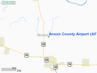
| Anson County Airport |
 |
| IATA: none – ICAO: KAFP – FAA LID: AFP |
| Summary |
| Airport type |
Public |
| Owner |
Anson County |
| Location |
Wadesboro, North Carolina |
| Elevation AMSL |
300 ft / 91 m |
| Coordinates |
35°01′14″N 080°04′38″W / 35.02056°N 80.07722°W / 35.02056; -80.07722 |
| Runways |
| Direction |
Length |
Surface |
| ft |
m |
| 16/34 |
5,498 |
1,676 |
Asphalt |
| Statistics (2005) |
| Aircraft operations |
7,200 |
| Based aircraft |
32 |
| Source: Federal Aviation Administration |
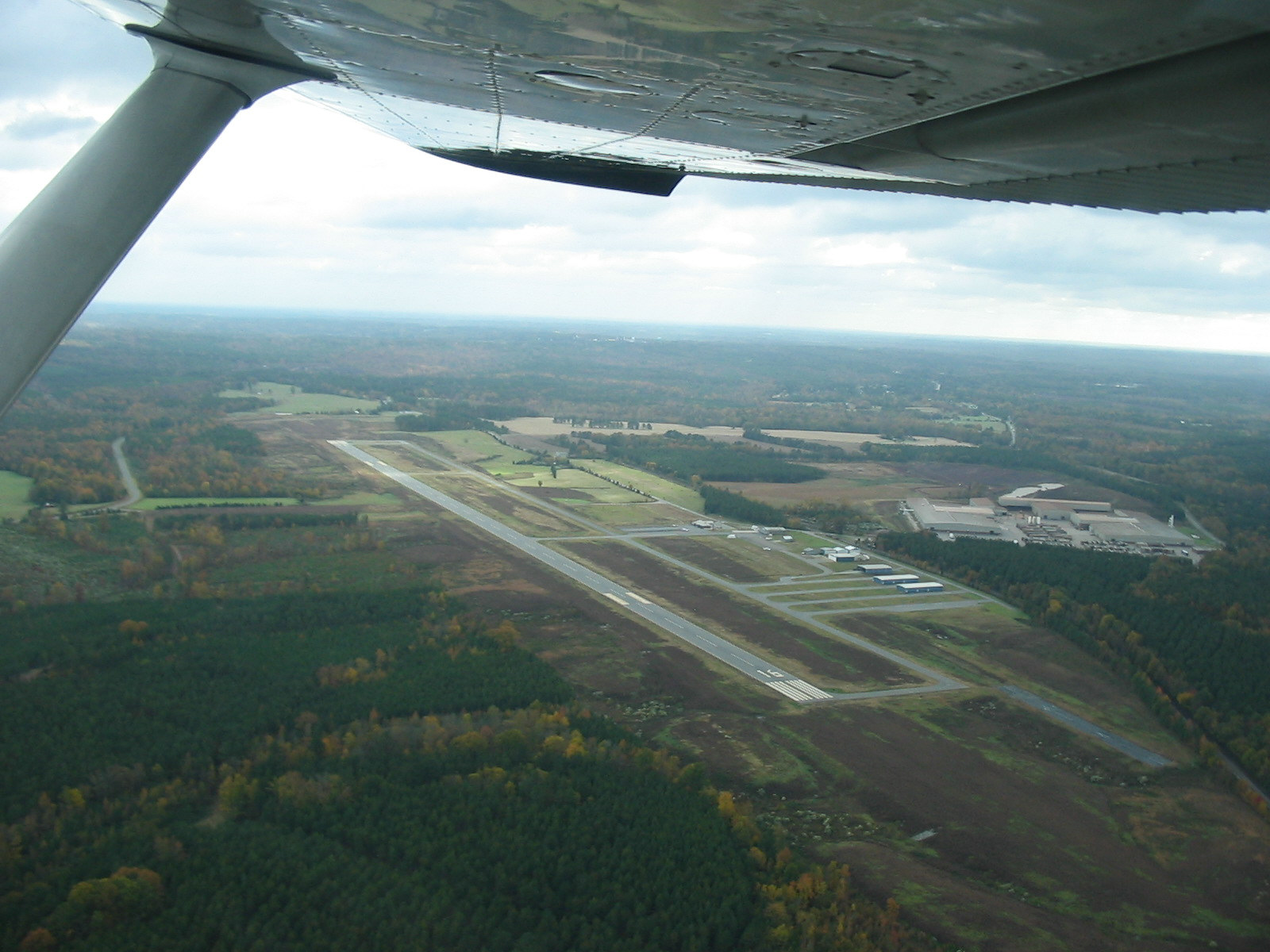
Anson County Airport (ICAO: KAFP, FAA LID: AFP) is a public airport located three miles (5 km) north of the central business district of Wadesboro, a town in Anson County, North Carolina, United States. It is owned by Anson County.
Although most U.S. airports use the same three-letter location identifier for the FAA and IATA, Anson County Airport is assigned AFP by the FAA but has no designation from the IATA. Facilities and aircraft
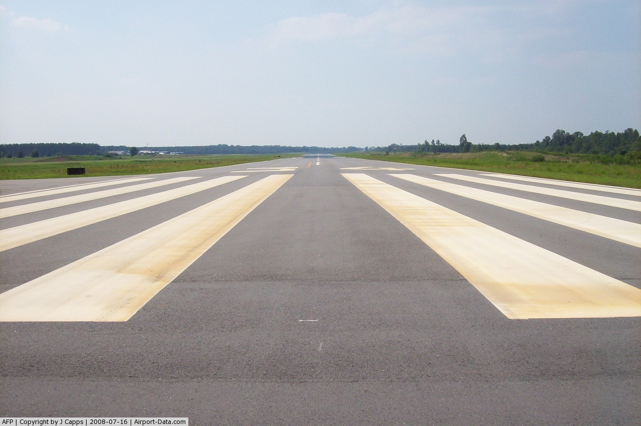
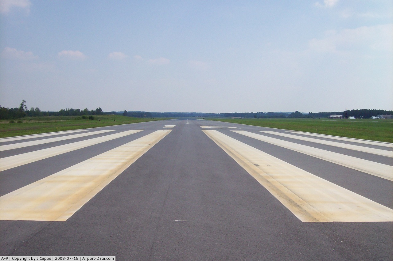
Anson County Airport covers an area of 286 acres (116 ha) which contains one asphalt paved runway (16/34) measuring 5,498 x 100 ft (1,676 x 30 m). For the 12-month period ending August 3, 2005, the airport had 7,200 aircraft operations, an average of 19 per day: 90% general aviation, 7% air taxi and 3% military. There are 32 aircraft based at this airport: 66% single engine, 25% ultralight, 6% multi-engine and 3% gliders.
History
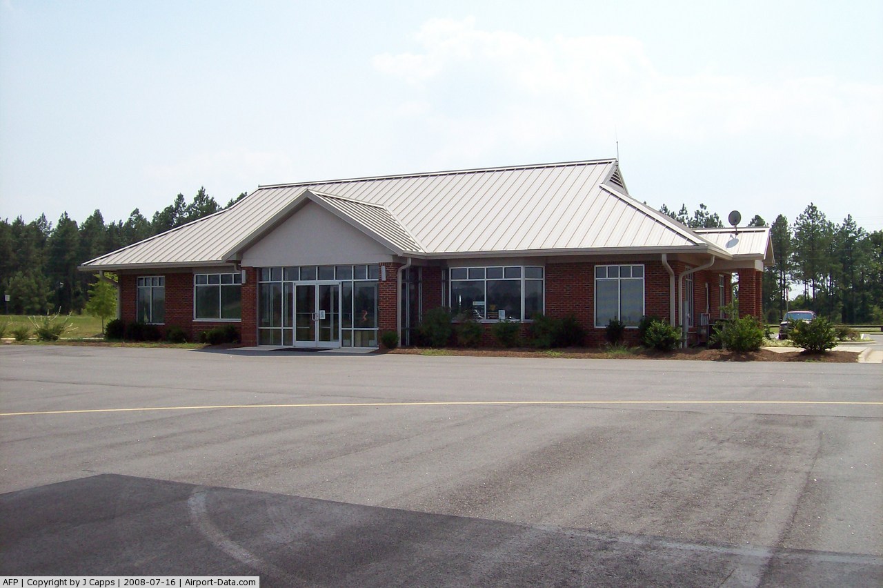
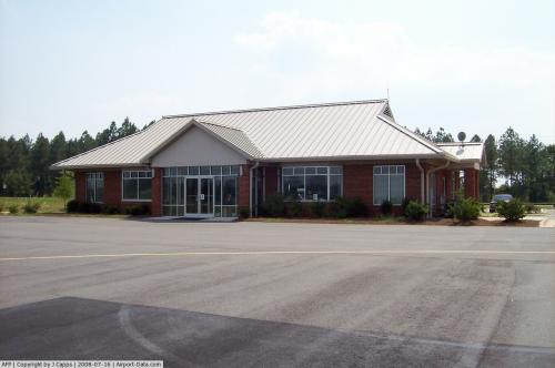
The Anson County Airport was originally equipped with a runway only 3,464 ft. long. In 2006, a new 5,500 ft. runway was completed, in addition to a new 2,400 sq. ft. terminal building and several new hangars. Future plans for the airport include the addition of a new Instrument Landing System.
The above content comes from Wikipedia and is published under free licenses – click here to read more.
 |
(Click on the photo to enlarge) |
 |
(Click on the photo to enlarge) |
 |
(Click on the photo to enlarge) |
Location & QuickFacts
| FAA Information Effective: | 2008-09-25 |
| Airport Identifier: | AFP |
| Airport Status: | Operational |
| Longitude/Latitude: | 080-04-37.6251W/35-01-14.2959N
-80.077118/35.020638 (Estimated) |
| Elevation: | 300 ft / 91.44 m (Surveyed) |
| Land: | 286 acres |
| From nearest city: | 3 nautical miles N of Wadesboro, NC |
| Location: | Anson County, NC |
| Magnetic Variation: | 07W (2000) |
Owner & Manager
| Ownership: | Publicly owned |
| Owner: | Anson County |
| Address: | 114 Greene Street
Wadesboro, NC 28170 |
| Phone number: | 704-694-2796 |
| Manager: | Gary N. Fincher |
| Address: | 2980 Airport Road
Wadesboro, NC 28170 |
| Phone number: | 704-694-2516 |
Airport Operations and Facilities
| Airport Use: | Open to public |
| Wind indicator: | Yes |
| Segmented Circle: | Yes |
| Control Tower: | No |
| Lighting Schedule: | DUSK-DAWN
ACTVT MIRL RY 16/34, PAPI & REILS RYS 16 & 34 - CTAF. |
| Beacon Color: | Clear-Green (lighted land airport) |
| Landing fee charge: | No |
| Sectional chart: | Charlotte |
| Region: | ASO - Southern |
| Boundary ARTCC: | ZTL - Atlanta |
| Tie-in FSS: | RDU - Raleigh |
| FSS on Airport: | No |
| FSS Toll Free: | 1-800-WX-BRIEF |
| NOTAMs Facility: | RDU (NOTAM-d service avaliable) |
| Federal Agreements: | N |
Airport Communications
| CTAF: | 122.800 |
| Unicom: | 122.800 |
Airport Services
| Fuel available: | 100LLA1+
100LL FUEL - 24 HR SELF SERVICE AVAILABLE WITH CREDIT CARD. |
| Airframe Repair: | NONE |
| Power Plant Repair: | NONE |
| Bottled Oxygen: | NONE |
| Bulk Oxygen: | NONE |
Runway Information
Runway 16/34
| Dimension: | 5498 x 100 ft / 1675.8 x 30.5 m |
| Surface: | ASPH, Good Condition |
| Weight Limit: | Single wheel: 12000 lbs.
Dual wheel: 60000 lbs. |
| Edge Lights: | Medium |
| |
Runway 16 |
Runway 34 |
| Longitude: | 080-04-51.8347W | 080-04-23.4155W |
| Latitude: | 35-01-38.8451N | 35-00-49.7466N |
| Elevation: | 299.00 ft | 297.00 ft |
| Alignment: | 127 | 127 |
| Traffic Pattern: | Left | Left |
| Markings: | Non-precision instrument, Good Condition | Non-precision instrument, Good Condition |
| Crossing Height: | 30.00 ft | 29.00 ft |
| VASI: | 2-light PAPI on left side | 2-light PAPI on left side |
| Visual Glide Angle: | 3.00° | 3.00° |
| Runway End Identifier: | Yes | Yes |
| Centerline Lights: | No | No |
| Touchdown Lights: | No | No |
| Obstruction: | 53 ft trees, 1512.0 ft from runway, 188 ft right of centerline, 24:1 slope to clear | 44 ft trees, 1579.0 ft from runway, 270 ft left of centerline, 31:1 slope to clear
7 FT HILL 0-200 FT FROM END OF RY AND 216 FT RIGHT OF CNTRLN. |
|
Radio Navigation Aids
| ID |
Type |
Name |
Ch |
Freq |
Var |
Dist |
| AFP | NDB | Anson County | | 283.00 | 07W | 0.4 nm |
| CQW | NDB | Cheraw | | 409.00 | 05W | 19.7 nm |
| PYG | NDB | Pageland | | 270.00 | 06W | 21.0 nm |
| RCZ | NDB | Roscoe | | 375.00 | 07W | 21.4 nm |
| VU | NDB | Aller | | 346.00 | 06W | 28.1 nm |
| HFF | NDB | Mackall | | 278.00 | 06W | 29.1 nm |
| BES | NDB | Bennettsville | | 230.00 | 07W | 29.5 nm |
| TWL | NDB | Wesley | | 204.00 | 06W | 31.2 nm |
| ME | NDB | Maxtn | | 257.00 | 08W | 35.6 nm |
| UDG | NDB | Darlington | | 245.00 | 06W | 36.0 nm |
| HVS | NDB | Hartsville | | 341.00 | 07W | 37.0 nm |
| LKR | NDB | Lancaster | | 400.00 | 07W | 42.4 nm |
| CQJ | NDB | City Lake | | 266.00 | 08W | 43.1 nm |
| SEN | NDB | Swearing/dcmsnd | | 260.00 | 06W | 46.9 nm |
| EEJ | NDB | Lee County/dcmsnd | | 428.00 | 07W | 47.0 nm |
| RU | NDB | Rovdy | | 275.00 | 06W | 47.4 nm |
| DLC | NDB | Dillon | | 274.00 | 05W | 49.0 nm |
| CTF | VOR/DME | Chesterfield | 019X | 108.20 | 03W | 24.3 nm |
| CLT | VOR/DME | Charlotte | 097X | 115.00 | 05W | 44.2 nm |
| SDZ | VORTAC | Sandhills | 055X | 111.80 | 03W | 26.7 nm |
| FML | VORTAC | Fort Mill | 071X | 112.40 | 02W | 43.3 nm |
| CLT | VOT | Charlotte | | 112.00 | | 43.9 nm |
Remarks
- DEER IN VICINITY OF ARPT.
- RY 16/34 USED FOR BOTH AERO TOW AND AUTO LAUNCH FOR GLIDERS.
Images and information placed above are from
http://www.airport-data.com/airport/AFP/
We thank them for the data!
| General Info
|
| Country |
United States
|
| State |
NORTH CAROLINA
|
| FAA ID |
AFP
|
| Latitude |
35-01-26.314N
|
| Longitude |
080-04-52.584W
|
| Elevation |
301 feet
|
| Near City |
WADESBORO
|
We don't guarantee the information is fresh and accurate. The data may
be wrong or outdated.
For more up-to-date information please refer to other sources.
|
|