|
|
| Western Carolina Regional Airport |
| IATA: none – ICAO: KRHP – FAA LID: RHP |
| Summary |
| Airport type |
Public |
| Owner |
Cherokee County |
| Serves |
Andrews, North Carolina |
| Elevation AMSL |
1,697 ft / 517 m |
| Coordinates |
35°11′43″N 083°51′47″W / 35.19528°N 83.86306°W / 35.19528; -83.86306 |
| Runways |
| Direction |
Length |
Surface |
| ft |
m |
| 8/26 |
5,500 |
1,676 |
Asphalt |
| Statistics (2008) |
| Aircraft operations |
20,500 |
| Based aircraft |
73 |
| Source: Federal Aviation Administration |
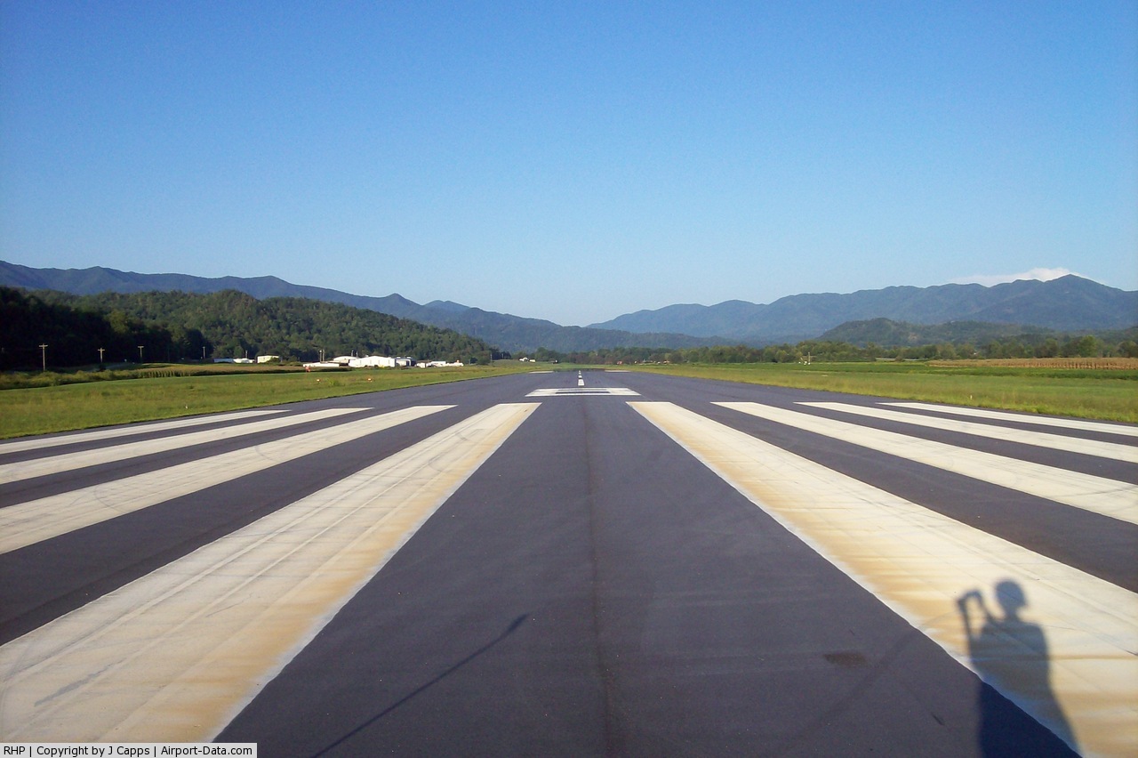
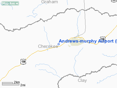
Western Carolina Regional Airport (ICAO: KRHP, FAA LID: RHP) is a county-owned public-use airport located two nautical miles (3.7 km) west of the central business district of Andrews, in Cherokee County, North Carolina, United States. It was formerly known as Andrews-Murphy Airport.
Although many U.S. airports use the same three-letter location identifier for the FAA and IATA, this facility is assigned RHP by the FAA and has no assignment from the IATA (which assigned RHP to Ramechhap, Nepal). The airport's ICAO identifier is KRHP.
Facilities and aircraft
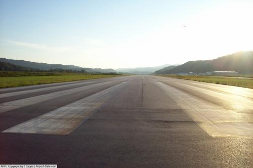
Western Carolina Regional Airport covers an area of 206 acres (83 ha) at an elevation of 1,697 feet (517 m) above mean sea level. It has one runway designated 8/26 with an asphalt surface measuring 5,500 by 100 feet (1,676 x 30 m).
For the 12-month period ending September 8, 2008, the airport had 20,500 aircraft operations, an average of 56 per day: 93% general aviation, 5% air taxi, and 2% military. At that time there were 73 aircraft based at this airport: 64% single-engine, 27% multi-engine and 8% helicopter.
The above content comes from Wikipedia and is published under free licenses – click here to read more.
 |
(Click on the photo to enlarge) |
 |
(Click on the photo to enlarge) |
Location & QuickFacts
| FAA Information Effective: | 2008-09-25 |
| Airport Identifier: | RHP |
| Airport Status: | Operational |
| Longitude/Latitude: | 083-51-46.9390W/35-11-42.8270N
-83.863039/35.195230 (Estimated) |
| Elevation: | 1697 ft / 517.25 m (Surveyed) |
| Land: | 206 acres |
| From nearest city: | 2 nautical miles W of Andrews, NC |
| Location: | Cherokee County, NC |
| Magnetic Variation: | 04W (2000) |
Owner & Manager
| Ownership: | Publicly owned |
| Owner: | Cherokee County |
| Address: | County Courthouse
Andrews, NC 28906 |
| Phone number: | 828-837-5527 |
| Manager: | Dan Ellis |
| Address: | 5840 Airport Road
Andrews, NC 28906 |
| Phone number: | 828-321-5114 |
Airport Operations and Facilities
| Airport Use: | Open to public |
| Wind indicator: | Yes |
| Segmented Circle: | Yes |
| Control Tower: | No |
| Lighting Schedule: | DUSK-DAWN
ACTVT REIL RY 08 - CTAF. PAPI RYS 08 & 26 OPER CONT, TO INCR INTST - CTAF. |
| Beacon Color: | Clear-Green (lighted land airport)
LCTD 0.5 MI NORTH OF WEST END OF RY 08/26. |
| Landing fee charge: | No |
| Sectional chart: | Atlanta |
| Region: | ASO - Southern |
| Boundary ARTCC: | ZTL - Atlanta |
| Tie-in FSS: | RDU - Raleigh |
| FSS on Airport: | No |
| FSS Toll Free: | 1-800-WX-BRIEF |
| NOTAMs Facility: | RHP (NOTAM-d service avaliable) |
| Federal Agreements: | NGY |
Airport Communications
| CTAF: | 122.800 |
| Unicom: | 122.800 |
Airport Services
| Fuel available: | 100 A A1+ |
| Airframe Repair: | MAJOR |
| Power Plant Repair: | MAJOR |
| Bottled Oxygen: | NONE |
| Bulk Oxygen: | HIGH |
Runway Information
Runway 08/26
| Dimension: | 5500 x 100 ft / 1676.4 x 30.5 m |
| Surface: | ASPH, Good Condition |
| Weight Limit: | Single wheel: 25000 lbs.
Dual wheel: 45000 lbs. |
| Edge Lights: | Medium |
| |
Runway 08 |
Runway 26 |
| Longitude: | 083-52-18.3348W | 083-51-15.5430W |
| Latitude: | 35-11-34.1022N | 35-11-51.5505N |
| Elevation: | 1682.00 ft | 1698.00 ft |
| Alignment: | 71 | 127 |
| Traffic Pattern: | Right | Left |
| Markings: | Non-precision instrument, Fair Condition | Non-precision instrument, Fair Condition |
| Crossing Height: | 38.00 ft | 44.00 ft |
| VASI: | 2-light PAPI on left side
RY 8 PAPI OTS INDEFLY. | 2-light PAPI on left side |
| Visual Glide Angle: | 3.50° | 4.00° |
| Runway End Identifier: | Yes | |
| Obstruction: | 3 ft other, 210.0 ft from runway, 3:1 slope to clear
HAS 3 FT CROPS 0-200 FT FROM THR 90 FT R. | 4 ft fence, 289.0 ft from runway, 75L/ ft right of centerline, 22:1 slope to clear
RWY 26 HAS 4FT FENCE 75 RIGHT AND LEFT OF RUNWAY AT THRESHOLD |
|
Radio Navigation Aids
| ID |
Type |
Name |
Ch |
Freq |
Var |
Dist |
| TTQ | NDB | Tomotla | | 335.00 | 01W | 6.6 nm |
| MNV | NDB | Madisonville | | 361.00 | 04W | 33.0 nm |
| MMI | NDB | Mc Minn County | | 242.00 | 03W | 36.3 nm |
| AJR | NDB | Habersham | | 347.00 | 03W | 44.5 nm |
| HRS | VORTAC | Harris | 035X | 109.80 | 00E | 15.4 nm |
| ODF | VORTAC | Foothills | 081X | 113.40 | 00E | 40.9 nm |
| VXV | VORTAC | Volunteer | 111X | 116.40 | 03W | 42.7 nm |
| TYS | VOT | Knoxville | | 112.00 | | 37.6 nm |
Remarks
- LOW FLYING MILITARY JET ACFT OVERFLY ARPT. CONTACT FSS.
- TWY UNLGTD.
- 4'-5' DITCH 75' FROM RWY CNTRLN ON BOTH SIDES.
- RY 08 RR 390 FT RIGHT OF CNTRLN 260 FT FM THLD.
- ARPT SURROUNDED BY HIGH TERRAIN.
- RY 08 HAS -8 FT DROP-OFF 108 FT FM THLD BOTH SIDES IN RY SAFETY AREA.
Images and information placed above are from
http://www.airport-data.com/airport/RHP/
We thank them for the data!
| General Info
|
| Country |
United States
|
| State |
NORTH CAROLINA
|
| FAA ID |
RHP
|
| Latitude |
35-11-42.020N
|
| Longitude |
083-51-49.830W
|
| Elevation |
1697 feet
|
| Near City |
ANDREWS
|
We don't guarantee the information is fresh and accurate. The data may
be wrong or outdated.
For more up-to-date information please refer to other sources.
|
|