 |
|
| Albert J. Ellis Airport |
| IATA: OAJ – ICAO: KOAJ – FAA LID: OAJ |
| Summary |
| Airport type |
Public |
| Owner |
Onslow County |
| Serves |
Jacksonville, North Carolina |
| Location |
Richlands, North Carolina |
| Elevation AMSL |
94 ft / 29 m |
| Coordinates |
34°49′45″N 077°36′44″W / 34.82917°N 77.61222°W / 34.82917; -77.61222 |
| Website |
www.FlyOAJ.com |
| Runways |
| Direction |
Length |
Surface |
| ft |
m |
| 5/23 |
7,100 |
2,164 |
Asphalt |
| Statistics (2010) |
| Aircraft operations |
36,820 |
| Based aircraft |
21 |
| Sources: FAA and airport web site |
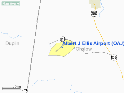
Albert J. Ellis Airport (IATA: OAJ, ICAO: KOAJ, FAA LID: OAJ) is a county-owned public-use airport in Onslow County, North Carolina, United States. It is located in Richlands, 10 nautical miles (19 km) northwest of the central business district of Jacksonville and Marine Corps Base Camp Lejeune. The airport has a single runway and three gates. Opening on February 15, 1971, the airport is used by general aviation, military and is served by two commercial airlines.
On August 30, 2006, Delta Air Lines announced new service from the airport to Atlanta, operated by Delta Connection carrier Atlantic Southeast Airlines, starting on December 11, 2006. Delta Connection operated by ASA operates CRJ-200/700s out of OAJ.
US Airways Express operated by PSA Airlines operates CRJ-100/200s, CRJ 700s and CRJ 900s out of OAJ. US Airways Express operated by Piedmont Airlines operates Dash 8-300/500s out of OAJ. Facilities and Aircraft
Albert J. Ellis Airport covers an area of 675 acres (273 ha) at an elevation of 94 feet (29 m) above mean sea level. It has one runway designated 5/23 with an asphalt surface measuring 7,100 by 150 feet (2,164 x 46 m).
For the 12-month period ending July 31, 2010, the airport had 36,820 aircraft operations, an average of 100 per day: 53% general aviation, 22% scheduled commercial, 19% military, and 6% air taxi. At that time there were 21 aircraft based at this airport: 81% single-engine and 19% multi-engine.
The Airport is served by a fixed based operator, Jacksonville Flying Service who offers fueling, maintenance, flight instruction and aircraft rentals.
Passenger Statistics
| Year |
Passengers |
| 2009 |
249,563 |
| 2008 |
262,178 |
| 2007 |
242,817 |
| 2006 |
179,878 |
| 2005 |
191,194 |
| 2004 |
151,257 |
| 2003 |
87,814 |
| 2002 |
65,210 |
| 2001 |
62,454 |
| 2000 |
77,342 |
Airlines and Destinations
| Airlines |
Destinations |
Delta Connection
operated by Atlantic Southeast Airlines |
Atlanta |
| US Airways Express operated by Piedmont Airlines |
Charlotte |
| US Airways Express operated by PSA Airlines |
Charlotte |
| US Airways Express operated by Air Wisconsin |
Charlotte |
The above content comes from Wikipedia and is published under free licenses – click here to read more.
Location & QuickFacts
| FAA Information Effective: | 2008-09-25 |
| Airport Identifier: | OAJ |
| Airport Status: | Operational |
| Longitude/Latitude: | 077-36-43.6960W/34-49-44.9920N
-77.612138/34.829164 (Estimated) |
| Elevation: | 94 ft / 28.65 m (Surveyed) |
| Land: | 675 acres |
| From nearest city: | 10 nautical miles NW of Jacksonville, NC |
| Location: | Onslow County, NC |
| Magnetic Variation: | 08W (1990) |
Owner & Manager
| Ownership: | Publicly owned |
| Owner: | Onslow County |
| Address: | 521 Mill Ave
Jacksonville, NC 28540 |
| Phone number: | 910-347-4717 |
| Manager: | Jerry Vickers |
| Address: | 264 Ellis Airport Rd
Richlands, NC 28574 |
| Phone number: | 910-324-1100 |
Airport Operations and Facilities
| Airport Use: | Open to public |
| Wind indicator: | Yes |
| Segmented Circle: | Yes |
| Control Tower: | No |
| Lighting Schedule: | DUSK-DAWN
ACTVT HIRL RY 05/23, MALSR RY 05, REIL RY 23 AND PAPI RYS 05 & 23 - CTAF. HIRL STEP 3 ONLY. |
| Beacon Color: | Clear-Green (lighted land airport) |
| Landing fee charge: | No |
| Sectional chart: | Charlotte |
| Region: | ASO - Southern |
| Boundary ARTCC: | ZDC - Washington |
| Tie-in FSS: | RDU - Raleigh |
| FSS on Airport: | No |
| FSS Toll Free: | 1-800-WX-BRIEF |
| NOTAMs Facility: | OAJ (NOTAM-d service avaliable) |
| Certification type/date: | I A S 05/1973
CLSD TO ACR OPNS WITH MORE THAN 30 PSGR SEATS 0000-0500 EXCP PPR CALL AMGR 910-324-1100. INDEX B ARFF EQUIPMENT IS AVAILABLE. |
| Federal Agreements: | NGY |
Airport Communications
| CTAF: | 123.000 |
| Unicom: | 123.000 |
Airport Services
| Fuel available: | 100LLA
FOR FUEL OTHER HRS CALL 910-347-8366. |
| Airframe Repair: | MAJOR |
| Power Plant Repair: | MAJOR |
| Bottled Oxygen: | NONE |
| Bulk Oxygen: | NONE |
Runway Information
Runway 05/23
| Dimension: | 7100 x 150 ft / 2164.1 x 45.7 m |
| Surface: | ASPH, Good Condition |
| Surface Treatment: | Saw-cut or plastic Grooved |
| Weight Limit: | Single wheel: 75000 lbs.
Dual wheel: 175000 lbs.
Dual tandem wheel: 300000 lbs. |
| Edge Lights: | High |
| |
Runway 05 |
Runway 23 |
| Longitude: | 077-37-13.5000W | 077-36-13.9050W |
| Latitude: | 34-49-19.8830N | 34-50-10.0560N |
| Elevation: | 90.00 ft | 92.00 ft |
| Alignment: | 44 | 127 |
| ILS Type: | ILS/DME
| |
| Traffic Pattern: | Left | Left |
| Markings: | Precision instrument, Good Condition | Non-precision instrument, Good Condition |
| Crossing Height: | 55.00 ft | 47.00 ft |
| VASI: | 4-light PAPI on left side | 4-light PAPI on left side |
| Visual Glide Angle: | 3.00° | 3.00° |
| Approach lights: | MALSR | |
| Runway End Identifier: | | Yes |
|
Radio Navigation Aids
| ID |
Type |
Name |
Ch |
Freq |
Var |
Dist |
| NCA | NDB | New River | | 356.00 | 08W | 11.1 nm |
| ACZ | NDB | Pendy | | 379.00 | 09W | 20.5 nm |
| DKA | NDB | Kenan | | 332.00 | 07W | 21.0 nm |
| CTZ | NDB | Clinton | | 412.00 | 08W | 38.0 nm |
| JYN | NDB | Wayne | | 208.00 | 08W | 44.2 nm |
| CLB | NDB | Carolina Beach | | 216.00 | 04W | 46.8 nm |
| MRH | NDB | Morehead | | 269.00 | 08W | 47.3 nm |
| RNW | NDB | Chocowinity | | 388.00 | 07W | 47.9 nm |
| TGQ | NDB | Elizabethtown | | 398.00 | 08W | 48.2 nm |
| DIW | NDB/DME | Dixon | 107X | 198.00 | 08W | 17.5 nm |
| NCA | TACAN | New River | 101X | | 08W | 11.2 nm |
| NJM | TACAN | Bogue Mcalf | 067X | | 08W | 30.1 nm |
| GSB | TACAN | Seymour Johnson | 112X | | 08W | 35.2 nm |
| NKT | TACAN | Cherry Point | 075X | | 09W | 36.6 nm |
| EWN | VOR/DME | New Bern | 083X | 113.60 | 08W | 31.6 nm |
| ILM | VORTAC | Wilmington | 117X | 117.00 | 07W | 31.5 nm |
| ISO | VORTAC | Kinston | 033X | 109.60 | 05W | 32.7 nm |
Remarks
- 180 DEG TURNS ON RY 05/23 NOT AUZD FOR ACFT 60000 LBS AND OVER.
- CLSD TO ALL MIL ACFT OVER 17000 LBS FOR ACR RAMP OPNS EXCP 24 HR PPR. CALL AMGR 910-324-1100 MON-FRI.
Images and information placed above are from
http://www.airport-data.com/airport/OAJ/
We thank them for the data!
| General Info
|
| Country |
United States
|
| State |
NORTH CAROLINA
|
| FAA ID |
OAJ
|
| Latitude |
34-49-44.992N
|
| Longitude |
077-36-43.696W
|
| Elevation |
94 feet
|
| Near City |
JACKSONVILLE
|
We don't guarantee the information is fresh and accurate. The data may
be wrong or outdated.
For more up-to-date information please refer to other sources.
|
|


