 |
|
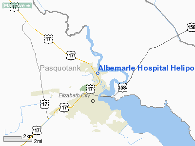
Albemarle Hospital Heliport |
Location & QuickFacts
| FAA Information Effective: | 2008-09-25 |
| Airport Identifier: | NC98 |
| Airport Status: | Operational |
| Longitude/Latitude: | 076-13-08.7610W/36-19-28.5610N
-76.219100/36.324600 (Estimated) |
| Elevation: | 12 ft / 3.66 m (Estimated) |
| Land: | 0 acres |
| From nearest city: | 1 nautical miles S of Elizabeth City, NC |
| Location: | Pasquotank County, NC |
| Magnetic Variation: | 09W (1985) |
Owner & Manager
| Ownership: | Privately owned |
| Owner: | Albemarle Hospital |
| Address: | Po Box 1587
Elizabeth City, NC 27909 |
| Phone number: | 252-335-0531 |
| Manager: | Douglas L. Fairfax |
| Address: | 1144 N. Road St
Elizabeth City, NC 27909 |
| Phone number: | 252-335-0531 |
Airport Operations and Facilities
| Airport Use: | Private
MEDICAL. |
| Wind indicator: | Yes |
| Segmented Circle: | No |
| Control Tower: | No |
| Sectional chart: | Washington |
| Region: | ASO - Southern |
| Boundary ARTCC: | ZDC - Washington |
| Tie-in FSS: | RDU - Raleigh |
| FSS on Airport: | No |
| FSS Toll Free: | 1-800-WX-BRIEF |
Runway Information
Helipad H1
| Dimension: | 70 x 70 ft / 21.3 x 21.3 m |
| Surface: | CONC, |
| |
Runway H1 |
Runway |
| Traffic Pattern: | Left | Left |
|
Radio Navigation Aids
| ID |
Type |
Name |
Ch |
Freq |
Var |
Dist |
| LLW | NDB | Woodville | | 254.00 | 10W | 5.3 nm |
| EY | NDB | Chesi | | 233.00 | 09W | 18.3 nm |
| EDE | NDB | Edenton | | 265.00 | 10W | 24.6 nm |
| RK | NDB | Waley | | 249.00 | 10W | 26.5 nm |
| PVG | NDB | Portsmouth | | 241.00 | 10W | 29.5 nm |
| MQI | NDB | Manteo | | 370.00 | 09W | 35.4 nm |
| PMZ | NDB | Plymouth | | 221.00 | 10W | 40.7 nm |
| ASJ | NDB | Ahoskie | | 415.00 | 10W | 46.3 nm |
| NTU | TACAN | Oceana | 113X | | 10W | 31.3 nm |
| NGU | TACAN | Chambers | 048X | | 10W | 37.1 nm |
| LFI | TACAN | Langley | 070X | | 10W | 46.2 nm |
| ECG | VOR/DME | Elizabeth City | 072X | 112.50 | 07W | 4.5 nm |
| RBX | VOR/DME | Wright Brothers | 053X | 111.60 | 08W | 35.1 nm |
| CVI | VORTAC | Cofield | 093X | 114.60 | 09W | 31.7 nm |
| ORF | VORTAC | Norfolk | 116X | 116.90 | 07W | 34.1 nm |
| FKN | VORTAC | Franklin | 043X | 110.60 | 09W | 44.9 nm |
Remarks
- VFR, PVT USE, USE OF HELI IS COORDD WITH RALEIGH GADO.
Images and information placed above are from
http://www.airport-data.com/airport/NC98/
We thank them for the data!
| General Info
|
| Country |
United States
|
| State |
NORTH CAROLINA
|
| FAA ID |
NC98
|
| Latitude |
36-19-28.561N
|
| Longitude |
076-13-08.761W
|
| Elevation |
12 feet
|
| Near City |
ELIZABETH CITY
|
We don't guarantee the information is fresh and accurate. The data may
be wrong or outdated.
For more up-to-date information please refer to other sources.
|
|


