 |
|
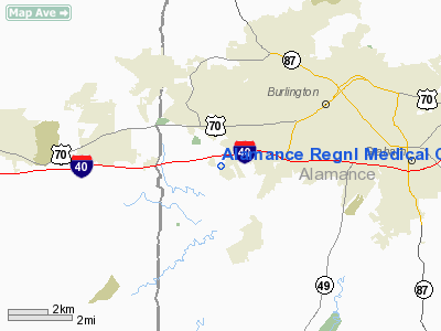
Alamance Regnl Medical Center Heliport |
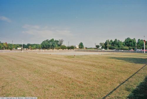 |
(Click on the photo to enlarge) |
Location & QuickFacts
| FAA Information Effective: | 2008-09-25 |
| Airport Identifier: | 91NC |
| Airport Status: | Operational |
| Longitude/Latitude: | 079-30-17.0000W/36-03-44.4000N
-79.504722/36.062333 (Estimated) |
| Elevation: | 688 ft / 209.70 m (Estimated) |
| Land: | 0 acres |
| From nearest city: | 4 nautical miles WS of Burlington, NC |
| Location: | Alamance County, NC |
| Magnetic Variation: | () |
Owner & Manager
| Ownership: | Privately owned |
| Owner: | Alamance Rgnl Medical Center |
| Address: | 1240 Huffman Mill Road
Burlington, NC 27215 |
| Phone number: | 336-538-7000 |
| Manager: | John Currin |
| Address: | 1240 Huffman Mill Road
Burlington, NC 27215 |
| Phone number: | 336-528-7000 |
Airport Operations and Facilities
| Airport Use: | Private |
| Control Tower: | No |
| Sectional chart: | Charlotte |
| Region: | ASO - Southern |
| Boundary ARTCC: | ZDC - Washington |
| Tie-in FSS: | RDU - Raleigh |
| FSS Toll Free: | 1-800-WX-BRIEF |
Runway Information
Helipad H1
| Dimension: | 50 x 50 ft / 15.2 x 15.2 m |
| Surface: | CONC, |
| |
Runway H1 |
Runway |
| Traffic Pattern: | Left | Left |
|
Radio Navigation Aids
| ID |
Type |
Name |
Ch |
Freq |
Var |
Dist |
| OQA | FAN MARKER | Rockingham County | | | | 27.0 nm |
| HB | NDB | Himun | | 361.00 | 08W | 6.4 nm |
| TOX | NDB | Siler City | | 371.00 | 07W | 18.2 nm |
| SIF | NDB | Slammer | | 423.00 | 07W | 23.0 nm |
| HUR | NDB | Person | | 220.00 | 08W | 23.6 nm |
| CQJ | NDB | City Lake | | 266.00 | 08W | 27.2 nm |
| UV | NDB | Bales | | 396.00 | 07W | 37.5 nm |
| TT | NDB | Leeco | | 406.00 | 08W | 38.3 nm |
| LE | NDB | Leevy | | 350.00 | 07W | 38.9 nm |
| SEN | NDB | Swearing/dcmsnd | | 260.00 | 06W | 42.2 nm |
| EEJ | NDB | Lee County/dcmsnd | | 428.00 | 07W | 43.6 nm |
| VU | NDB | Aller | | 346.00 | 06W | 44.5 nm |
| HXO | NDB | Huntsboro | | 271.00 | 07W | 45.3 nm |
| DVZ | NDB | Davie | | 354.00 | 06W | 47.1 nm |
| DAN | VOR | Danville | | 113.10 | 06W | 31.5 nm |
| LIB | VORTAC | Liberty | 077X | 113.00 | 03W | 16.0 nm |
| GSO | VORTAC | Greensboro | 109X | 116.20 | 03W | 22.9 nm |
| RDU | VORTAC | Raleigh/durham | 119X | 117.20 | 04W | 36.9 nm |
| SBV | VORTAC | South Boston | 041X | 110.40 | 05W | 43.8 nm |
Remarks
- PRVDD VFR OPNS, PVT USE, AREA IS MARKED AND WIND INDICATOR IS MAINTAINED.
Images and information placed above are from
http://www.airport-data.com/airport/91NC/
We thank them for the data!
|
|


