 |
|
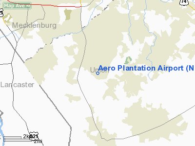
Location & QuickFacts
| FAA Information Effective: | 2008-09-25 |
| Airport Identifier: | NC21 |
| Airport Status: | Operational |
| Longitude/Latitude: | 080-44-54.2500W/34-59-30.5370N
-80.748403/34.991816 (Estimated) |
| Elevation: | 634 ft / 193.24 m (Surveyed) |
| Land: | 15 acres |
| From nearest city: | 2 nautical miles SE of Weddington, NC |
| Location: | Union County, NC |
| Magnetic Variation: | 05W (1985) |
Owner & Manager
| Ownership: | Privately owned |
| Owner: | Aero Plantation Inc. |
| Address: | 865 Baron Road
Weddington, NC 28173 |
| Phone number: | 704-843-5338 |
| Manager: | Allen Osborne |
| Address: | 865 Baron Road
Weddington, NC 28173 |
| Phone number: | 704-289-9475 |
Airport Operations and Facilities
| Airport Use: | Private |
| Wind indicator: | Yes |
| Segmented Circle: | No |
| Control Tower: | No |
| Lighting Schedule: | RDO-CTL
ACTVT LIRL RY 06/24 & ARPT BCN - 123.0. |
| Beacon Color: | Clear-Green (lighted land airport) |
| Landing fee charge: | No |
| Sectional chart: | Charlotte |
| Region: | ASO - Southern |
| Boundary ARTCC: | ZTL - Atlanta |
| Tie-in FSS: | RDU - Raleigh |
| FSS on Airport: | No |
| FSS Toll Free: | 1-800-WX-BRIEF |
Airport Communications
Airport Services
| Airframe Repair: | NONE |
| Power Plant Repair: | NONE |
Runway Information
Runway 06/24
| Dimension: | 2400 x 60 ft / 731.5 x 18.3 m |
| Surface: | ASPH, |
| Edge Lights: | Low |
| |
Runway 06 |
Runway 24 |
| Traffic Pattern: | Left | Left |
|
Radio Navigation Aids
| ID |
Type |
Name |
Ch |
Freq |
Var |
Dist |
| TWL | NDB | Wesley | | 204.00 | 06W | 3.2 nm |
| LKR | NDB | Lancaster | | 400.00 | 07W | 17.0 nm |
| UZ | NDB | Rally | | 227.00 | 05W | 17.5 nm |
| GHJ | NDB | Stonia | | 260.00 | 06W | 23.4 nm |
| PYG | NDB | Pageland | | 270.00 | 06W | 25.1 nm |
| DCM | NDB | Chester | | 220.00 | 06W | 25.5 nm |
| AFP | NDB | Anson County | | 283.00 | 07W | 32.8 nm |
| IZN | NDB | Lincolnton | | 432.00 | 06W | 36.8 nm |
| CDN | NDB | Camden | | 263.00 | 05W | 43.6 nm |
| VU | NDB | Aller | | 346.00 | 06W | 44.4 nm |
| FDW | NDB | Winnsboro | | 414.00 | 05W | 44.5 nm |
| SLP | NDB | First River | | 417.00 | 06W | 44.7 nm |
| CQW | NDB | Cheraw | | 409.00 | 05W | 46.1 nm |
| RU | NDB | Rovdy | | 275.00 | 06W | 46.3 nm |
| HVS | NDB | Hartsville | | 341.00 | 07W | 46.9 nm |
| UOT | NDB | Union County | | 326.00 | 04W | 47.8 nm |
| VW | NDB | Temky | | 280.00 | 05W | 49.5 nm |
| CLT | VOR/DME | Charlotte | 097X | 115.00 | 05W | 15.6 nm |
| CTF | VOR/DME | Chesterfield | 019X | 108.20 | 03W | 31.1 nm |
| FML | VORTAC | Fort Mill | 071X | 112.40 | 02W | 10.2 nm |
| CLT | VOT | Charlotte | | 112.00 | | 16.3 nm |
Remarks
Images and information placed above are from
http://www.airport-data.com/airport/NC21/
We thank them for the data!
| General Info
|
| Country |
United States
|
| State |
NORTH CAROLINA
|
| FAA ID |
NC21
|
| Latitude |
34-59-30.537N
|
| Longitude |
080-44-54.250W
|
| Elevation |
634 feet
|
| Near City |
WEDDINGTON
|
We don't guarantee the information is fresh and accurate. The data may
be wrong or outdated.
For more up-to-date information please refer to other sources.
|
|


