 |
|
Location & QuickFacts
| FAA Information Effective: | 2008-09-25 |
| Airport Identifier: | NY47 |
| Airport Status: | Operational |
| Longitude/Latitude: | 074-01-29.0000W/41-04-39.0000N
-74.024722/41.077500 (Estimated) |
| Elevation: | 270 ft / 82.30 m () |
| Land: | 0 acres |
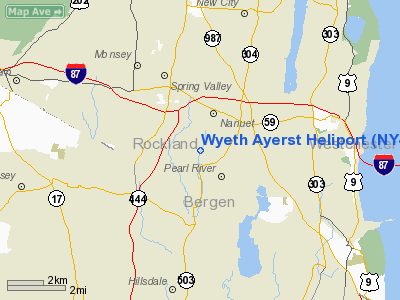
| From nearest city: | 1 nautical miles N of Pearl River, NY |
| Location: | Rockland County, NY |
| Magnetic Variation: | 13W (2000) |
Owner & Manager
| Ownership: | Privately owned |
| Owner: | Wyeth Ayerst, Injc. |
| Address: | 401 N. Middletoen Rd
Pearl River, NY 10965 |
| Phone number: | 845-602-2692 |
| Manager: | John Banyo |
| Address: | 401 N. Middletown Rd
Pearl River, NY 10965 |
| Phone number: | 845-602-2692 |
Airport Operations and Facilities
| Airport Use: | Private |
| Wind indicator: | Yes |
| Segmented Circle: | No |
| Control Tower: | No |
| Lighting Schedule: | DUSK-DAWN |
| Sectional chart: | New York |
| Region: | AEA - Eastern |
| Boundary ARTCC: | ZNY - New York |
| Tie-in FSS: | ISP - New York |
| FSS Toll Free: | 1-800-WX-BRIEF |
Runway Information
Helipad H1
| Dimension: | 60 x 60 ft / 18.3 x 18.3 m |
| Surface: | ASPH, |
| |
Runway H1 |
Runway |
| Traffic Pattern: | Left | Left |
|
Radio Navigation Aids
| ID |
Type |
Name |
Ch |
Freq |
Var |
Dist |
| EWR | FAN MARKER | Maryann | | | 11W | 23.7 nm |
| SKU | FAN MARKER | Stanwyck | | | 12W | 27.1 nm |
| PNJ | NDB | Paterson | | 347.00 | 12W | 9.7 nm |
| SW | NDB | Neely | | 335.00 | 14W | 26.2 nm |
| SKU | NDB | Stanwyck | | 261.00 | 12W | 27.1 nm |
| CAT | NDB | Chatham | | 254.00 | 11W | 27.3 nm |
| PO | NDB | Meier | | 403.00 | 12W | 30.0 nm |
| OGY | NDB | Bridge | | 414.00 | 12W | 31.3 nm |
| BBN | NDB | Babylon | | 275.00 | 14W | 37.9 nm |
| OP | NDB | Old Field Point Light | | 316.00 | 13W | 41.5 nm |
| TBY | NDB | Waterbury | | 257.00 | 14W | 48.2 nm |
| TEB | VOR/DME | Teterboro | 021X | 108.40 | 11W | 13.9 nm |
| LGA | VOR/DME | La Guardia | 078X | 113.10 | 12W | 18.7 nm |
| CMK | VOR/DME | Carmel | 113X | 116.60 | 12W | 23.5 nm |
| CRI | VOR/DME | Canarsie | 070X | 112.30 | 11W | 28.6 nm |
| JFK | VOR/DME | Kennedy | 106X | 115.90 | 12W | 29.1 nm |
| HUO | VOR/DME | Huguenot | 108X | 116.10 | 11W | 32.5 nm |
| IGN | VOR/DME | Kingston | 123X | 117.60 | 12W | 36.5 nm |
| DPK | VOR/DME | Deer Park | 124X | 117.70 | 12W | 37.0 nm |
| STW | VOR/DME | Stillwater | 033X | 109.60 | 11W | 38.6 nm |
| BWZ | VOR/DME | Broadway | 089X | 114.20 | 11W | 39.9 nm |
| BDR | VOR/DME | Bridgeport | 25X | 108.80 | 12W | 41.1 nm |
| SBJ | VOR/DME | Solberg | 076X | 112.90 | 10W | 44.1 nm |
| PWL | VOR/DME | Pawling | 090X | 114.30 | 12W | 45.8 nm |
| COL | VOR/DME | Colts Neck | 101X | 115.40 | 11W | 46.4 nm |
| SAX | VORTAC | Sparta | 104X | 115.70 | 11W | 23.3 nm |
| JFK | VOT | Kennedy | | 115.10 | | 28.9 nm |
| BDR | VOT | Bridgeport | | 109.25 | | 41.0 nm |
| ISP | VOT | Long Island Mac Arthur | | 109.40 | | 45.7 nm |
Remarks
- PRVDD CLEAR 8:1 INGRESS/EGRESS, APPROPRIATE MKGS FOR INGRESS/EGRESS, LGTD WINDSOCK, OPR TO MINIMIZE NOISE, & POTENTIAL OBST REMOVED, RELOCATED, OR MKD.
Images and information placed above are from
http://www.airport-data.com/airport/NY47/
We thank them for the data!
| General Info
|
| Country |
United States
|
| State |
NEW YORK
|
| FAA ID |
NY47
|
| Latitude |
41-04-39.000N
|
| Longitude |
074-01-29.000W
|
| Elevation |
270 feet
|
| Near City |
PEARL RIVER
|
We don't guarantee the information is fresh and accurate. The data may
be wrong or outdated.
For more up-to-date information please refer to other sources.
|
|


