 |
|
Location & QuickFacts
| FAA Information Effective: | 2008-09-25 |
| Airport Identifier: | 14NY |
| Airport Status: | Operational |
| Longitude/Latitude: | 073-25-51.5600W/40-47-52.0000N
-73.430989/40.797778 (Estimated) |
| Elevation: | 222 ft / 67.67 m (Estimated) |
| Land: | 0 acres |
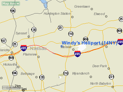
| From nearest city: | 1 nautical miles NW of Melville, NY |
| Location: | Suffolk County, NY |
| Magnetic Variation: | () |
Owner & Manager
| Ownership: | Privately owned |
| Owner: | David Windmiller |
| Address: | 18 Gwynne Road
Melville, NY 11747 |
| Phone number: | 631-271-9057 |
| Manager: | David Windmiller |
| Address: | 18 Gwynne Road
Melville, NY 11747 |
| Phone number: | 631-271-9057 |
Airport Operations and Facilities
| Airport Use: | Private |
| Wind indicator: | Yes |
| Control Tower: | No |
| Sectional chart: | New York |
| Region: | AEA - Eastern |
| Boundary ARTCC: | ZBW - Boston |
| Responsible ARTCC: | ZBW - Boston |
| Tie-in FSS: | ISP - New York |
| FSS Toll Free: | 1-800-WX-BRIEF |
Runway Information
Helipad H1
| Dimension: | 44 x 44 ft / 13.4 x 13.4 m |
| Surface: | TURF, |
| |
Runway H1 |
Runway |
| Traffic Pattern: | Left | Left |
|
Radio Navigation Aids
| ID |
Type |
Name |
Ch |
Freq |
Var |
Dist |
| EWR | FAN MARKER | Maryann | | | 11W | 34.9 nm |
| BBN | NDB | Babylon | | 275.00 | 14W | 7.8 nm |
| OP | NDB | Old Field Point Light | | 316.00 | 13W | 17.8 nm |
| OGY | NDB | Bridge | | 414.00 | 12W | 24.8 nm |
| PNJ | NDB | Paterson | | 347.00 | 12W | 33.9 nm |
| CAT | NDB | Chatham | | 254.00 | 11W | 45.6 nm |
| TBY | NDB | Waterbury | | 257.00 | 14W | 45.8 nm |
| FOK | TACAN | Suffolk Co | 047X | | 13W | 36.4 nm |
| DPK | VOR/DME | Deer Park | 124X | 117.70 | 12W | 5.8 nm |
| JFK | VOR/DME | Kennedy | 106X | 115.90 | 12W | 18.4 nm |
| LGA | VOR/DME | La Guardia | 078X | 113.10 | 12W | 20.3 nm |
| CRI | VOR/DME | Canarsie | 070X | 112.30 | 11W | 23.9 nm |
| BDR | VOR/DME | Bridgeport | 25X | 108.80 | 12W | 25.9 nm |
| TEB | VOR/DME | Teterboro | 021X | 108.40 | 11W | 28.9 nm |
| CMK | VOR/DME | Carmel | 113X | 116.60 | 12W | 29.8 nm |
| CCC | VOR/DME | Calverton | 119X | 117.20 | 13W | 29.8 nm |
| HVN | VOR/DME | New Haven | 035X | 109.80 | 13W | 37.3 nm |
| COL | VOR/DME | Colts Neck | 101X | 115.40 | 11W | 44.3 nm |
| MAD | VOR/DME | Madison | 041X | 110.40 | 13W | 45.6 nm |
| ISP | VOT | Long Island Mac Arthur | | 109.40 | | 15.3 nm |
| JFK | VOT | Kennedy | | 115.10 | | 18.7 nm |
| BDR | VOT | Bridgeport | | 109.25 | | 25.9 nm |
Remarks
- PRVDD PVT USE ONLY. VFR OPNS ONLY. AREA IS MARKED. WIND INDICATOR IS MAINTAINED.
Images and information placed above are from
http://www.airport-data.com/airport/14NY/
We thank them for the data!
| General Info
|
| Country |
United States
|
| State |
NEW YORK
|
| FAA ID |
14NY
|
| Latitude |
42-08-20.267N
|
| Longitude |
076-23-08.775W
|
| Elevation |
1140 feet
|
| Near City |
STRAITS CORNERS
|
We don't guarantee the information is fresh and accurate. The data may
be wrong or outdated.
For more up-to-date information please refer to other sources.
|
|


