 |
|
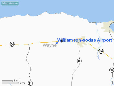
| Williamson-Sodus Airport |
| IATA: none – ICAO: KSDC – FAA LID: SDC |
| Summary |
| Airport type |
Public |
| Owner |
Williamson Flying Club Inc |
| Serves |
Williamson and Sodus, New York |
| Elevation AMSL |
424 ft / 129 m |
| Coordinates |
43°14′04.6″N 077°07′10.1″W / 43.234611°N 77.119472°W / 43.234611; -77.119472 |
| Runways |
| Direction |
Length |
Surface |
| ft |
m |
| 10/28 |
3,801 |
1,219 |
Asphalt |
| Statistics (2006) |
| Aircraft operations |
26,541 |
| Based aircraft |
74 |
| Source: Federal Aviation Administration |
Williamson-Sodus Airport is a public use airport in Wayne County, New York, United States. It is owned by the Williamson Flying Club Inc and is located three nautical miles (5.56 km) west of the central business district of the Town of Sodus, and east of the Town of Williamson. According to the FAA's National Plan of Integrated Airport Systems for 2007-2011, it is categorized as a reliever airport.
Although most U.S. airports use the same three-letter location identifier for the FAA and IATA, this airport is assigned SDC by the FAA but has no designation from the IATA, which assigned SDC to Sandcreek Airport in Guyana.
Facilities and aircraft
Williamson-Sodus Airport covers an area of 109 acres (44 ha) at an elevation of 424 feet (129 m) above mean sea level. It has one runway designated 10/28 with an asphalt surface measuring 3,801 by 60 feet (1,219 x 18 m).
For the 12-month period ending October 18, 2006, the airport had 26,541 aircraft operations, an average of 73 per day: 100% general aviation with a few military and ultralights. At that time there were 74 aircraft based at this airport: 91% single-engine, 1% multi-engine, 1% helicopter and 7% ultralights.
The above content comes from Wikipedia and is published under free licenses – click here to read more.
Location & QuickFacts
| FAA Information Effective: | 2008-09-25 |
| Airport Identifier: | SDC |
| Airport Status: | Operational |
| Longitude/Latitude: | 077-07-10.1000W/43-14-04.6000N
-77.119472/43.234611 (Estimated) |
| Elevation: | 424 ft / 129.24 m (Surveyed) |
| Land: | 109 acres |
| From nearest city: | 3 nautical miles W of Williamson/sodus, NY |
| Location: | Wayne County, NY |
| Magnetic Variation: | 12W (1995) |
Owner & Manager
| Ownership: | Privately owned |
| Owner: | Williamson Flying Club Inc |
| Address: | Po Box 148
Williamson, NY 14589 |
| Phone number: | 315-483-6011 |
| Manager: | Williamson Flying Club Inc |
| Address: | Po Box 148
Williamson, NY 14589 |
| Phone number: | 315-483-6011 |
Airport Operations and Facilities
| Airport Use: | Open to public |
| Wind indicator: | Yes |
| Segmented Circle: | No |
| Control Tower: | No |
| Lighting Schedule: | DUSK-DAWN
ACTIVATE MIRL RY 10/28 - CTAF. |
| Beacon Color: | Clear-Green (lighted land airport) |
| Landing fee charge: | No |
| Sectional chart: | Detroit |
| Region: | AEA - Eastern |
| Traffic Pattern Alt: | 675 ft |
| Boundary ARTCC: | ZOB - Cleveland |
| Tie-in FSS: | BUF - Buffalo |
| FSS on Airport: | No |
| FSS Toll Free: | 1-800-WX-BRIEF |
| NOTAMs Facility: | BUF (NOTAM-d service avaliable) |
| Federal Agreements: | N |
Airport Communications
| CTAF: | 122.800 |
| Unicom: | 122.800 |
Airport Services
| Fuel available: | 100LL
CREDIT CARD FUEL AVBL 24 HRS. |
| Airframe Repair: | MAJOR |
| Power Plant Repair: | MAJOR |
Runway Information
Runway 10/28
| Dimension: | 3801 x 60 ft / 1158.5 x 18.3 m |
| Surface: | ASPH, Good Condition |
| Weight Limit: | Single wheel: 12000 lbs. |
| Edge Lights: | Medium |
| |
Runway 10 |
Runway 28 |
| Longitude: | 077-07-35.7305W | 077-06-44.4028W |
| Latitude: | 43-14-04.0307N | 43-14-05.0720N |
| Elevation: | 424.00 ft | 419.00 ft |
| Alignment: | 88 | 127 |
| Traffic Pattern: | Left | Left |
| Markings: | Non-precision instrument, Good Condition | Non-precision instrument, Good Condition |
| Crossing Height: | 20.00 ft | 20.00 ft |
| VASI: | 2-light PAPI on left side | 2-light PAPI on left side |
| Visual Glide Angle: | 3.00° | 3.00° |
| Obstruction: | 48 ft tree, 456.0 ft from runway, 189 ft right of centerline, 5:1 slope to clear
+2 FT TERRAIN 190 FT OUT AND 200 FT LEFT | 28 ft pole, 363.0 ft from runway, 85 ft left of centerline, 5:1 slope to clear |
|
Radio Navigation Aids
| ID |
Type |
Name |
Ch |
Freq |
Var |
Dist |
| AVN | NDB | Avon | | 344.00 | 09W | 31.5 nm |
| PYA | NDB | Penn Yan | | 260.00 | 12W | 35.6 nm |
| GEE | VOR/DME | Geneseo | 019X | 108.20 | 09W | 36.1 nm |
| ROC | VORTAC | Rochester | 037X | 110.00 | 09W | 25.2 nm |
| SYR | VORTAC | Syracuse | 117X | 117.00 | 11W | 40.3 nm |
Remarks
- AREAS OTHER THAN RWY & TWY MAY BE VERY SOFT IN FALL, WINTER & SPRING.
- GEESE & DEER ON & INVOF ARPT.
Images and information placed above are from
http://www.airport-data.com/airport/SDC/
We thank them for the data!
|
|


