 |
|
| Whitford's Airport |
| IATA: none – ICAO: none – FAA LID: B16 |
| Summary |
| Airport type |
Public |
| Owner |
John Whitford |
| Serves |
Weedsport, New York |
| Elevation AMSL |
400 ft / 122 m |
| Coordinates |
43°04′48.994″N 076°32′18.152″W / 43.08027611°N 76.53837556°W / 43.08027611; -76.53837556 |
| Runways |
| Direction |
Length |
Surface |
| ft |
m |
| 10/28 |
3,630 |
1,106 |
Asphalt |
| E/W |
2,800 |
853 |
Turf |
| Statistics (2006) |
| Aircraft operations |
6,104 |
| Based aircraft |
32 |
| Source: Federal Aviation Administration |
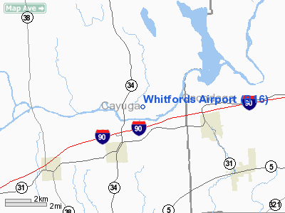
Whitford's Airport is a public use airport in Cayuga County, New York, United States. It is owned by John Whitford and is located two nautical miles (3.74 km) northeast of the central business district of the Village of Weedsport. According to the FAA's National Plan of Integrated Airport Systems for 2007-2011, it is categorized as a reliever airport.
Although most U.S. airports use the same three-letter location identifier for the FAA and IATA, this airport is assigned B16 by the FAA but has no designation from the IATA.
Facilities and aircraft
Whitford's Airport covers an area of 120 acres (48.6 ha) at an elevation of 400 feet (122 m) above mean sea level. It has two runways designated 10/28, with an asphalt surface measuring 3,630 by 60 feet (1,106 x 18 m) and E/W, with a turf surface measuring 2,800 by 100 feet (853 x 30 m).
For the 12-month period ending August 9, 2006, the airport had 6,104 aircraft operations, an average of 17 per day: 98% general aviation, 2% military and a few ultralights. At that time there were 32 aircraft based at this airport: 84% single-engine, 3% multi-engine and 13% ultralights.
The above content comes from Wikipedia and is published under free licenses – click here to read more.
Location & QuickFacts
| FAA Information Effective: | 2008-09-25 |
| Airport Identifier: | B16 |
| Airport Status: | Operational |
| Longitude/Latitude: | 076-32-18.1520W/43-04-48.9940N
-76.538376/43.080276 (Estimated) |
| Elevation: | 400 ft / 121.92 m (Surveyed) |
| Land: | 120 acres |
| From nearest city: | 2 nautical miles NE of Weedsport, NY |
| Location: | Cayuga County, NY |
| Magnetic Variation: | 12W (1990) |
Owner & Manager
| Ownership: | Privately owned |
| Owner: | John Whitford |
| Address: | 3043 Ditmar Road
Weedsport, NY 13166 |
| Phone number: | 315-834-9950 |
| Manager: | John Whitford |
| Address: | 3043 Ditmar Road
Weedsport, NY 13166 |
| Phone number: | 315-834-9950 |
Airport Operations and Facilities
| Airport Use: | Open to public |
| Wind indicator: | Yes |
| Segmented Circle: | Yes |
| Control Tower: | No |
| Lighting Schedule: | DUSK-2300
ACTVT MIRL RY 10/28 - 122.7. FOR ROTG BCN AFTER 2300 CALL 315-834-9059. |
| Beacon Color: | Clear-Green (lighted land airport) |
| Landing fee charge: | No |
| Sectional chart: | New York |
| Region: | AEA - Eastern |
| Traffic Pattern Alt: | 800 ft |
| Boundary ARTCC: | ZBW - Boston |
| Tie-in FSS: | BUF - Buffalo |
| FSS on Airport: | No |
| FSS Toll Free: | 1-800-WX-BRIEF |
| NOTAMs Facility: | BUF (NOTAM-d service avaliable) |
| Federal Agreements: | N |
Airport Communications
| CTAF: | 122.800 |
| Unicom: | 122.800 |
Airport Services
| Fuel available: | 100LLMOGAS
87 OCTANE ALSO AVBL. |
| Airframe Repair: | NONE |
| Power Plant Repair: | NONE |
Runway Information
Runway 10/28
| Dimension: | 3630 x 60 ft / 1106.4 x 18.3 m |
| Surface: | ASPH, |
| Edge Lights: | Medium |
| |
Runway 10 |
Runway 28 |
| Longitude: | 076-32-45.9420W | 076-31-57.0990W |
| Latitude: | 43-04-49.7750N | 43-04-51.6920N |
| Elevation: | 398.00 ft | 398.00 ft |
| Alignment: | 87 | 127 |
| Traffic Pattern: | Left | Left |
| Markings: | Non-precision instrument, Good Condition | Non-precision instrument, Good Condition |
| Displaced threshold: | 430.00 ft | 350.00 ft |
| Obstruction: | 28 ft trees, 320.0 ft from runway, 172 ft left of centerline, 4:1 slope to clear
RY 10, +62' TREES, 736 FT FRM RY THRES, 250 FT RT.; 18:1 APCH SLOPE BASED ON DSPLCD THR. | 58 ft trees, 305.0 ft from runway, 226 ft right of centerline, 1:1 slope to clear
RY 28, APCH SLOPE 11:1 TO DSPLCD THR. |
|
Runway E/W
| Dimension: | 2800 x 100 ft / 853.4 x 30.5 m |
| Surface: | TURF, Good Condition |
| |
Runway E |
Runway W |
| Longitude: | 076-31-54.9270W | 076-32-32.6430W |
| Latitude: | 43-04-47.2120N | 43-04-46.2680N |
| Elevation: | 400.00 ft | 397.00 ft |
| Alignment: | 127 | 88 |
| Traffic Pattern: | Left | Left |
| Obstruction: | 16 ft hill, 609.0 ft from runway, 149L/ ft right of centerline, 38:1 slope to clear
RY 3 HILL AT CNTRLN 125 FT RIGHT. | 49 ft trees, 214.0 ft from runway, 113 ft left of centerline, 4:1 slope to clear |
|
Radio Navigation Aids
| ID |
Type |
Name |
Ch |
Freq |
Var |
Dist |
| PYA | NDB | Penn Yan | | 260.00 | 12W | 34.8 nm |
| BK | NDB | Plein | | 329.00 | 12W | 47.1 nm |
| ITH | VOR/DME | Ithaca | 055X | 111.80 | 10W | 35.3 nm |
| SYR | VORTAC | Syracuse | 117X | 117.00 | 11W | 15.4 nm |
| GGT | VORTAC | Georgetown | 125X | 117.80 | 11W | 35.9 nm |
| ROC | VORTAC | Rochester | 037X | 110.00 | 09W | 49.9 nm |
Remarks
- RY E/W CLSD NOV 1 - MAY 15.
- ULTRALGTS ON & INVOF ARPT.
- EXISTED PRIOR TO 1959.
Images and information placed above are from
http://www.airport-data.com/airport/B16/
We thank them for the data!
| General Info
|
| Country |
United States
|
| State |
NEW YORK
|
| FAA ID |
B16
|
| Latitude |
43-04-48.994N
|
| Longitude |
076-32-18.152W
|
| Elevation |
400 feet
|
| Near City |
WEEDSPORT
|
We don't guarantee the information is fresh and accurate. The data may
be wrong or outdated.
For more up-to-date information please refer to other sources.
|
|


