 |
|
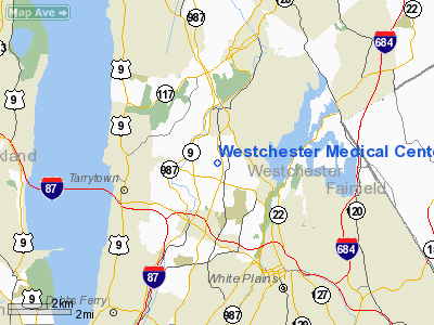
Westchester Medical Center Heliport |
Location & QuickFacts
| FAA Information Effective: | 2008-09-25 |
| Airport Identifier: | 7NK8 |
| Airport Status: | Operational |
| Longitude/Latitude: | 073-48-12.0000W/41-04-56.0000N
-73.803333/41.082222 (Estimated) |
| Elevation: | 409 ft / 124.66 m (Estimated) |
| Land: | 0 acres |
| From nearest city: | 2 nautical miles W of Valhalla, NY |
| Location: | Westchester County, NY |
| Magnetic Variation: | () |
Owner & Manager
| Ownership: | Privately owned |
| Owner: | Westchester Medical Center |
| Address: | One Woods Rd.
Valhalla, NY 10595 |
| Phone number: | 914-493-7000
EXT 5078. |
| Manager: | Kerry Finnerty |
| Address: | One Woods Rd.
Valhalla, NY 10595 |
| Phone number: | 914-493-7000
EXT. 5078. |
Airport Operations and Facilities
| Airport Use: | Private
MEDICAL USE. |
| Wind indicator: | Yes |
| Control Tower: | No |
| Lighting Schedule: | DUSK DAWN |
| Sectional chart: | New York |
| Region: | AEA - Eastern |
| Boundary ARTCC: | ZBW - Boston |
| Tie-in FSS: | BUF - Buffalo |
| FSS Toll Free: | 1-800-WX-BRIEF |
Runway Information
Helipad H1
| Dimension: | 45 x 45 ft / 13.7 x 13.7 m |
| Surface: | MATS, |
| |
Runway H1 |
Runway |
| Traffic Pattern: | Left | Left |
|
Radio Navigation Aids
| ID |
Type |
Name |
Ch |
Freq |
Var |
Dist |
| EWR | FAN MARKER | Maryann | | | 11W | 28.7 nm |
| SKU | FAN MARKER | Stanwyck | | | 12W | 28.9 nm |
| PNJ | NDB | Paterson | | 347.00 | 12W | 17.7 nm |
| SKU | NDB | Stanwyck | | 261.00 | 12W | 28.9 nm |
| PO | NDB | Meier | | 403.00 | 12W | 30.5 nm |
| SW | NDB | Neely | | 335.00 | 14W | 30.9 nm |
| OGY | NDB | Bridge | | 414.00 | 12W | 31.1 nm |
| BBN | NDB | Babylon | | 275.00 | 14W | 31.1 nm |
| OP | NDB | Old Field Point Light | | 316.00 | 13W | 31.7 nm |
| CAT | NDB | Chatham | | 254.00 | 11W | 35.1 nm |
| TBY | NDB | Waterbury | | 257.00 | 14W | 40.1 nm |
| CMK | VOR/DME | Carmel | 113X | 116.60 | 12W | 15.6 nm |
| LGA | VOR/DME | La Guardia | 078X | 113.10 | 12W | 18.0 nm |
| TEB | VOR/DME | Teterboro | 021X | 108.40 | 11W | 18.3 nm |
| JFK | VOR/DME | Kennedy | 106X | 115.90 | 12W | 27.0 nm |
| CRI | VOR/DME | Canarsie | 070X | 112.30 | 11W | 28.5 nm |
| DPK | VOR/DME | Deer Park | 124X | 117.70 | 12W | 28.6 nm |
| BDR | VOR/DME | Bridgeport | 25X | 108.80 | 12W | 31.1 nm |
| IGN | VOR/DME | Kingston | 123X | 117.60 | 12W | 35.1 nm |
| HUO | VOR/DME | Huguenot | 108X | 116.10 | 11W | 40.7 nm |
| PWL | VOR/DME | Pawling | 090X | 114.30 | 12W | 42.3 nm |
| HVN | VOR/DME | New Haven | 035X | 109.80 | 13W | 42.9 nm |
| CCC | VOR/DME | Calverton | 119X | 117.20 | 13W | 46.5 nm |
| STW | VOR/DME | Stillwater | 033X | 109.60 | 11W | 48.6 nm |
| COL | VOR/DME | Colts Neck | 101X | 115.40 | 11W | 49.1 nm |
| BWZ | VOR/DME | Broadway | 089X | 114.20 | 11W | 49.3 nm |
| SAX | VORTAC | Sparta | 104X | 115.70 | 11W | 33.3 nm |
| JFK | VOT | Kennedy | | 115.10 | | 26.9 nm |
| BDR | VOT | Bridgeport | | 109.25 | | 31.0 nm |
| ISP | VOT | Long Island Mac Arthur | | 109.40 | | 36.7 nm |
Remarks
- PRVDD VFR OPNS, OVT USE AREA IS MARKED, AND WIND INDICATOR IS MAINTAINED.
Images and information placed above are from
http://www.airport-data.com/airport/7NK8/
We thank them for the data!
|
|


