|
 |
|
||||
|
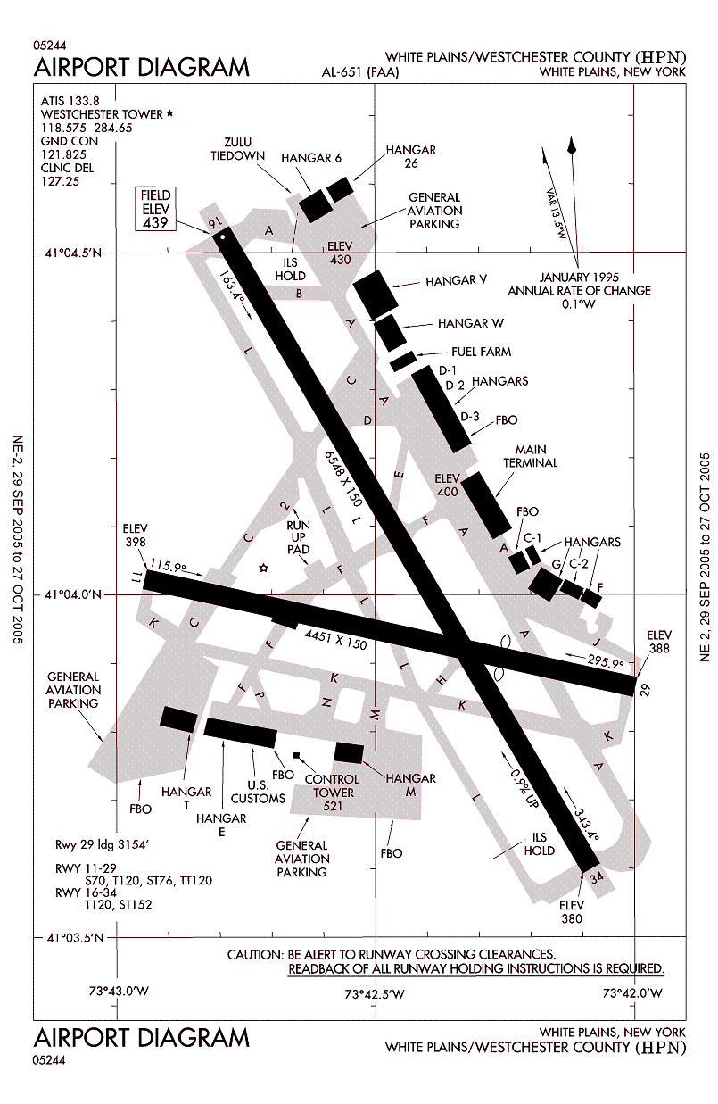
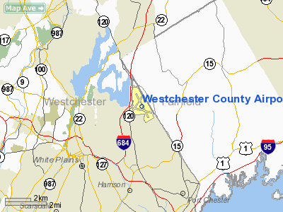
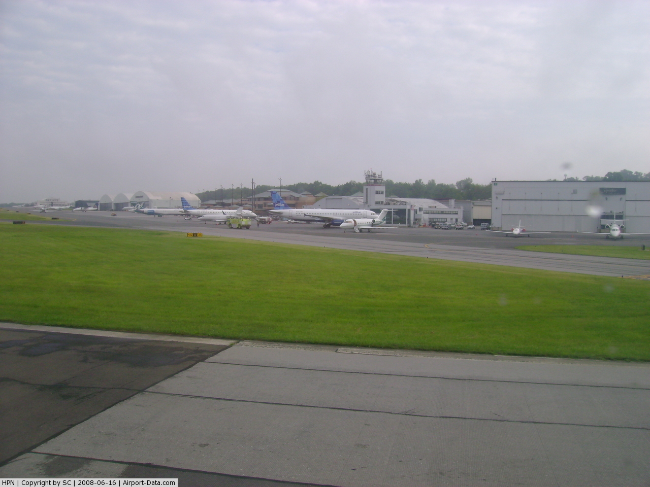
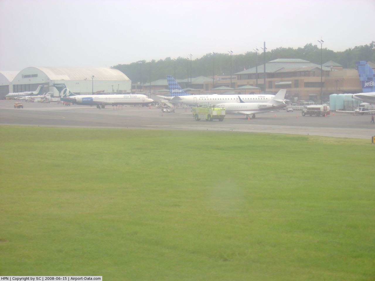
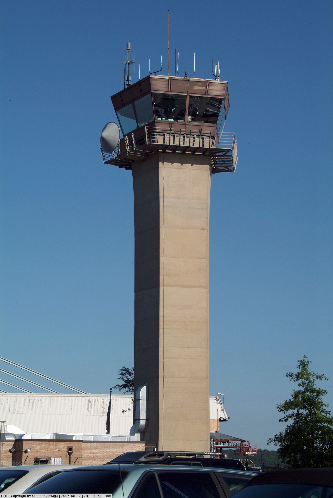
Westchester County Airport (IATA: HPN, ICAO: KHPN, FAA LID: HPN) is a public airport located in the towns of Harrison, North Castle and Rye in Westchester County, New York, United States. It is approximately 3 nautical miles (5.56 km) northeast of the central business district of White Plains, New York. It serves the areas of Westchester, a suburban county of New York City, as well as Fairfield County, Connecticut, as the New York-Connecticut state border coincides with the airport's eastern limits. It also serves, to a lesser extent, the New York metropolitan area, as it is located approximately 33 miles (53 km) north of Midtown Manhattan. It is often used by those who wish to avoid the congestion of the other New York City-area airports. According to Federal Aviation Administration records, the airport had 901,831 passenger boardings (enplanements) in 2008, up from 823,478 boardings in 2007. The Westchester County Airport currently has 7 airlines flying to 16 destinations around the United States only. HistoryWestchester County Airport was originally built during World War II in 1942 as a home to an Air National Guard unit to protect New York City and Rye Lake, the reservoir which the New York City obtains a majority of its drinking water. In May 1983, with the quick growth of the suburban area in Westchester, the Guard unit was moved to Stewart International Airport further to the north near Newburgh. In 1947, passenger service began, and before the passing of the Airline Deregulation Act the airport was served by several regional airlines, including: Allegheny Airlines, Command Airways and Empire Airlines. On January 5, 2006, the airport was the point of departure for the last flight of Independence Air; a flight to Washington, DC at 7:26pm. The airport is served by seven commercial airlines. Besides Independence Air, Continental Airlines used to serve the airport, with non-stop service to Cleveland on Continental Connection. This airport has now become a big focus for low-cost carriers AirTran and JetBlue, for their Northeast to Southeast markets. They are looking to continue to add new service and add connections throughout their route networks. Today, JetBlue is the airport's largest carrier. It operates 12 daily round trips to 5 destinations: Fort Lauderdale, Fort Myers, Orlando, Tampa, and West Palm Beach. JetBlue began service at the airport in 2007. Customers use this airport as an alternative to the busy John F. Kennedy International Airport, LaGuardia, and Newark Liberty airports. In 2009, Cape Air became the latest airline to serve Westchester County Airport in June, with service to two destinations in Massachusetts, Nantucket and Martha's Vineyard. Cape Air also introduced service to Lebanon Municipal Airport in New Hampshire during early 2010. All Cape Air flights are depart and arrive from the Signature Flight Support facility located south of the Main Terminal as a result of the lack of availability for ticket counter space in the Main Terminal. In June 2010, Air Canada, operated by Air Georgian, announced that it would be dropping service at the airport. Local concernsAfter several renovations, as well as discussions about the airport's viability, the airport today is served by seven airlines to a range of destinations in the United States. Although there has always been some controversy about the airport and proposed expansions, more have occurred recently due to travelers seeking to avoid delays at the other New York airports. The most recent concerns have to do with flight paths and traffic congestion, the latter of which Westchester County is addressing via increased Bee-Line bus service and the county encouraging travelers not to drive. Due to its location near a number of residential neighborhoods, Westchester County Airport instituted a Voluntary Restraint from Flying Program, sometimes referred to as a voluntary curfew, which has helped to ease some of the local worry over the airport's activity. In an effort to alleviate concerns over expansion and noise, studies are done on a regular basis. ExpansionAirline expansionsFlights to/from White Plains are extremely limited, and many end up full. The airport has a limit of how many flights can come through per hour. In 2010, AirTran Airways, American Eagle, Delta Connection, United Express, and US Express asked for approval for new routes, and all were rejected. On June 10, 2010, Delta Connection resumed service to Cincinnati/Northern Kentucky International Airport after being previously suspended. The service will be re-suspended on October 29, 2010. Possible terminal expansionOver the years the Westchester County Airport has had an incredible amount of increase in passengers per year. Due to the county's limits, airlines would have to have very few flights per day, eliminate regional service, or expand the main terminal (or possibly even replace it with a bigger one). Cape Air, the airport's newest airline, was forced out of the main terminal due to no counter space. The counter is currently dominated by JetBlue, taking up most of the space. Another possibility is to add jetways to Gates A, B, G, and H, and then have a separate door for regional carriers that can't reach the jetways. Due to space, building two separate terminals would cause problems. At this rate soon the current Main Terminal Building will have to be expanded on or even demolished and a bigger terminal be built in its place. There is not much space to expand on the terminal so the airport might be looking at major expansions such as a rental car facility separate from the terminal or even the demolition of current buildings not in use at the airport. Due to various complaints about sound the plan for a new terminal or expansion of the current terminal will probably not come into place for years to come. IATA codeThe IATA Code for Westchester County Airport is HPN. There is a small debate in the origins of this IATA Code. Many believe that it is derived from the name of the city, White Plains (IATA Codes normally do not begin with W because those are reserved for radio signals). Others, however, believe that the IATA Code represents the first letter of the three neighboring communities, Harrison, Purchase, and North Castle. Facilities and aircraftWestchester County Airport covers an area of 702 acres (284 ha) which contains two asphalt paved runways: 16/34 measuring 6,548 x 150 ft (1,996 x 46 m) and 11/29 measuring 4,451 x 150 ft (1,357 x 46 m). Runway 29's threshold is displaced 1,297 feet (395 m) due to trees obstructing the approach path. The trees, located in Connecticut, are 37 ft (11 m) tall and 370 ft (113 m) from the end of the runway. The runways can handle planes such as AirTran's Boeing 717 and Boeing 737 and JetBlue's Airbus A320 aircraft. Westchester County Airport is the home of several fixed base operators (FBOs), including Avitat, Signature Flight Support, Landmark, NetJets, Panorama, and Million Air. Panorama and Million Air also support their own flight schools. Although varied in the services offered, the FBOs at Westchester County Airport provide Jet A and 100LL fueling services, repairs and maintenance, aircraft tiedowns, de-icing, United States Customs, and other aircraft services. Some of the FBOs are particularly luxurious, providing limousine transportation services and deluxe surroundings. Parking space is limited and prices are significantly higher than at other NY Metro Area airports. Travelers are strongly encouraged to get rides to the airport. Westchester County Airport is also the current home of the New York Wing of the United States Civil Air Patrol, as well as the Southeastern Group of the New York Wing. Both are housed in the same building as the Airport Precinct of the Westchester County Police. These facilities are currently undergoing remodeling to accommodate the recent arrival of the New York Wing. For the 12-month period ending December 31, 2008, the airport had 154,128 aircraft operations, an average of 422 per day: 75% general aviation, 18% air taxi, 6% air carrier, and <1% military. There are 326 aircraft based at this airport: 54% single-engine, 23% jet, 19% multi-engine and 4% helicopter. Flight schoolsThere are two nationally-recognized flight schools at the Westchester County Airport. Performance Flight operates out of the Million Air Hangar, while Panorama Flight School operates out of the Panorama Flight Services Hangar. Terminal
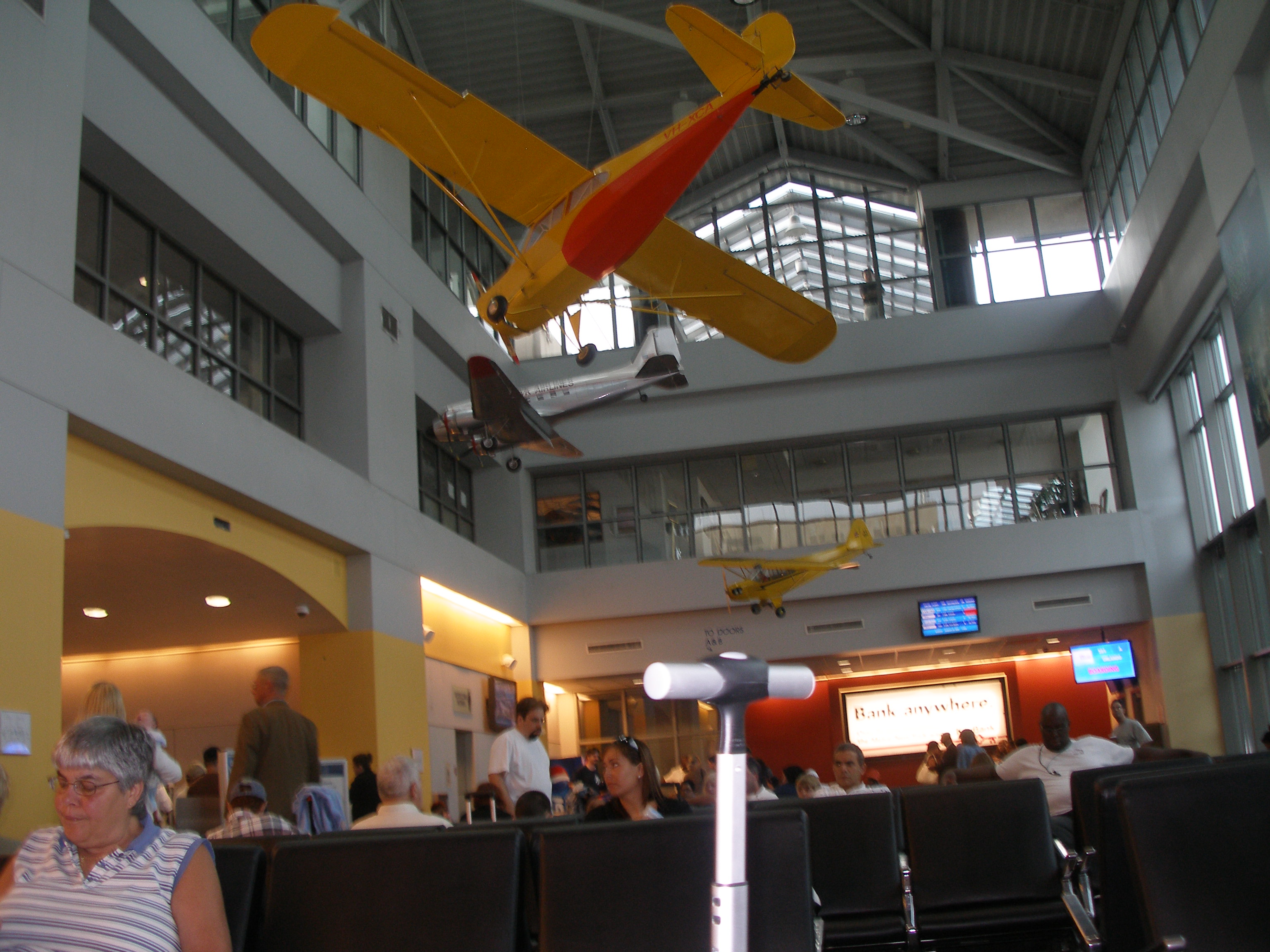
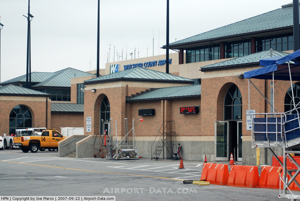
Westchester County Airport has one relatively small three-level terminal with six gate spaces (A,B,C,F,G,H) of which only four may be used, except early in the morning and late at night, when all six may be used. Gates C and F are the only gates that have jetways. Generally, AirTran Airways, JetBlue, and occasionally United Express use the jetway gates, because of the fact that they use larger planes. The other airlines' small planes cannot reach the jetways, so they require you to go onto the tarmac and board via airstairs. The terminal also has one luggage carousel, one baggage reclaim office and two or three Transportation Security Administration (TSA) screening lanes. When not assigned to the jetbridge-equipped gates, JetBlue avoids delays by using their own stairs and ramps to board the aircraft from the front and back simultaneously. The stairs and ramps are property of JetBlue and are not used by any other airline in White Plains. On the second level of the terminal there is a coffee shop, bar and restaurant with tarmac and runway views and an eatery called Skytop Restaurant. On the third floor there is an outside observation deck with views of the runway and tarmac. Also, a number of ATMs are located in the terminal along with a little candy bodega on the first floor. The coffee shop, bar, and restaurant are all before the TSA checkpoint. Airlines and destinations
Popular culture
The above content comes from Wikipedia and is published under free licenses – click here to read more.
Location & QuickFacts
Owner & Manager
Airport Operations and Facilities
Airport Communications
Airport Services
Runway InformationRunway 11/29
Runway 16/34
Radio Navigation Aids
Remarks
Images and information placed above are from We thank them for the data!
We don't guarantee the information is fresh and accurate. The data may
be wrong or outdated.
|
|||||||||||||||||||||||||||||||||||||||||||||||||||||||||||||||||||||||||||||||||||||||||||||||||||||||||||||||||||||||||||||||||||||||||||||||||||||||||||||||||||||||||||||||||||||||||||||||||||||||||||||||||||||||||||||||||||||||||||||||||||||||||||||||||||||||||||||||||||||||||||||||||||||||||||||||||||||||||||||||||||||||||||||||||||||||||||||||||||||||||||||||||||||||||||||||||||||||||||||||||||||||||||||||||||||||||||||||||||||||||||||||||||||||||||||||||||||||||||||||||||||||||||||||||||||||||||||||||||||||||||||||||||||||||||||||||||||||||||||||||||||||||||||||||||||||||||||

 |
|
Copyright 2004-2026 © by Airports-Worldwide.com, Vyshenskoho st. 36, Lviv 79010, Ukraine Legal Disclaimer |