 |
|
Wellsville Muni Arpt,tarantine Fld Airport |
Wellsville Municipal Airport
(Tarantine Field) |
| IATA: ELF – ICAO: KELZ |
| Summary |
| Airport type |
Public |
| Operator |
Town of Wellsville |
| Location |
Wellsville, New York |
| Elevation AMSL |
2,124 ft / 647.4 m |
| Coordinates |
42°06′34.3″N 77°59′23.9″W / 42.109528°N 77.989972°W / 42.109528; -77.989972Coordinates: 42°06′34.3″N 77°59′23.9″W / 42.109528°N 77.989972°W / 42.109528; -77.989972 |
| Runways |
| Direction |
Length |
Surface |
| ft |
m |
| 10/28 |
5,302 |
1,616 |
Asphalt |
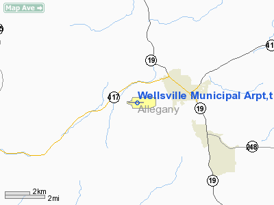
Wellsville Municipal Airport (IATA: ELZ, ICAO: KELZ), also known as Tarantine Field, is a public general aviation airport located two statute miles (3 km) southwest of Wellsville, in Allegany County, New York, USA.
The original Wellsville airport prior to about 1970 was located several miles north of the present airport's location.
Facilities
Wellsville Municipal Airport covers 382 acres (155 ha) and has one runway:
- Runway 10/28: 5,302 x 100 ft. (1,616 x 30 m), Surface: Asphalt
The single east-west runway is 5302 feet long, however only 4900 feet is available for landing. The west-facing ruwnay is equipped with a localizer instrument approach and a medium intensity approach lighting system which allows for a small improvement in landing minimums.
The above content comes from Wikipedia and is published under free licenses – click here to read more.
Location & QuickFacts
| FAA Information Effective: | 2008-09-25 |
| Airport Identifier: | ELZ |
| Airport Status: | Operational |
| Longitude/Latitude: | 077-59-23.9000W/42-06-34.3000N
-77.989972/42.109528 (Estimated) |
| Elevation: | 2124 ft / 647.40 m (Surveyed) |
| Land: | 382 acres |
| From nearest city: | 2 nautical miles SW of Wellsville, NY |
| Location: | Allegany County, NY |
| Magnetic Variation: | 08W (1965) |
Owner & Manager
| Ownership: | Publicly owned |
| Owner: | Town Of Wellsville |
| Address: | Muni Bldg
Wellsville, NY 14895 |
| Phone number: | 716-593-1780 |
| Manager: | Gary Barnes |
| Address: | 2600 Tarantine Rd.
Wellsville, NY 14895 |
| Phone number: | 716-593-3350
FAX: 585-593-1543 |
Airport Operations and Facilities
| Airport Use: | Open to public |
| Wind indicator: | Yes |
| Segmented Circle: | Yes
NO TFC PATTERN INDICATOR. |
| Control Tower: | No |
| Lighting Schedule: | DUSK-DAWN
ACTVT HIRL RY 10/28; REIL RY 10 & MALS RY 28 - CTAF. |
| Beacon Color: | Clear-Green (lighted land airport) |
| Sectional chart: | Detroit |
| Region: | AEA - Eastern |
| Boundary ARTCC: | ZOB - Cleveland |
| Tie-in FSS: | BUF - Buffalo |
| FSS on Airport: | No |
| FSS Toll Free: | 1-800-WX-BRIEF |
| NOTAMs Facility: | ELZ (NOTAM-d service avaliable) |
| Federal Agreements: | NGY |
Airport Communications
| CTAF: | 123.000 |
| Unicom: | 123.000 |
Airport Services
| Fuel available: | 100LLA |
| Airframe Repair: | MINOR |
| Power Plant Repair: | MINOR |
| Bottled Oxygen: | NONE |
| Bulk Oxygen: | NONE |
Runway Information
Runway 10/28
| Dimension: | 5302 x 100 ft / 1616.0 x 30.5 m |
| Surface: | ASPH, Good Condition |
| Surface Treatment: | Saw-cut or plastic Grooved |
| Weight Limit: | Single wheel: 25000 lbs.
Dual wheel: 45000 lbs. |
| Edge Lights: | High |
| |
Runway 10 |
Runway 28 |
| Longitude: | 077-59-59.0895W | 077-58-48.7678W |
| Latitude: | 42-06-33.9602N | 42-06-34.6099N |
| Elevation: | 2122.00 ft | 2100.00 ft |
| Alignment: | 89 | 127 |
| ILS Type: | | LOCALIZER
|
| Traffic Pattern: | Left | Left |
| Markings: | Precision instrument, Good Condition | Precision instrument, Good Condition |
| Crossing Height: | 0.00 ft | 49.00 ft |
| Displaced threshold: | 400.00 ft | 0.00 ft |
| VASI: | 4-box on left side | 4-box on left side |
| Visual Glide Angle: | 0.00° | 3.00° |
| Approach lights: | | MALS |
| Runway End Identifier: | Yes | |
| Obstruction: | 30 ft trees, 349.0 ft from runway, 431 ft right of centerline, 4:1 slope to clear
RWY 10, APPR. SLOPE 24:1 TO DSPLCD. THR.
+20' GND 1' FROM RWY END 460' R. | 21 ft trees, 281.0 ft from runway, 461 ft right of centerline, 3:1 slope to clear
+1 FT TERRAIN 1 FT OUT AND 135 FT RIGHT |
| Decleard distances: | Take off run available 5300.00 ft
Take off distance available 6300.00 ft
Actual stop distance available 5300.00 ft
Landing distance available 4900.00 ft
| Take off run available 5300.00 ft
Take off distance available 6300.00 ft
Actual stop distance available 4900.00 ft
Landing distance available 4900.00 ft
|
|
Radio Navigation Aids
| ID |
Type |
Name |
Ch |
Freq |
Var |
Dist |
| EL | NDB | Halos | | 269.00 | 09W | 3.3 nm |
| LYS | NDB | Olean | | 360.00 | 09W | 18.6 nm |
| BFD | VOR/DME | Bradford | 113X | 116.60 | 07W | 34.2 nm |
| SFK | VOR/DME | Stonyfork | 023X | 108.60 | 08W | 35.6 nm |
| ULW | VOR/DME | Elmira | 033Y | 109.65 | 12W | 43.1 nm |
| GEE | VOR/DME | Geneseo | 019X | 108.20 | 09W | 45.0 nm |
| ELZ | VORTAC | Wellsville | 051X | 111.40 | 09W | 1.3 nm |
| SLT | VORTAC | Slate Run | 086X | 113.90 | 08W | 35.9 nm |
Remarks
- RWY 10, +22' HIGH TREES PENETRATE RT. SIDE TRANS. SURF. (0' FRM RWY BEG., 570' RT.)
- CD THRU BUF AFSS ON ELZ VOR 122.1R/111.4T, CALL 800-622-6640/716-631-1096.
Images and information placed above are from
http://www.airport-data.com/airport/ELZ/
We thank them for the data!
| General Info
|
| Country |
United States
|
| State |
NEW YORK
|
| FAA ID |
ELZ
|
| Latitude |
42-06-34.300N
|
| Longitude |
077-59-23.900W
|
| Elevation |
2124 feet
|
| Near City |
WELLSVILLE
|
We don't guarantee the information is fresh and accurate. The data may
be wrong or outdated.
For more up-to-date information please refer to other sources.
|
|


