 |
|
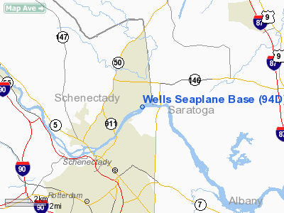
Wells Seaplane Base Airport |
Location & QuickFacts
| FAA Information Effective: | 2008-09-25 |
| Airport Identifier: | 94D |
| Airport Status: | Operational |
| Longitude/Latitude: | 073-54-17.4440W/42-50-59.2750N
-73.904846/42.849799 (Estimated) |
| Elevation: | 210 ft / 64.01 m (Estimated) |
| Land: | 0 acres |
| From nearest city: | 3 nautical miles NE of Schenectady, NY |
| Location: | Schenectady County, NY |
| Magnetic Variation: | 14W (1985) |
Owner & Manager
| Ownership: | Privately owned |
| Owner: | Swett-kivort Corp. |
| Address: | 47 Mohawk Avenue
Alplaus, NY 12008 |
| Phone number: | 518-370-0876 |
| Manager: | Swett-kivort Corp. |
| Address: | 47 Mohawk Avenue
Alplaus, NY 12008 |
| Phone number: | 518-370-0876 |
Airport Operations and Facilities
| Airport Use: | Open to public |
| Wind indicator: | Yes |
| Segmented Circle: | No |
| Control Tower: | No |
| Landing fee charge: | No |
| Sectional chart: | New York |
| Region: | AEA - Eastern |
| Boundary ARTCC: | ZBW - Boston |
| Tie-in FSS: | BTV - Burlington |
| FSS on Airport: | No |
| FSS Toll Free: | 1-800-WX-BRIEF |
| NOTAMs Facility: | BTV (NOTAM-d service avaliable) |
Airport Communications
Airport Services
| Bottled Oxygen: | NONE |
| Bulk Oxygen: | NONE |
Runway Information
Runway NE/SW
| Dimension: | 5000 x 600 ft / 1524.0 x 182.9 m |
| Surface: | WATER, |
| |
Runway NE |
Runway SW |
| Traffic Pattern: | Left | Left |
| Obstruction: | 100 ft plines, 250.0 ft from runway, 2:1 slope to clear | 100 ft plines-m, 500.0 ft from runway, 5:1 slope to clear |
|
Radio Navigation Aids
| ID |
Type |
Name |
Ch |
Freq |
Var |
Dist |
| PSF | FAN MARKER | Abyss | | | 13W | 38.7 nm |
| GBR | FAN MARKER | Sheffield | | | 13W | 49.6 nm |
| HEU | NDB | Hunter | | 356.00 | 14W | 1.3 nm |
| JJH | NDB | Johnstown | | 523.00 | 14W | 20.9 nm |
| PFH | NDB | Philmont | | 272.00 | 13W | 36.8 nm |
| DXT | NDB | Dalton | | 370.00 | 15W | 39.7 nm |
| GBR | NDB | Great Barrington | | 395.00 | 14W | 45.8 nm |
| VWD | NDB | Mount Snow | | 224.00 | 15W | 46.1 nm |
| CAM | VOR/DME | Cambridge | 097X | 115.00 | 14W | 26.2 nm |
| ALB | VORTAC | Albany | 100X | 115.30 | 13W | 7.6 nm |
| GFL | VORTAC | Glens Falls | 039X | 110.20 | 14W | 32.2 nm |
| ALB | VOT | Albany County | | 108.20 | | 7.4 nm |
Remarks
Images and information placed above are from
http://www.airport-data.com/airport/94D/
We thank them for the data!
| General Info
|
| Country |
United States
|
| State |
NEW YORK
|
| FAA ID |
94D
|
| Latitude |
42-50-59.275N
|
| Longitude |
073-54-17.444W
|
| Elevation |
210 feet
|
| Near City |
SCHENECTADY
|
We don't guarantee the information is fresh and accurate. The data may
be wrong or outdated.
For more up-to-date information please refer to other sources.
|
|


