 |
|
Location & QuickFacts
| FAA Information Effective: | 2008-09-25 |
| Airport Identifier: | 4NK0 |
| Airport Status: | Operational |
| Longitude/Latitude: | 079-13-50.1730W/42-05-24.2080N
-79.230604/42.090058 (Estimated) |
| Elevation: | 1340 ft / 408.43 m (Estimated) |
| Land: | 0 acres |
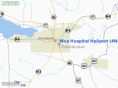
| From nearest city: | 0 nautical miles N of Jamestown, NY |
| Location: | Chautauqua County, NY |
| Magnetic Variation: | 09W (1985) |
Owner & Manager
| Ownership: | Privately owned |
| Owner: | Wca Hospital |
| Address: | 207 Foote Ave
Jamestown, NY 14701 |
| Phone number: | 716-487-0141 |
| Manager: | Murray S. Marsh |
| Address: | 207 Foote Ave
Jamestown, NY 14701 |
| Phone number: | 716-487-0141 |
Airport Operations and Facilities
| Airport Use: | Private
MEDICAL USE. |
| Wind indicator: | Yes |
| Segmented Circle: | No |
| Control Tower: | No |
| Lighting Schedule: | RDO-CTL
ACTVT ROTG BCN & PERIMETER LGTS - 123.050. |
| Beacon Color: | Clear-Green-Yellow (heliport) |
| Sectional chart: | Detroit |
| Region: | AEA - Eastern |
| Boundary ARTCC: | ZOB - Cleveland |
| Tie-in FSS: | BUF - Buffalo |
| FSS Toll Free: | 1-800-WX-BRIEF |
Airport Communications
Airport Services
Runway Information
Helipad H1
| Dimension: | 45 x 45 ft / 13.7 x 13.7 m |
| Surface: | CONC, |
| |
Runway H1 |
Runway |
| Traffic Pattern: | Left | Left |
|
Radio Navigation Aids
| ID |
Type |
Name |
Ch |
Freq |
Var |
Dist |
| ORJ | NDB | Corry | | 258.00 | 09W | 21.5 nm |
| CQD | NDB | Cascade | | 372.00 | 08W | 39.0 nm |
| LYS | NDB | Olean | | 360.00 | 09W | 41.6 nm |
| FKL | VOR | Franklin | | 109.60 | 06W | 48.2 nm |
| JHW | VOR/DME | Jamestown | 094X | 114.70 | 07W | 7.7 nm |
| BFD | VOR/DME | Bradford | 113X | 116.60 | 07W | 32.9 nm |
| DKK | VORTAC | Dunkirk | 109X | 116.20 | 07W | 24.2 nm |
| TDT | VORTAC | Tidioute | 123X | 117.60 | 09W | 24.2 nm |
| ERI | VORTAC | Erie | 031X | 109.40 | 06W | 47.6 nm |
Remarks
- PRVDD PAD IS LMTD TO MEDICAL EMERGENCIES; DOCTOR'S BLDG IS OBSTRUCTION LGTD; TREES ARE TRIMMED.
Images and information placed above are from
http://www.airport-data.com/airport/4NK0/
We thank them for the data!
| General Info
|
| Country |
United States
|
| State |
NEW YORK
|
| FAA ID |
4NK0
|
| Latitude |
42-05-24.208N
|
| Longitude |
079-13-50.173W
|
| Elevation |
1340 feet
|
| Near City |
JAMESTOWN
|
We don't guarantee the information is fresh and accurate. The data may
be wrong or outdated.
For more up-to-date information please refer to other sources.
|
|


