 |
|
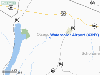
Location & QuickFacts
| FAA Information Effective: | 2008-09-25 |
| Airport Identifier: | 43NY |
| Airport Status: | Operational |
| Longitude/Latitude: | 074-48-09.0000W/42-47-05.0000N
-74.802500/42.784722 (Estimated) |
| Elevation: | 1993 ft / 607.47 m () |
| Land: | 164 acres |
| From nearest city: | 2 nautical miles W of Cherry Valley, NY |
| Location: | Otsego County, NY |
| Magnetic Variation: | 14W (2000) |
Owner & Manager
| Ownership: | Publicly owned |
| Owner: | Lonni Sue Johnson |
| Address: | 345 Hayes Rd
Cherry Valley, NY 13320 |
| Phone number: | 607-264-3580 |
| Manager: | Lonni Sue Johnson |
| Address: | 345 Hayes Rd
Cherry Valley, NY 13320 |
| Phone number: | 607-264-3580 |
Airport Operations and Facilities
| Airport Use: | Private |
| Wind indicator: | Yes |
| Segmented Circle: | No |
| Control Tower: | No |
| Sectional chart: | New York |
| Region: | AEA - Eastern |
| Boundary ARTCC: | ZBW - Boston |
| Tie-in FSS: | BUF - Buffalo |
| FSS Toll Free: | 1-800-WX-BRIEF |
Runway Information
Runway 02/20
| Dimension: | 1500 x 50 ft / 457.2 x 15.2 m |
| Surface: | TURF, |
| |
Runway 02 |
Runway 20 |
| Longitude: | 074-48-09.0000W | 074-48-02.1190W |
| Latitude: | 42-47-05.0000N | 42-47-18.9220N |
| Elevation: | 1993.00 ft | 1993.00 ft |
| Alignment: | 20 | 127 |
| Traffic Pattern: | Left | Left |
| Obstruction: | 3 ft brush | 20 ft trees, 200.0 ft from runway |
|
Radio Navigation Aids
| ID |
Type |
Name |
Ch |
Freq |
Var |
Dist |
| JJH | NDB | Johnstown | | 523.00 | 14W | 24.4 nm |
| CJY | NDB | Clay | | 275.00 | 12W | 25.9 nm |
| HEU | NDB | Hunter | | 356.00 | 14W | 38.5 nm |
| BK | NDB | Plein | | 329.00 | 12W | 39.8 nm |
| GSS | TACAN | Griffiss | 057X | | 12W | 37.9 nm |
| RKA | VOR/DME | Rockdale | 073X | 112.60 | 11W | 27.2 nm |
| DNY | VOR/DME | De Lancey | 058X | 112.10 | 11W | 37.1 nm |
| HNK | VOR/DME | Hancock | 115X | 116.80 | 11W | 49.0 nm |
| UCA | VORTAC | Utica | 049X | 111.20 | 12W | 21.6 nm |
| ALB | VORTAC | Albany | 100X | 115.30 | 13W | 44.2 nm |
| GGT | VORTAC | Georgetown | 125X | 117.80 | 11W | 45.2 nm |
| ALB | VOT | Albany County | | 108.20 | | 43.3 nm |
Remarks
- NORTH END OF RY HAS ROLLING TERRAIN TILTED TO WEST.
- NOT PLOWED IN WINTER.
- WATCH OUT FOR DEER.
- PRVDD DALGT, VFR; CLEAR 20:1 APRCH/DEP PATH; CLEAR PRIMARY SFC (125 FT EITHER SIDE OF CNTRLN); TREES/BRUSH/SHRUBS SHOULD BE CLEARED FM EACH RY END.
Images and information placed above are from
http://www.airport-data.com/airport/43NY/
We thank them for the data!
| General Info
|
| Country |
United States
|
| State |
NEW YORK
|
| FAA ID |
43NY
|
| Latitude |
42-47-05.000N
|
| Longitude |
074-48-09.000W
|
| Elevation |
1993 feet
|
| Near City |
CHERRY VALLEY
|
We don't guarantee the information is fresh and accurate. The data may
be wrong or outdated.
For more up-to-date information please refer to other sources.
|
|


