 |
|
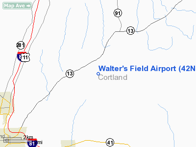
Location & QuickFacts
| FAA Information Effective: | 2008-09-25 |
| Airport Identifier: | 42NY |
| Airport Status: | Operational |
| Longitude/Latitude: | 076-03-22.2000W/42-40-08.4000N
-76.056167/42.669000 (Estimated) |
| Elevation: | 1560 ft / 475.49 m () |
| Land: | 10 acres |
| From nearest city: | 2 nautical miles W of East Homer, NY |
| Location: | Cortland County, NY |
| Magnetic Variation: | 13W (2000) |
Owner & Manager
| Ownership: | Privately owned |
| Owner: | Walter Feint |
| Address: | 5691 Rt 281
Homer, NY 13077 |
| Phone number: | 607-749-4399 |
| Manager: | Walter Feint |
| Address: | 5691 Rt 281
Homer, NY 13077 |
| Phone number: | 607-749-4399 |
Airport Operations and Facilities
| Airport Use: | Private |
| Wind indicator: | Yes |
| Segmented Circle: | No |
| Control Tower: | No |
| Sectional chart: | New York |
| Region: | AEA - Eastern |
| Boundary ARTCC: | ZNY - New York |
| Tie-in FSS: | BUF - Buffalo |
| FSS Toll Free: | 1-800-WX-BRIEF |
Airport Communications
Runway Information
Runway 11/29
| Dimension: | 1150 x 80 ft / 350.5 x 24.4 m |
| Surface: | TURF, |
| |
Runway 11 |
Runway 29 |
| Traffic Pattern: | Left | Left |
| Obstruction: | 30 ft pline, 75.0 ft from runway | |
|
Radio Navigation Aids
| ID |
Type |
Name |
Ch |
Freq |
Var |
Dist |
| ALP | NDB | Alpine | | 245.00 | 12W | 40.7 nm |
| BK | NDB | Plein | | 329.00 | 12W | 41.8 nm |
| CJY | NDB | Clay | | 275.00 | 12W | 41.8 nm |
| PYA | NDB | Penn Yan | | 260.00 | 12W | 44.2 nm |
| GSS | TACAN | Griffiss | 057X | | 12W | 44.1 nm |
| ITH | VOR/DME | Ithaca | 055X | 111.80 | 10W | 20.7 nm |
| RKA | VOR/DME | Rockdale | 073X | 112.60 | 11W | 38.2 nm |
| HNK | VOR/DME | Hancock | 115X | 116.80 | 11W | 49.1 nm |
| GGT | VORTAC | Georgetown | 125X | 117.80 | 11W | 12.4 nm |
| SYR | VORTAC | Syracuse | 117X | 117.00 | 11W | 30.3 nm |
| CFB | VORTAC | Binghamton | 059X | 112.20 | 10W | 31.0 nm |
| UCA | VORTAC | Utica | 049X | 111.20 | 12W | 44.8 nm |
Remarks
- PRVDD VFR, NO IFR OPNS, CLEAR 20:1 APCH/DEP PATH, PLINES MKD, PILOTS MADE AWARE OF STEEP INCLINE & DROP-OFF ZONES AT EACH RY END.
Images and information placed above are from
http://www.airport-data.com/airport/42NY/
We thank them for the data!
| General Info
|
| Country |
United States
|
| State |
NEW YORK
|
| FAA ID |
42NY
|
| Latitude |
42-40-08.400N
|
| Longitude |
076-03-22.200W
|
| Elevation |
1560 feet
|
| Near City |
EAST HOMER
|
We don't guarantee the information is fresh and accurate. The data may
be wrong or outdated.
For more up-to-date information please refer to other sources.
|
|


