 |
|
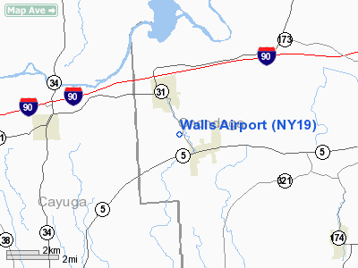
Location & QuickFacts
| FAA Information Effective: | 2008-09-25 |
| Airport Identifier: | NY19 |
| Airport Status: | Operational |
| Longitude/Latitude: | 076-27-42.7710W/43-02-38.2380N
-76.461881/43.043955 (Estimated) |
| Elevation: | 610 ft / 185.93 m (Estimated) |
| Land: | 28 acres |
| From nearest city: | 1 nautical miles NW of Elbridge, NY |
| Location: | Onondaga County, NY |
| Magnetic Variation: | 12W (1985) |
Owner & Manager
| Ownership: | Privately owned |
| Owner: | C. P. Wall |
| Address: | 3015 Buckinghammock Trail
Vero Beach, FL 32960 |
| Phone number: | 407-569-8862 |
| Manager: | C. P. Wall |
| Address: | Box 17
Elbridge, NY 13060 |
| Phone number: | 315-689-6884 |
Airport Operations and Facilities
| Airport Use: | Private |
| Wind indicator: | Yes |
| Segmented Circle: | No |
| Control Tower: | No |
| Landing fee charge: | No |
| Sectional chart: | New York |
| Region: | AEA - Eastern |
| Boundary ARTCC: | ZBW - Boston |
| Tie-in FSS: | BUF - Buffalo |
| FSS on Airport: | No |
| FSS Toll Free: | 1-800-WX-BRIEF |
Airport Services
| Airframe Repair: | NONE |
| Power Plant Repair: | NONE |
Runway Information
Runway 17/35
| Dimension: | 1500 x 50 ft / 457.2 x 15.2 m |
| Surface: | TURF, |
| |
Runway 17 |
Runway 35 |
| Traffic Pattern: | Left | Left |
| Obstruction: | 10 ft trees, 25.0 ft from runway, 2:1 slope to clear | 55 ft brush, 10.0 ft from runway, 55 ft left of centerline, 9:1 slope to clear |
|
Radio Navigation Aids
| ID |
Type |
Name |
Ch |
Freq |
Var |
Dist |
| PYA | NDB | Penn Yan | | 260.00 | 12W | 35.6 nm |
| BK | NDB | Plein | | 329.00 | 12W | 44.3 nm |
| GSS | TACAN | Griffiss | 057X | | 12W | 47.4 nm |
| ITH | VOR/DME | Ithaca | 055X | 111.80 | 10W | 33.0 nm |
| SYR | VORTAC | Syracuse | 117X | 117.00 | 11W | 13.3 nm |
| GGT | VORTAC | Georgetown | 125X | 117.80 | 11W | 31.9 nm |
Remarks
- USE IN VFR CONDITIONS ONLY.
Images and information placed above are from
http://www.airport-data.com/airport/NY19/
We thank them for the data!
| General Info
|
| Country |
United States
|
| State |
NEW YORK
|
| FAA ID |
NY19
|
| Latitude |
43-02-38.238N
|
| Longitude |
076-27-42.771W
|
| Elevation |
610 feet
|
| Near City |
ELBRIDGE
|
We don't guarantee the information is fresh and accurate. The data may
be wrong or outdated.
For more up-to-date information please refer to other sources.
|
|


