 |
|
Location & QuickFacts
| FAA Information Effective: | 2008-09-25 |
| Airport Identifier: | 01NY |
| Airport Status: | Operational |
| Longitude/Latitude: | 073-56-58.4960W/41-42-00.3360N
-73.949582/41.700093 (Estimated) |
| Elevation: | 100 ft / 30.48 m (Estimated) |
| Land: | 0 acres |
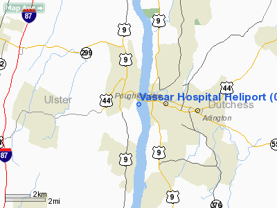
| From nearest city: | 3 nautical miles SW of Poughkeepsie, NY |
| Location: | Dutchess County, NY |
| Magnetic Variation: | 13W (1985) |
Owner & Manager
| Ownership: | Privately owned |
| Owner: | Vassar Bros. Hospital |
| Address: | Read Place
Poughkeepsie, NY 12601 |
| Phone number: | 914-454-8500 |
| Manager: | Vincent P. Veltre |
| Address: | Read Place
Poughkeepsie, NY 12601 |
| Phone number: | 914-437-3003 |
Airport Operations and Facilities
| Airport Use: | Private
MEDICAL USE. |
| Wind indicator: | Yes |
| Segmented Circle: | No |
| Control Tower: | No |
| Lighting Schedule: | DUSK-DAWN |
| Landing fee charge: | No |
| Sectional chart: | New York |
| Region: | AEA - Eastern |
| Boundary ARTCC: | ZBW - Boston |
| Responsible ARTCC: | ZNY - New York |
| Tie-in FSS: | ISP - New York |
| FSS on Airport: | No |
| FSS Toll Free: | 1-800-WX-BRIEF |
Runway Information
Helipad H1
| Dimension: | 100 x 75 ft / 30.5 x 22.9 m |
| Surface: | ASPH, |
| |
Runway H1 |
Runway |
| Traffic Pattern: | Left | Left |
|
Radio Navigation Aids
| ID |
Type |
Name |
Ch |
Freq |
Var |
Dist |
| SKU | FAN MARKER | Stanwyck | | | 12W | 11.2 nm |
| GBR | FAN MARKER | Sheffield | | | 13W | 36.7 nm |
| PO | NDB | Meier | | 403.00 | 12W | 7.5 nm |
| SKU | NDB | Stanwyck | | 261.00 | 12W | 11.2 nm |
| SW | NDB | Neely | | 335.00 | 14W | 18.0 nm |
| PFH | NDB | Philmont | | 272.00 | 13W | 34.7 nm |
| TBY | NDB | Waterbury | | 257.00 | 14W | 37.6 nm |
| GBR | NDB | Great Barrington | | 395.00 | 14W | 37.9 nm |
| MS | NDB | Monga | | 359.00 | 12W | 41.1 nm |
| PNJ | NDB | Paterson | | 347.00 | 12W | 46.2 nm |
| IGN | VOR/DME | Kingston | 123X | 117.60 | 12W | 6.1 nm |
| PWL | VOR/DME | Pawling | 090X | 114.30 | 12W | 16.2 nm |
| CMK | VOR/DME | Carmel | 113X | 116.60 | 12W | 30.2 nm |
| HUO | VOR/DME | Huguenot | 108X | 116.10 | 11W | 33.7 nm |
| BDR | VOR/DME | Bridgeport | 25X | 108.80 | 12W | 49.3 nm |
| SAX | VORTAC | Sparta | 104X | 115.70 | 11W | 46.4 nm |
| BDR | VOT | Bridgeport | | 109.25 | | 49.3 nm |
Remarks
- VFR ONLY,RCMND.TRS BOTH ENDS PKG LOT BE RMVD,ADJ STK BE OBSTD LGTD.
Images and information placed above are from
http://www.airport-data.com/airport/01NY/
We thank them for the data!
| General Info
|
| Country |
United States
|
| State |
NEW YORK
|
| FAA ID |
01NY
|
| Latitude |
41-42-00.336N
|
| Longitude |
073-56-58.496W
|
| Elevation |
100 feet
|
| Near City |
POUGHKEEPSIE
|
We don't guarantee the information is fresh and accurate. The data may
be wrong or outdated.
For more up-to-date information please refer to other sources.
|
|


