 |
|
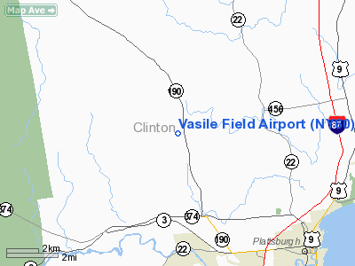
Location & QuickFacts
| FAA Information Effective: | 2008-09-25 |
| Airport Identifier: | NY60 |
| Airport Status: | Operational |
| Longitude/Latitude: | 073-33-33.4950W/44-45-45.1460N
-73.559304/44.762541 (Estimated) |
| Elevation: | 580 ft / 176.78 m (Estimated) |
| Land: | 0 acres |
| From nearest city: | 3 nautical miles W of Beekmanton, NY |
| Location: | Clinton County, NY |
| Magnetic Variation: | 15W (1985) |
Owner & Manager
| Ownership: | Privately owned |
| Owner: | Dr. John Vasile |
| Address: | 2671 Military Turnpike
West Chazy, NY 12992 |
| Phone number: | 518-561-5952 |
| Address: |
|
Airport Operations and Facilities
| Airport Use: | Private |
| Wind indicator: | No |
| Segmented Circle: | No |
| Control Tower: | No |
| Landing fee charge: | No |
| Sectional chart: | Montreal |
| Region: | AEA - Eastern |
| Boundary ARTCC: | ZBW - Boston |
| Tie-in FSS: | BTV - Burlington |
| FSS on Airport: | No |
| FSS Toll Free: | 1-800-WX-BRIEF |
Airport Services
| Airframe Repair: | NONE |
| Power Plant Repair: | NONE |
Runway Information
Runway E/W
| Dimension: | 1850 x 130 ft / 563.9 x 39.6 m |
| Surface: | TURF, |
| |
Runway E |
Runway W |
| Traffic Pattern: | Left | Left |
|
Radio Navigation Aids
| ID |
Type |
Name |
Ch |
Freq |
Var |
Dist |
| MPV | FAN MARKER | Brook | | | | 46.9 nm |
| JL | NDB | Cote St Luc | | 370.00 | 16W | 42.5 nm |
| U | NDB | Uniform | | 201.00 | 15W | 42.6 nm |
| JRV | NDB | Morrisville/stowe | | 375.00 | 16W | 43.0 nm |
| VKN | NDB | Mount Mansfield | | 268.00 | 16W | 43.4 nm |
| UL | NDB | Montreal | | 248.00 | 16W | 43.7 nm |
| NDB | Mike | | 348.00 | 15W | 45.9 nm |
| L | NDB | Lima | | 284.00 | 16W | 47.1 nm |
| H | NDB | Hotel | | 407.00 | 16W | 49.0 nm |
| SLK | VOR/DME | Saranac Lake | 029X | 109.20 | 14W | 35.8 nm |
| PLB | VORTAC | Plattsburgh | 116X | 116.90 | 15W | 4.9 nm |
| BTV | VORTAC | Burlington | 122X | 117.50 | 15W | 27.2 nm |
| YJN | VORTAC | St Jean | 105X | 115.80 | 16W | 31.3 nm |
| BTV | VOT | Burlington Intl | | 109.00 | | 25.0 nm |
Remarks
Images and information placed above are from
http://www.airport-data.com/airport/NY60/
We thank them for the data!
| General Info
|
| Country |
United States
|
| State |
NEW YORK
|
| FAA ID |
NY60
|
| Latitude |
44-45-45.146N
|
| Longitude |
073-33-33.495W
|
| Elevation |
580 feet
|
| Near City |
BEEKMANTON
|
We don't guarantee the information is fresh and accurate. The data may
be wrong or outdated.
For more up-to-date information please refer to other sources.
|
|


