 |
|
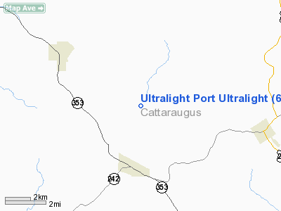
Ultralight Port Ultralight Airport |
Location & QuickFacts
| FAA Information Effective: | 2008-09-25 |
| Airport Identifier: | 67NY |
| Airport Status: | Operational |
| Longitude/Latitude: | 078-47-24.1190W/42-17-35.2260N
-78.790033/42.293118 (Estimated) |
| Elevation: | 1860 ft / 566.93 m (Estimated) |
| Land: | 1 acres |
| From nearest city: | 7 nautical miles N of Little Valley, NY |
| Location: | Cattaraugus County, NY |
| Magnetic Variation: | 10W (1990) |
Owner & Manager
| Ownership: | Privately owned |
| Owner: | Larry Tocha |
| Address: | Rd 1, Box 12 Sodum Rd
Little Valley, NY 14755 |
| Phone number: | 716-938-6315 |
| Manager: | Larry Tocha |
| Address: | Rd 1, Box 12 Sodum Rd
Little Valley, NY 14755 |
| Phone number: | 716-938-6315 |
Airport Operations and Facilities
| Airport Use: | Private |
| Wind indicator: | Yes |
| Segmented Circle: | No |
| Control Tower: | No |
| Sectional chart: | Detroit |
| Region: | AEA - Eastern |
| Boundary ARTCC: | ZOB - Cleveland |
| Tie-in FSS: | BUF - Buffalo |
| FSS on Airport: | No |
| FSS Toll Free: | 1-800-WX-BRIEF |
Runway Information
Runway E/W
| Dimension: | 325 x 100 ft / 99.1 x 30.5 m |
| Surface: | TURF, |
| |
Runway E |
Runway W |
| Traffic Pattern: | Left | Left |
|
Radio Navigation Aids
| ID |
Type |
Name |
Ch |
Freq |
Var |
Dist |
| LYS | NDB | Olean | | 360.00 | 09W | 20.2 nm |
| EL | NDB | Halos | | 269.00 | 09W | 40.5 nm |
| ORJ | NDB | Corry | | 258.00 | 09W | 44.6 nm |
| IAG | TACAN | Niagara Falls | 047X | | 10W | 49.8 nm |
| JHW | VOR/DME | Jamestown | 094X | 114.70 | 07W | 16.0 nm |
| BFD | VOR/DME | Bradford | 113X | 116.60 | 07W | 31.4 nm |
| BUF | VOR/DME | Buffalo | 111X | 116.40 | 08W | 38.7 nm |
| DKK | VORTAC | Dunkirk | 109X | 116.20 | 07W | 24.5 nm |
| ELZ | VORTAC | Wellsville | 051X | 111.40 | 09W | 37.3 nm |
| TDT | VORTAC | Tidioute | 123X | 117.60 | 09W | 44.7 nm |
| BUF | VOT | Buffalo | | 109.00 | | 38.9 nm |
Remarks
- PRVDD PLINE W IS OBSTN MKD.
Images and information placed above are from
http://www.airport-data.com/airport/67NY/
We thank them for the data!
| General Info
|
| Country |
United States
|
| State |
NEW YORK
|
| FAA ID |
67NY
|
| Latitude |
42-17-35.226N
|
| Longitude |
078-47-24.119W
|
| Elevation |
1860 feet
|
| Near City |
LITTLE VALLEY
|
We don't guarantee the information is fresh and accurate. The data may
be wrong or outdated.
For more up-to-date information please refer to other sources.
|
|


