 |
|
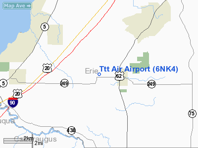
Location & QuickFacts
| FAA Information Effective: | 2008-09-25 |
| Airport Identifier: | 6NK4 |
| Airport Status: | Operational |
| Longitude/Latitude: | 078-58-08.0000W/42-35-52.0000N
-78.968889/42.597778 (Estimated) |
| Elevation: | 891 ft / 271.58 m (Estimated) |
| Land: | 0 acres |
| From nearest city: | 2 nautical miles W of North Collins, NY |
| Location: | Erie County, NY |
| Magnetic Variation: | () |
Owner & Manager
| Ownership: | Privately owned |
| Owner: | Ttt Inc |
| Address: | Rfd Pontiac Rd.
Angola, NY 14006 |
| Phone number: | 716-337-0612 |
| Manager: | Ernie Bower |
| Address: | Rfd Pontiac Road
Angola, NY 14006 |
| Phone number: | 716-984-7007 |
Airport Operations and Facilities
| Airport Use: | Private |
| Wind indicator: | Yes |
| Control Tower: | No |
| Sectional chart: | Detroit |
| Region: | AEA - Eastern |
| Boundary ARTCC: | ZOB - Cleveland |
| Tie-in FSS: | BUF - Buffalo |
| FSS Toll Free: | 1-800-WX-BRIEF |
Runway Information
Runway 09/27
| Dimension: | 1800 x 50 ft / 548.6 x 15.2 m |
| Surface: | TURF, |
| |
Runway 09 |
Runway 27 |
| Traffic Pattern: | Left | Left |
| Obstruction: | 45 ft pline, 2000.0 ft from runway | |
|
Radio Navigation Aids
| ID |
Type |
Name |
Ch |
Freq |
Var |
Dist |
| LYS | NDB | Olean | | 360.00 | 09W | 33.9 nm |
| SN | NDB | St Catherines | | 408.00 | 01E | 35.3 nm |
| IAG | TACAN | Niagara Falls | 047X | | 10W | 30.9 nm |
| BUF | VOR/DME | Buffalo | 111X | 116.40 | 08W | 24.5 nm |
| JHW | VOR/DME | Jamestown | 094X | 114.70 | 07W | 25.5 nm |
| DKK | VORTAC | Dunkirk | 109X | 116.20 | 07W | 15.0 nm |
| BUF | VOT | Buffalo | | 109.00 | | 23.0 nm |
Remarks
Images and information placed above are from
http://www.airport-data.com/airport/6NK4/
We thank them for the data!
|
|


