 |
|
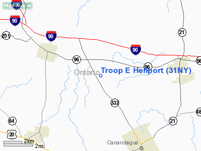
Location & QuickFacts
| FAA Information Effective: | 2008-09-25 |
| Airport Identifier: | 31NY |
| Airport Status: | Operational |
| Longitude/Latitude: | 077-20-13.9500W/42-57-30.2280N
-77.337208/42.958397 (Estimated) |
| Elevation: | 677 ft / 206.35 m (Estimated) |
| Land: | 0 acres |
| From nearest city: | 4 nautical miles NW of Canandaigua, NY |
| Location: | Ontario County, NY |
| Magnetic Variation: | 11W (1985) |
Owner & Manager
| Ownership: | Publicly owned |
| Owner: | Ny State Police |
| Address: | State Campus Bldg 22
Albany, NY 12226 |
| Phone number: | 518-457-5929 |
| Manager: | Troop Commander |
| Address: | State Campus, Bldg 22
Albany, NY 12226
NYSP AVIATION UNIT. |
| Phone number: | 518-457-5929 |
Airport Operations and Facilities
| Airport Use: | Private |
| Wind indicator: | No |
| Segmented Circle: | No |
| Control Tower: | No |
| Lighting Schedule: | PHONE REQ
FOR PERIMETER LGTS CALL 716-398-3200. |
| Landing fee charge: | No |
| Sectional chart: | Detroit |
| Region: | AEA - Eastern |
| Boundary ARTCC: | ZOB - Cleveland |
| Tie-in FSS: | BUF - Buffalo |
| FSS on Airport: | No |
| FSS Toll Free: | 1-800-WX-BRIEF |
Airport Services
| Airframe Repair: | NONE |
| Power Plant Repair: | NONE |
Runway Information
Helipad H1
| Dimension: | 100 x 100 ft / 30.5 x 30.5 m |
| Surface: | ASPH, |
| |
Runway H1 |
Runway |
| Traffic Pattern: | Left | Left |
|
Radio Navigation Aids
| ID |
Type |
Name |
Ch |
Freq |
Var |
Dist |
| AVN | NDB | Avon | | 344.00 | 09W | 19.2 nm |
| PYA | NDB | Penn Yan | | 260.00 | 12W | 22.6 nm |
| GEE | VOR/DME | Geneseo | 019X | 108.20 | 09W | 18.9 nm |
| ITH | VOR/DME | Ithaca | 055X | 111.80 | 10W | 47.7 nm |
| ROC | VORTAC | Rochester | 037X | 110.00 | 09W | 17.7 nm |
Remarks
- HELIPAD FOR OFCL ST POLICE ACTIVITY; OTHER USE WITH PRIOR PMSN.
- VFR ONLY
Images and information placed above are from
http://www.airport-data.com/airport/31NY/
We thank them for the data!
| General Info
|
| Country |
United States
|
| State |
NEW YORK
|
| FAA ID |
31NY
|
| Latitude |
42-57-30.228N
|
| Longitude |
077-20-13.950W
|
| Elevation |
677 feet
|
| Near City |
CANANDAIGUA
|
We don't guarantee the information is fresh and accurate. The data may
be wrong or outdated.
For more up-to-date information please refer to other sources.
|
|


