 |
|
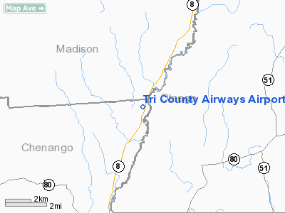
Tri County Airways Airport |
Location & QuickFacts
| FAA Information Effective: | 2008-09-25 |
| Airport Identifier: | NY53 |
| Airport Status: | Operational |
| Longitude/Latitude: | 075-18-00.6020W/42-44-20.2580N
-75.300167/42.738961 (Estimated) |
| Elevation: | 1150 ft / 350.52 m (Estimated) |
| Land: | 6 acres |
| From nearest city: | 2 nautical miles SW of West Edmeston, NY |
| Location: | Chenango County, NY |
| Magnetic Variation: | 13W (1985) |
Owner & Manager
| Ownership: | Privately owned |
| Owner: | Marvin G. Maxson |
| Address: | Box 298
New Berlin, NY 13411 |
| Phone number: | 607-847-6223 |
| Manager: | Marvin G. Maxson |
| Address: | 29 Green St
New Berlin, NY 13411 |
| Phone number: | 607-847-6223 |
Airport Operations and Facilities
| Airport Use: | Private |
| Wind indicator: | Yes |
| Segmented Circle: | No |
| Control Tower: | No |
| Lighting Schedule: | PHONE REQ
FOR RWY LGTS, PHONE 607-847-6223. |
| Landing fee charge: | No |
| Sectional chart: | New York |
| Region: | AEA - Eastern |
| Boundary ARTCC: | ZBW - Boston |
| Tie-in FSS: | BUF - Buffalo |
| FSS on Airport: | No |
| FSS Toll Free: | 1-800-WX-BRIEF |
Airport Communications
Airport Services
| Fuel available: | 80 |
| Airframe Repair: | NONE |
| Power Plant Repair: | NONE |
Runway Information
Runway 04/22
| Dimension: | 2804 x 50 ft / 854.7 x 15.2 m |
| Surface: | TURF, |
| Edge Lights: | Low |
| |
Runway 04 |
Runway 22 |
| Traffic Pattern: | Left | Left |
|
Radio Navigation Aids
| ID |
Type |
Name |
Ch |
Freq |
Var |
Dist |
| CJY | NDB | Clay | | 275.00 | 12W | 18.9 nm |
| BK | NDB | Plein | | 329.00 | 12W | 30.1 nm |
| JJH | NDB | Johnstown | | 523.00 | 14W | 45.4 nm |
| GSS | TACAN | Griffiss | 057X | | 12W | 30.0 nm |
| RKA | VOR/DME | Rockdale | 073X | 112.60 | 11W | 16.6 nm |
| DNY | VOR/DME | De Lancey | 058X | 112.10 | 11W | 37.0 nm |
| HNK | VOR/DME | Hancock | 115X | 116.80 | 11W | 40.6 nm |
| UCA | VORTAC | Utica | 049X | 111.20 | 12W | 18.3 nm |
| GGT | VORTAC | Georgetown | 125X | 117.80 | 11W | 23.4 nm |
| SYR | VORTAC | Syracuse | 117X | 117.00 | 11W | 47.2 nm |
Images and information placed above are from
http://www.airport-data.com/airport/NY53/
We thank them for the data!
| General Info
|
| Country |
United States
|
| State |
NEW YORK
|
| FAA ID |
NY53
|
| Latitude |
42-44-20.258N
|
| Longitude |
075-18-00.602W
|
| Elevation |
1150 feet
|
| Near City |
WEST EDMESTON
|
We don't guarantee the information is fresh and accurate. The data may
be wrong or outdated.
For more up-to-date information please refer to other sources.
|
|


