 |
|
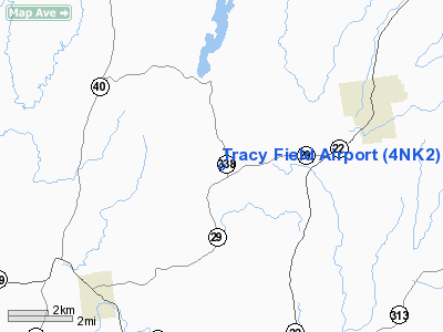
Location & QuickFacts
| FAA Information Effective: | 2008-09-25 |
| Airport Identifier: | 4NK2 |
| Airport Status: | Operational |
| Longitude/Latitude: | 073-25-10.7400W/43-08-42.8400N
-73.419650/43.145233 (Estimated) |
| Elevation: | 455 ft / 138.68 m (Estimated) |
| Land: | 0 acres |
| From nearest city: | 5 nautical miles W of Greenwich, NY |
| Location: | Washington County, NY |
| Magnetic Variation: | () |
Owner & Manager
| Ownership: | Privately owned |
| Owner: | Charles Tracy |
| Address: | 30 Wilson St.
Greenwich, NY 12834 |
| Phone number: | 518-692-2488 |
| Manager: | Charles Tracy |
| Address: | 30 Wilson St.
Greenwich, NY 12834 |
| Phone number: | 518-692-2488 |
Airport Operations and Facilities
| Airport Use: | Private |
| Control Tower: | No |
| Sectional chart: | New York |
| Region: | AEA - Eastern |
| Boundary ARTCC: | ZBW - Boston |
| Tie-in FSS: | BTV - Burlington |
| FSS Toll Free: | 1-800-WX-BRIEF |
Runway Information
Runway 01/19
| Dimension: | 2000 x 75 ft / 609.6 x 22.9 m |
| Surface: | TURF, |
| |
Runway 01 |
Runway 19 |
| Traffic Pattern: | Left | Left |
|
Radio Navigation Aids
| ID |
Type |
Name |
Ch |
Freq |
Var |
Dist |
| R | FAN MARKER | Chitt | | | 14W | 35.4 nm |
| PSF | FAN MARKER | Abyss | | | 13W | 42.4 nm |
| VWD | NDB | Mount Snow | | 224.00 | 15W | 27.7 nm |
| HEU | NDB | Hunter | | 356.00 | 14W | 28.6 nm |
| SXD | NDB | Springfield | | 265.00 | 15W | 37.3 nm |
| DYO | NDB | Smuto | | 221.00 | 15W | 39.3 nm |
| JJH | NDB | Johnstown | | 523.00 | 14W | 41.0 nm |
| DXT | NDB | Dalton | | 370.00 | 15W | 42.0 nm |
| CNH | NDB | Claremont | | 233.00 | 16W | 47.8 nm |
| IVV | NDB | White River | | 379.00 | 16W | 48.6 nm |
| CAM | VOR/DME | Cambridge | 097X | 115.00 | 14W | 9.7 nm |
| RUT | VOR/DME | Rutland | 47X | 111.00 | 15W | 30.8 nm |
| GFL | VORTAC | Glens Falls | 039X | 110.20 | 14W | 14.5 nm |
| ALB | VORTAC | Albany | 100X | 115.30 | 13W | 29.3 nm |
| ALB | VOT | Albany County | | 108.20 | | 30.0 nm |
Remarks
- PRVDD VFR OPNS & PVT USE.
Images and information placed above are from
http://www.airport-data.com/airport/4NK2/
We thank them for the data!
| General Info
|
| Country |
United States
|
| State |
NEW YORK
|
| FAA ID |
4NK2
|
| Latitude |
43-04-32.227N
|
| Longitude |
077-13-59.935W
|
| Elevation |
460 feet
|
| Near City |
PALMYRA
|
We don't guarantee the information is fresh and accurate. The data may
be wrong or outdated.
For more up-to-date information please refer to other sources.
|
|


