 |
|
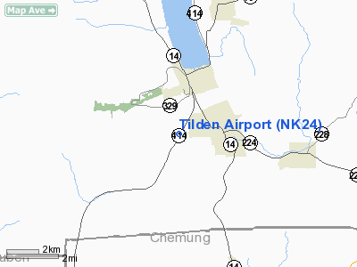
Location & QuickFacts
| FAA Information Effective: | 2008-09-25 |
| Airport Identifier: | NK24 |
| Airport Status: | Operational |
| Longitude/Latitude: | 076-52-43.8520W/42-20-50.2640N
-76.878848/42.347296 (Estimated) |
| Elevation: | 900 ft / 274.32 m (Estimated) |
| Land: | 0 acres |
| From nearest city: | 1 nautical miles NW of Montour Falls, NY |
| Location: | Schuyler County, NY |
| Magnetic Variation: | 11W (1990) |
Owner & Manager
| Ownership: | Privately owned |
| Owner: | Robert D. Tilden |
| Address: | 3640 Cr 16
Montour Falls, NY 14865 |
| Phone number: | 607-535-2217 |
| Manager: | Robert D. Tilden |
| Address: | 3640 Cr 16
Montour Falls, NY 14865 |
| Phone number: | 607-535-2217 |
Airport Operations and Facilities
| Airport Use: | Private |
| Wind indicator: | Yes |
| Segmented Circle: | No |
| Control Tower: | No |
| Sectional chart: | New York |
| Region: | AEA - Eastern |
| Boundary ARTCC: | ZNY - New York |
| Tie-in FSS: | BUF - Buffalo |
| FSS on Airport: | No |
| FSS Toll Free: | 1-800-WX-BRIEF |
Runway Information
Runway 01/19
| Dimension: | 1600 x 60 ft / 487.7 x 18.3 m |
| Surface: | TURF, |
| |
Runway 01 |
Runway 19 |
| Traffic Pattern: | Left | Left |
| Obstruction: | 50 ft trees, 150.0 ft from runway | 326 ft ant, 1584.0 ft from runway |
|
Radio Navigation Aids
| ID |
Type |
Name |
Ch |
Freq |
Var |
Dist |
| ALP | NDB | Alpine | | 245.00 | 12W | 8.3 nm |
| PYA | NDB | Penn Yan | | 260.00 | 12W | 19.5 nm |
| EL | NDB | Halos | | 269.00 | 09W | 48.3 nm |
| ULW | VOR/DME | Elmira | 033Y | 109.65 | 12W | 16.5 nm |
| ITH | VOR/DME | Ithaca | 055X | 111.80 | 10W | 20.6 nm |
| SFK | VOR/DME | Stonyfork | 023X | 108.60 | 08W | 46.0 nm |
| GEE | VOR/DME | Geneseo | 019X | 108.20 | 09W | 47.8 nm |
| CFB | VORTAC | Binghamton | 059X | 112.20 | 10W | 34.9 nm |
Remarks
- OWNER DESIRES ARPT NOT BE CHARTED.
- RY SURROUNDED ON 3 SIDES BY HIGH TERRAIN & ON EAST SIDE BY TREES; IN ONE LOCATION RY ONLY 25 FT WIDE; ON WEST SIDE OF RY EMBANKMENT TOO CLOSE & A 325 FT TOWER IS LOCATED 0.3 MILES FROM NORTHEAST END OF RY.
Images and information placed above are from
http://www.airport-data.com/airport/NK24/
We thank them for the data!
| General Info
|
| Country |
United States
|
| State |
NEW YORK
|
| FAA ID |
NK24
|
| Latitude |
42-20-50.264N
|
| Longitude |
076-52-43.852W
|
| Elevation |
900 feet
|
| Near City |
MONTOUR FALLS
|
We don't guarantee the information is fresh and accurate. The data may
be wrong or outdated.
For more up-to-date information please refer to other sources.
|
|


