 |
|
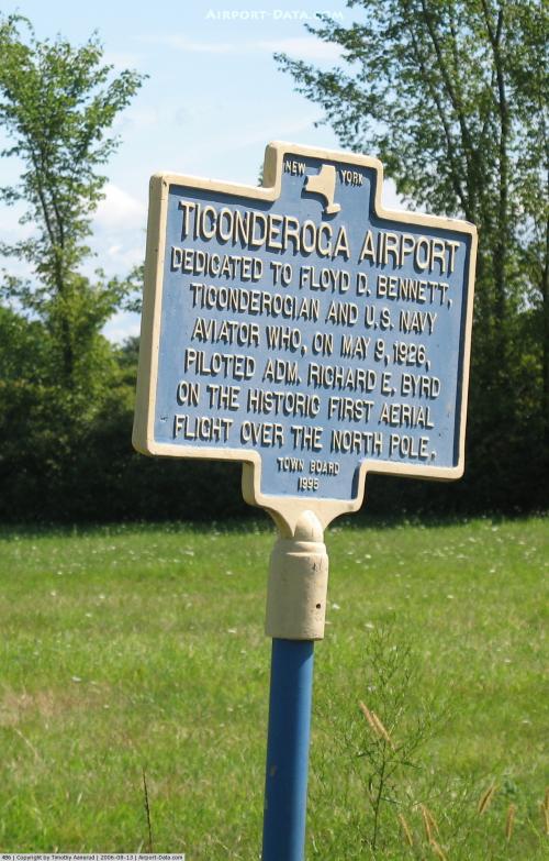 |
(Click on the photo to enlarge) |
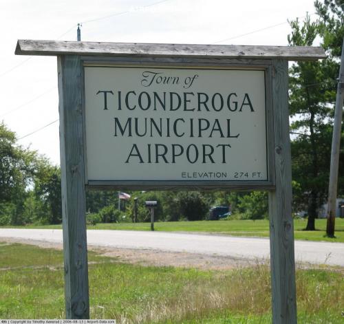 |
(Click on the photo to enlarge) |
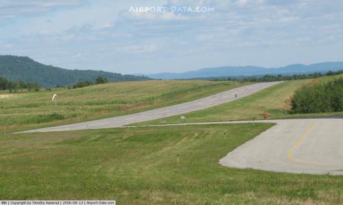 |
(Click on the photo to enlarge) |
Location & QuickFacts
| FAA Information Effective: | 2008-09-25 |
| Airport Identifier: | 4B6 |
| Airport Status: | Operational |
| Longitude/Latitude: | 073-24-47.3000W/43-52-38.2000N
-73.413139/43.877278 (Estimated) |
| Elevation: | 273 ft / 83.21 m (Surveyed) |
| Land: | 60 acres |
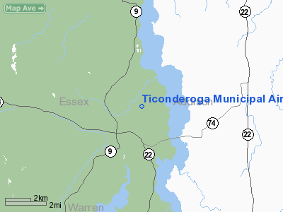
| From nearest city: | 2 nautical miles NE of Ticonderoga, NY |
| Location: | Essex County, NY |
| Magnetic Variation: | 15W (2000) |
Owner & Manager
| Ownership: | Publicly owned |
| Owner: | Town Of Ticonderoga |
| Address: | Hwy Dept Old Chilson Road
Ticonderoga, NY 12883 |
| Phone number: | 518-585-7317 |
| Manager: | Philip Huestis, Hwy Supt. |
| Address: | Town Highway Dept.
Ticonderoga, NY 12883 |
| Phone number: | 518-585-7317 |
Airport Operations and Facilities
| Airport Use: | Open to public |
| Wind indicator: | Yes |
| Segmented Circle: | Yes |
| Control Tower: | No |
| Lighting Schedule: | DUSK-DAWN
ACTVT MIRL RY 02/20; PAPI RYS 02 & 20; REIL RYS 02 & 20 - CTAF. |
| Beacon Color: | Clear-Green (lighted land airport) |
| Landing fee charge: | No |
| Sectional chart: | New York |
| Region: | AEA - Eastern |
| Boundary ARTCC: | ZBW - Boston |
| Tie-in FSS: | BTV - Burlington |
| FSS on Airport: | No |
| FSS Toll Free: | 1-800-WX-BRIEF |
| NOTAMs Facility: | BTV (NOTAM-d service avaliable) |
| Federal Agreements: | NGY |
Airport Communications
| CTAF: | 122.800 |
| Unicom: | 122.800 |
Airport Services
Runway Information
Runway 02/20
| Dimension: | 4041 x 60 ft / 1231.7 x 18.3 m |
| Surface: | ASPH, Good Condition |
| Edge Lights: | Medium |
| |
Runway 02 |
Runway 20 |
| Longitude: | 073-24-48.4762W | 073-24-46.1197W |
| Latitude: | 43-52-18.2293N | 43-52-58.0975N |
| Elevation: | 273.00 ft | 265.00 ft |
| Alignment: | 2 | 127 |
| Traffic Pattern: | Left | Right |
| Markings: | Basic, Good Condition | Basic, Good Condition |
| VASI: | 2-light PAPI on left side
OTS INDEF. | 2-light PAPI on left side
OTS INDEF. |
| Runway End Identifier: | Yes
OTS INDEF. | Yes
OTS INDEF. |
| Obstruction: | 8 ft gnd, 200.0 ft from runway, 250 ft left of centerline
RY 02 +8 FT GND, 200 FT FM THLD, 250 FT LEFT. | 24 ft trees, 577.0 ft from runway, 281 ft left of centerline, 16:1 slope to clear |
|
Radio Navigation Aids
| ID |
Type |
Name |
Ch |
Freq |
Var |
Dist |
| R | FAN MARKER | Chitt | | | 14W | 23.9 nm |
| MPV | FAN MARKER | Brook | | | | 42.1 nm |
| DYO | NDB | Smuto | | 221.00 | 15W | 22.3 nm |
| VKN | NDB | Mount Mansfield | | 268.00 | 16W | 43.6 nm |
| IVV | NDB | White River | | 379.00 | 16W | 45.4 nm |
| RUT | VOR/DME | Rutland | 47X | 111.00 | 15W | 29.1 nm |
| MPV | VOR/DME | Montpelier | 045X | 110.80 | 16W | 43.5 nm |
| SLK | VOR/DME | Saranac Lake | 029X | 109.20 | 14W | 45.8 nm |
| BTV | VORTAC | Burlington | 122X | 117.50 | 15W | 32.8 nm |
| GFL | VORTAC | Glens Falls | 039X | 110.20 | 14W | 33.3 nm |
| PLB | VORTAC | Plattsburgh | 116X | 116.90 | 15W | 48.8 nm |
| BTV | VOT | Burlington Intl | | 109.00 | | 37.2 nm |
Remarks
Images and information placed above are from
http://www.airport-data.com/airport/4B6/
We thank them for the data!
| General Info
|
| Country |
United States
|
| State |
NEW YORK
|
| FAA ID |
4B6
|
| Latitude |
43-52-38.170N
|
| Longitude |
073-24-47.300W
|
| Elevation |
274 feet
|
| Near City |
TICONDEROGA
|
We don't guarantee the information is fresh and accurate. The data may
be wrong or outdated.
For more up-to-date information please refer to other sources.
|
|


