 |
|
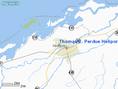
Thomas E. Perdue Heliport |
Location & QuickFacts
| FAA Information Effective: | 2008-09-25 |
| Airport Identifier: | NK75 |
| Airport Status: | Operational |
| Longitude/Latitude: | 074-54-35.0000W/44-56-12.0000N
-74.909722/44.936667 (Estimated) |
| Elevation: | 260 ft / 79.25 m (Estimated) |
| Land: | 0 acres |
| From nearest city: | 1 nautical miles SE of Massena, NY |
| Location: | St Lawrence County, NY |
| Magnetic Variation: | 14W (1985) |
Owner & Manager
| Ownership: | Publicly owned |
| Owner: | Town Of Massena, Massena Mem |
| Address: | 1 Hospital Drive
Massena, NY 13662 |
| Phone number: | 315-764-1711 |
| Manager: | Mark P Brouilette |
| Address: | Massena Memorial Hospital
Massena, NY 13662 |
| Phone number: | 315-764-1711 |
Airport Operations and Facilities
| Airport Use: | Private
MEDICAL USE. |
| Wind indicator: | Yes |
| Segmented Circle: | No |
| Control Tower: | No |
| Landing fee charge: | No |
| Sectional chart: | New York |
| Region: | AEA - Eastern |
| Boundary ARTCC: | ZBW - Boston |
| Tie-in FSS: | BTV - Burlington |
| FSS on Airport: | No |
| FSS Toll Free: | 1-800-WX-BRIEF |
Runway Information
Helipad H1
| Dimension: | 60 x 50 ft / 18.3 x 15.2 m |
| Surface: | ASPH, |
| |
Runway H1 |
Runway |
| Traffic Pattern: | Left | Left |
|
Radio Navigation Aids
| ID |
Type |
Name |
Ch |
Freq |
Var |
Dist |
| PTD | NDB | Potsdam | | 400.00 | 14W | 12.9 nm |
| YUP | NDB | Uplands | | 352.00 | 14W | 30.4 nm |
| YRR | NDB | Greely | | 377.00 | 14W | 34.5 nm |
| OW | NDB | Ottawa | | 236.00 | 14W | 37.6 nm |
| O | NDB | Oscar | | 344.00 | 14W | 41.1 nm |
| YSH | NDB | Smiths Falls | | 334.00 | 13W | 46.9 nm |
| UUP | TACAN | Uplands | 025X | | 14W | 39.6 nm |
| SLK | VOR/DME | Saranac Lake | 029X | 109.20 | 14W | 44.8 nm |
| MSS | VORTAC | Massena | 088X | 114.10 | 14W | 8.1 nm |
Images and information placed above are from
http://www.airport-data.com/airport/NK75/
We thank them for the data!
| General Info
|
| Country |
United States
|
| State |
NEW YORK
|
| FAA ID |
NK75
|
| Latitude |
44-56-12.000N
|
| Longitude |
074-54-35.000W
|
| Elevation |
260 feet
|
| Near City |
MASSENA
|
We don't guarantee the information is fresh and accurate. The data may
be wrong or outdated.
For more up-to-date information please refer to other sources.
|
|


