 |
|
Location & QuickFacts
| FAA Information Effective: | 2008-09-25 |
| Airport Identifier: | NY64 |
| Airport Status: | Operational |
| Longitude/Latitude: | 074-09-18.4710W/43-06-10.2630N
-74.155131/43.102851 (Estimated) |
| Elevation: | 850 ft / 259.08 m (Estimated) |
| Land: | 14 acres |
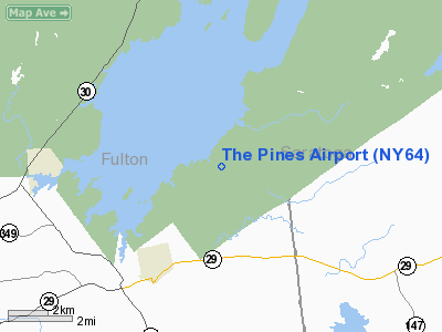
| From nearest city: | 3 nautical miles NE of Broadalbin, NY |
| Location: | Fulton County, NY |
| Magnetic Variation: | 14W (1985) |
Owner & Manager
| Ownership: | Privately owned |
| Owner: | Bill Dee Wade |
| Address: | 772 Cr 110
North Broadalbin, NY 12025 |
| Phone number: | 518-883-7189 |
| Manager: | Bill Dee Wade |
| Address: | 772 Cr 110
North Broadalbin, NY 12025 |
| Phone number: | 518-883-7189 |
Airport Operations and Facilities
| Airport Use: | Private |
| Wind indicator: | Yes |
| Segmented Circle: | No |
| Control Tower: | No |
| Landing fee charge: | No |
| Sectional chart: | New York |
| Region: | AEA - Eastern |
| Boundary ARTCC: | ZBW - Boston |
| Tie-in FSS: | BTV - Burlington |
| FSS on Airport: | No |
| FSS Toll Free: | 1-800-WX-BRIEF |
Airport Services
| Airframe Repair: | NONE |
| Power Plant Repair: | NONE |
Runway Information
Runway 12/30
| Dimension: | 2800 x 120 ft / 853.4 x 36.6 m
500' OVERRUN EACH END - UNMARKED. |
| Surface: | TURF, |
| |
Runway 12 |
Runway 30 |
| Traffic Pattern: | Left | Left |
| Obstruction: | | 60 ft trees, 0.0 ft from runway |
|
Radio Navigation Aids
| ID |
Type |
Name |
Ch |
Freq |
Var |
Dist |
| JJH | NDB | Johnstown | | 523.00 | 14W | 10.0 nm |
| HEU | NDB | Hunter | | 356.00 | 14W | 17.9 nm |
| CJY | NDB | Clay | | 275.00 | 12W | 48.8 nm |
| CAM | VOR/DME | Cambridge | 097X | 115.00 | 14W | 36.2 nm |
| ALB | VORTAC | Albany | 100X | 115.30 | 13W | 26.4 nm |
| GFL | VORTAC | Glens Falls | 039X | 110.20 | 14W | 27.8 nm |
| UCA | VORTAC | Utica | 049X | 111.20 | 12W | 44.6 nm |
| ALB | VOT | Albany County | | 108.20 | | 26.2 nm |
Images and information placed above are from
http://www.airport-data.com/airport/NY64/
We thank them for the data!
| General Info
|
| Country |
United States
|
| State |
NEW YORK
|
| FAA ID |
NY64
|
| Latitude |
43-06-10.263N
|
| Longitude |
074-09-18.471W
|
| Elevation |
850 feet
|
| Near City |
BROADALBIN
|
We don't guarantee the information is fresh and accurate. The data may
be wrong or outdated.
For more up-to-date information please refer to other sources.
|
|


