 |
|
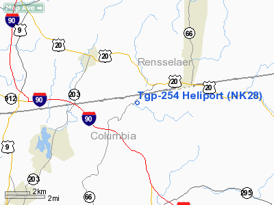
Location & QuickFacts
| FAA Information Effective: | 2008-09-25 |
| Airport Identifier: | NK28 |
| Airport Status: | Operational |
| Longitude/Latitude: | 073-33-46.4100W/42-28-53.2940N
-73.562892/42.481471 (Estimated) |
| Elevation: | 560 ft / 170.69 m (Estimated) |
| Land: | 20 acres |
| From nearest city: | 4 nautical miles SE of Nassau, NY |
| Location: | Columbia County, NY |
| Magnetic Variation: | 14W (1990) |
Owner & Manager
| Ownership: | Privately owned |
| Owner: | Tennessee Gas Pipeline |
| Address: | Rte 66 South
Nassau, NY 12123 |
| Phone number: | 518-766-3611 |
| Manager: | Michael Quaintance |
| Address: | C/o Tgp Po Box 286
Agawam, MA 01001 |
| Phone number: | 413-786-2832 |
Airport Operations and Facilities
| Airport Use: | Private |
| Segmented Circle: | No |
| Control Tower: | No |
| Sectional chart: | New York |
| Region: | AEA - Eastern |
| Boundary ARTCC: | ZBW - Boston |
| Tie-in FSS: | BTV - Burlington |
| FSS on Airport: | No |
| FSS Toll Free: | 1-800-WX-BRIEF |
Runway Information
Helipad H1
| Dimension: | 150 x 150 ft / 45.7 x 45.7 m |
| Surface: | TURF, |
| |
Runway H1 |
Runway |
| Traffic Pattern: | Left | Left |
|
Radio Navigation Aids
| ID |
Type |
Name |
Ch |
Freq |
Var |
Dist |
| PSF | FAN MARKER | Abyss | | | 13W | 15.6 nm |
| GBR | FAN MARKER | Sheffield | | | 13W | 23.0 nm |
| PFH | NDB | Philmont | | 272.00 | 13W | 15.5 nm |
| DXT | NDB | Dalton | | 370.00 | 15W | 17.4 nm |
| GBR | NDB | Great Barrington | | 395.00 | 14W | 19.3 nm |
| HEU | NDB | Hunter | | 356.00 | 14W | 27.7 nm |
| VWD | NDB | Mount Snow | | 224.00 | 15W | 40.9 nm |
| JJH | NDB | Johnstown | | 523.00 | 14W | 46.1 nm |
| CTR | VOR/DME | Chester | 098X | 115.10 | 13W | 29.5 nm |
| CAM | VOR/DME | Cambridge | 097X | 115.00 | 14W | 32.3 nm |
| PWL | VOR/DME | Pawling | 090X | 114.30 | 12W | 42.8 nm |
| ALB | VORTAC | Albany | 100X | 115.30 | 13W | 19.2 nm |
| BAF | VORTAC | Barnes | 077X | 113.00 | 14W | 42.2 nm |
| CEF | VORTAC | Westover | 87X | 114.00 | 14W | 49.1 nm |
| ALB | VOT | Albany County | | 108.20 | | 19.4 nm |
Remarks
- PRVDD CONDUCT OPS TO MINIMIZE NOISE; FACILITY USED BY SINGLE ENGINE HELS & THE TWO METAL PIPES ADJACENT TO HELIPAD BE MARKED.
Images and information placed above are from
http://www.airport-data.com/airport/NK28/
We thank them for the data!
| General Info
|
| Country |
United States
|
| State |
NEW YORK
|
| FAA ID |
NK28
|
| Latitude |
42-28-53.294N
|
| Longitude |
073-33-46.410W
|
| Elevation |
560 feet
|
| Near City |
NASSAU
|
We don't guarantee the information is fresh and accurate. The data may
be wrong or outdated.
For more up-to-date information please refer to other sources.
|
|


