 |
|
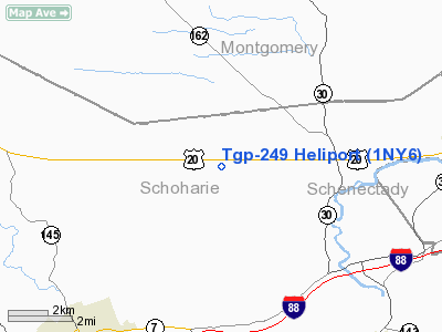
Location & QuickFacts
| FAA Information Effective: | 2008-09-25 |
| Airport Identifier: | 1NY6 |
| Airport Status: | Operational |
| Longitude/Latitude: | 074-24-02.4810W/42-45-14.2690N
-74.400689/42.753964 (Estimated) |
| Elevation: | 1300 ft / 396.24 m (Estimated) |
| Land: | 20 acres |
| From nearest city: | 2 nautical miles SE of Carlisle, NY |
| Location: | Schoharie County, NY |
| Magnetic Variation: | 14W (1990) |
Owner & Manager
| Ownership: | Privately owned |
| Owner: | Tennessee Gas Pipeline Co |
| Address: | Rte 20 Box D
Carlisle, NY 12031 |
| Phone number: | 518-868-9391 |
| Manager: | Michael Quaintance |
| Address: | C/o Tgp P O Box 286
Agawam, MA 01001 |
| Phone number: | 413-786-2832 |
Airport Operations and Facilities
| Airport Use: | Private |
| Segmented Circle: | No |
| Control Tower: | No |
| Sectional chart: | New York |
| Region: | AEA - Eastern |
| Boundary ARTCC: | ZBW - Boston |
| Tie-in FSS: | BUF - Buffalo |
| FSS on Airport: | No |
| FSS Toll Free: | 1-800-WX-BRIEF |
Runway Information
Helipad H1
| Dimension: | 100 x 100 ft / 30.5 x 30.5 m |
| Surface: | TURF, |
| |
Runway H1 |
Runway |
| Traffic Pattern: | Left | Left |
|
Radio Navigation Aids
| ID |
Type |
Name |
Ch |
Freq |
Var |
Dist |
| JJH | NDB | Johnstown | | 523.00 | 14W | 15.1 nm |
| HEU | NDB | Hunter | | 356.00 | 14W | 21.4 nm |
| CJY | NDB | Clay | | 275.00 | 12W | 42.1 nm |
| PFH | NDB | Philmont | | 272.00 | 13W | 42.5 nm |
| RKA | VOR/DME | Rockdale | 073X | 112.60 | 11W | 40.9 nm |
| DNY | VOR/DME | De Lancey | 058X | 112.10 | 11W | 42.5 nm |
| CAM | VOR/DME | Cambridge | 097X | 115.00 | 14W | 48.7 nm |
| ALB | VORTAC | Albany | 100X | 115.30 | 13W | 26.4 nm |
| UCA | VORTAC | Utica | 049X | 111.20 | 12W | 37.4 nm |
| GFL | VORTAC | Glens Falls | 039X | 110.20 | 14W | 49.5 nm |
| ALB | VOT | Albany County | | 108.20 | | 25.5 nm |
Images and information placed above are from
http://www.airport-data.com/airport/1NY6/
We thank them for the data!
| General Info
|
| Country |
United States
|
| State |
NEW YORK
|
| FAA ID |
1NY6
|
| Latitude |
42-45-14.269N
|
| Longitude |
074-24-02.481W
|
| Elevation |
1300 feet
|
| Near City |
CARLISLE
|
We don't guarantee the information is fresh and accurate. The data may
be wrong or outdated.
For more up-to-date information please refer to other sources.
|
|


