 |
|
Location & QuickFacts
| FAA Information Effective: | 2008-09-25 |
| Airport Identifier: | 12NY |
| Airport Status: | Operational |
| Longitude/Latitude: | 075-10-15.5800W/42-52-24.2560N
-75.170994/42.873404 (Estimated) |
| Elevation: | 1440 ft / 438.91 m (Estimated) |
| Land: | 20 acres |
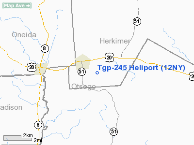
| From nearest city: | 2 nautical miles SE of West Winfield, NY |
| Location: | Herkimer County, NY |
| Magnetic Variation: | 13W (1990) |
Owner & Manager
| Ownership: | Privately owned |
| Owner: | Tennessee Gas Pipeline |
| Address: | Tennessee Road
W Winfield, NY 13491 |
| Phone number: | 315-822-6311 |
| Manager: | Michael Quaintance |
| Address: | C/o Tgp Pob 286
Agawam, MA 01001 |
| Phone number: | 413-786-2832 |
Airport Operations and Facilities
| Airport Use: | Private |
| Segmented Circle: | No |
| Control Tower: | No |
| Sectional chart: | New York |
| Region: | AEA - Eastern |
| Boundary ARTCC: | ZBW - Boston |
| Tie-in FSS: | BUF - Buffalo |
| FSS on Airport: | No |
| FSS Toll Free: | 1-800-WX-BRIEF |
Runway Information
Helipad H1
| Dimension: | 300 x 150 ft / 91.4 x 45.7 m |
| Surface: | TURF, |
| |
Runway H1 |
Runway |
| Traffic Pattern: | Left | Left |
|
Radio Navigation Aids
| ID |
Type |
Name |
Ch |
Freq |
Var |
Dist |
| CJY | NDB | Clay | | 275.00 | 12W | 11.5 nm |
| BK | NDB | Plein | | 329.00 | 12W | 25.1 nm |
| JJH | NDB | Johnstown | | 523.00 | 14W | 37.7 nm |
| GSS | TACAN | Griffiss | 057X | | 12W | 24.0 nm |
| RKA | VOR/DME | Rockdale | 073X | 112.60 | 11W | 24.7 nm |
| DNY | VOR/DME | De Lancey | 058X | 112.10 | 11W | 42.8 nm |
| HNK | VOR/DME | Hancock | 115X | 116.80 | 11W | 49.1 nm |
| UCA | VORTAC | Utica | 049X | 111.20 | 12W | 9.2 nm |
| GGT | VORTAC | Georgetown | 125X | 117.80 | 11W | 29.3 nm |
| SYR | VORTAC | Syracuse | 117X | 117.00 | 11W | 48.6 nm |
Remarks
- PRVDD YOU MAINTAIN A 8:1 APCH/DEPTH PATH TO HELIPORT; DALGT OPNS ONLY; OPNS ARE CONDUCTED TO MINIMIZE NOISE IN RESIDENTIAL AREAS.
Images and information placed above are from
http://www.airport-data.com/airport/12NY/
We thank them for the data!
| General Info
|
| Country |
United States
|
| State |
NEW YORK
|
| FAA ID |
12NY
|
| Latitude |
42-52-24.256N
|
| Longitude |
075-10-15.580W
|
| Elevation |
1440 feet
|
| Near City |
WEST WINFIELD
|
We don't guarantee the information is fresh and accurate. The data may
be wrong or outdated.
For more up-to-date information please refer to other sources.
|
|


